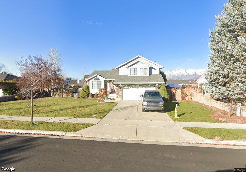
232 W 1250 N American Fork, UT 84003
Estimated Value: $599,000 - $669,000
5
Beds
4
Baths
2,529
Sq Ft
$247/Sq Ft
Est. Value
About This Home
This home is located at 232 W 1250 N, American Fork, UT 84003 and is currently estimated at $625,051, approximately $247 per square foot. 232 W 1250 N is a home located in Utah County with nearby schools including Legacy Elementary School, American Fork Junior High School, and American Fork High School.
Ownership History
Date
Name
Owned For
Owner Type
Purchase Details
Closed on
May 19, 2020
Sold by
Pickett Duane and Pickett Joanne
Bought by
Leinweber David and Leinweber Stephanie
Current Estimated Value
Home Financials for this Owner
Home Financials are based on the most recent Mortgage that was taken out on this home.
Original Mortgage
$368,207
Outstanding Balance
$326,282
Interest Rate
3.3%
Mortgage Type
FHA
Estimated Equity
$298,769
Purchase Details
Closed on
Dec 31, 2015
Sold by
Lebaron Justin L
Bought by
Pickett Duane and Pickett Joanne
Home Financials for this Owner
Home Financials are based on the most recent Mortgage that was taken out on this home.
Original Mortgage
$204,800
Interest Rate
3.94%
Mortgage Type
New Conventional
Purchase Details
Closed on
May 25, 2010
Sold by
Lebaron Leslie Allison
Bought by
Lebaron Justin L
Home Financials for this Owner
Home Financials are based on the most recent Mortgage that was taken out on this home.
Original Mortgage
$161,657
Interest Rate
4.75%
Mortgage Type
FHA
Purchase Details
Closed on
Sep 23, 2002
Sold by
Lebaron Shirl Don
Bought by
Lebaron Shirl Don and Lebaron Leslie Allison
Home Financials for this Owner
Home Financials are based on the most recent Mortgage that was taken out on this home.
Original Mortgage
$161,500
Interest Rate
6.16%
Purchase Details
Closed on
Jun 2, 2000
Sold by
Cook Robert E and Cook Joann
Bought by
Lebaron Shirl Don and Lebaron Leslie Allison
Home Financials for this Owner
Home Financials are based on the most recent Mortgage that was taken out on this home.
Original Mortgage
$148,000
Interest Rate
8.18%
Purchase Details
Closed on
Jan 5, 2000
Sold by
Cook Robert E
Bought by
Cook Robert E and Cook Joann
Purchase Details
Closed on
Mar 17, 1997
Sold by
Cook Robert E and Cook Cynthia S
Bought by
Cook Robert E
Home Financials for this Owner
Home Financials are based on the most recent Mortgage that was taken out on this home.
Original Mortgage
$117,500
Interest Rate
7.74%
Create a Home Valuation Report for This Property
The Home Valuation Report is an in-depth analysis detailing your home's value as well as a comparison with similar homes in the area
Home Values in the Area
Average Home Value in this Area
Purchase History
| Date | Buyer | Sale Price | Title Company |
|---|---|---|---|
| Leinweber David | -- | Sutherland Title Co | |
| Pickett Duane | -- | Backman Title Services Ltd | |
| Lebaron Justin L | -- | Quality Title | |
| Lebaron Shirl Don | -- | Guardian Title Insurance Ag | |
| Lebaron Shirl Don | -- | Guardian Title Insurance Ag | |
| Lebaron Shirl Don | -- | Equity Title Agency Inc | |
| Cook Robert E | -- | Equity Title Agency Inc | |
| Cook Robert E | -- | -- |
Source: Public Records
Mortgage History
| Date | Status | Borrower | Loan Amount |
|---|---|---|---|
| Open | Leinweber David | $368,207 | |
| Previous Owner | Pickett Duane | $204,800 | |
| Previous Owner | Lebaron Justin L | $161,657 | |
| Previous Owner | Lebaron Shirl Don | $161,500 | |
| Previous Owner | Lebaron Shirl Don | $148,000 | |
| Previous Owner | Cook Robert E | $117,500 | |
| Closed | Lebaron Shirl Don | $18,500 |
Source: Public Records
Tax History Compared to Growth
Tax History
| Year | Tax Paid | Tax Assessment Tax Assessment Total Assessment is a certain percentage of the fair market value that is determined by local assessors to be the total taxable value of land and additions on the property. | Land | Improvement |
|---|---|---|---|---|
| 2025 | $2,449 | $300,135 | $221,400 | $324,300 |
| 2024 | $2,449 | $272,085 | $0 | $0 |
| 2023 | $2,294 | $270,215 | $0 | $0 |
| 2022 | $2,258 | $262,515 | $0 | $0 |
| 2021 | $1,930 | $350,500 | $158,900 | $191,600 |
| 2020 | $1,804 | $317,700 | $141,900 | $175,800 |
| 2019 | $1,611 | $293,500 | $131,200 | $162,300 |
| 2018 | $1,566 | $272,800 | $124,100 | $148,700 |
| 2017 | $1,514 | $142,285 | $0 | $0 |
| 2016 | $1,421 | $124,135 | $0 | $0 |
| 2015 | $1,373 | $113,795 | $0 | $0 |
| 2014 | $1,367 | $111,760 | $0 | $0 |
Source: Public Records
Map
Nearby Homes
- 179 W 1290 N
- 287 W 1360 N
- 356 W 1300 N
- 344 W 1080 N
- 425 W 1120 N
- 35 W 1350 N
- 1438 N 400 W
- 1071 Timpview Dr
- 984 N 300 W
- 471 W 1040 N
- 987 N 410 W
- 3889 W 950 Cir N Unit 366
- 914 N 400 W Unit A
- 10238 N 6530 W Unit 15
- 1051 N 390 E Unit 103
- 6079 W Whisper Ln Unit 404
- 1220 E 700 N
- 1039 N 390 E Unit 102
- 11338 N Annes Way Unit 8
- 6111 W Whisper Ln Unit 402