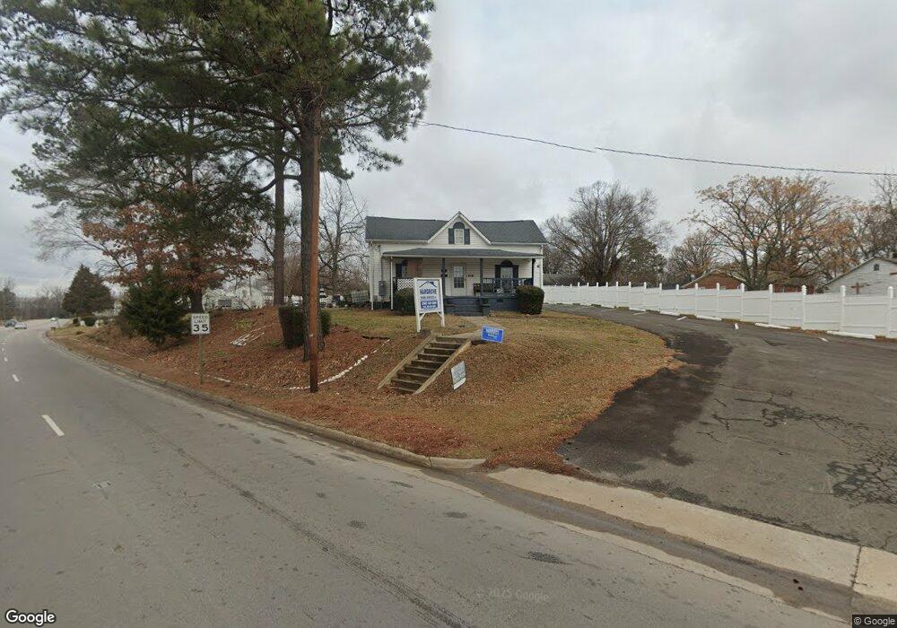
232 W Andrews Ave Henderson, NC 27536
Estimated Value: $119,000 - $167,000
--
Bed
--
Bath
1,860
Sq Ft
$73/Sq Ft
Est. Value
About This Home
This home is located at 232 W Andrews Ave, Henderson, NC 27536 and is currently estimated at $136,355, approximately $73 per square foot. 232 W Andrews Ave is a home with nearby schools including E.M. Rollins Elementary School, Vance County Middle School, and Vance County High School.
Ownership History
Date
Name
Owned For
Owner Type
Purchase Details
Closed on
Aug 22, 2019
Sold by
Five Coutny Construction Llc
Bought by
Hargrove Robert Lathomas
Current Estimated Value
Purchase Details
Closed on
Feb 17, 2012
Sold by
Howard Eleanor
Bought by
Hargrove Home Services Inc
Purchase Details
Closed on
Nov 6, 2007
Sold by
Deutsche Bank National Trust Co
Bought by
Five County Construction Llc
Purchase Details
Closed on
Sep 12, 2007
Sold by
Hargrove Robert
Bought by
Dutsche Bank National Trust Company
Create a Home Valuation Report for This Property
The Home Valuation Report is an in-depth analysis detailing your home's value as well as a comparison with similar homes in the area
Home Values in the Area
Average Home Value in this Area
Purchase History
| Date | Buyer | Sale Price | Title Company |
|---|---|---|---|
| Hargrove Robert Lathomas | -- | None Available | |
| Hargrove Home Services Inc | -- | None Available | |
| Five County Construction Llc | $60,000 | -- | |
| Dutsche Bank National Trust Company | $74,044 | -- |
Source: Public Records
Tax History Compared to Growth
Tax History
| Year | Tax Paid | Tax Assessment Tax Assessment Total Assessment is a certain percentage of the fair market value that is determined by local assessors to be the total taxable value of land and additions on the property. | Land | Improvement |
|---|---|---|---|---|
| 2025 | $1,527 | $112,042 | $31,000 | $81,042 |
| 2024 | $1,652 | $112,042 | $31,000 | $81,042 |
| 2023 | $1,782 | $101,340 | $25,000 | $76,340 |
| 2022 | $1,743 | $101,340 | $25,000 | $76,340 |
| 2021 | $1,623 | $101,340 | $25,000 | $76,340 |
| 2020 | $1,740 | $101,340 | $25,000 | $76,340 |
| 2019 | $1,623 | $101,340 | $25,000 | $76,340 |
| 2018 | $1,623 | $101,340 | $25,000 | $76,340 |
| 2017 | $1,623 | $101,340 | $25,000 | $76,340 |
| 2016 | $1,623 | $101,340 | $25,000 | $76,340 |
| 2015 | $1,498 | $109,920 | $13,373 | $96,547 |
| 2014 | $1,552 | $109,922 | $13,374 | $96,548 |
Source: Public Records
Map
Nearby Homes
- 315 Hamilton St
- 332 Hamilton St
- 239 Gary St
- 436 John St
- 810 Vaughan St
- 632 Breckenridge St
- 638 Poplar Pine St
- 228 Crozier St Unit 230
- 428 Merriman St
- 732 E Rockspring St
- 500 Zene St
- 232 Burwell Ave
- 605 E Montgomery St
- 503 Adams St
- 533 E Winder St
- 0 U S 158 Unit 1131934
- 330 W Young Ave
- 0 Merriman St
- 450 Ft Merriman St
- 246 Keene St
- 403 Oakhill St
- 405 Oakhill St
- 241 W Andrews Ave
- 241 W Andrews Ave
- 510 Oakhill St
- 402 Oakhill St
- 256 W Andrews Ave
- 205 W Andrews Ave
- 407 Oakhill St Unit 409
- 413 Oakhill St
- 210 Whitten Ave
- 203 W Andrews Ave
- 419 Oakhill St
- 435 N Chestnut St
- 435 N Chestnut St
- 266 W Andrews Ave
- 40 Fort Oak Hill St
- 418 Oakhill St
- 437 N Chestnut St
- 311 Hamilton St