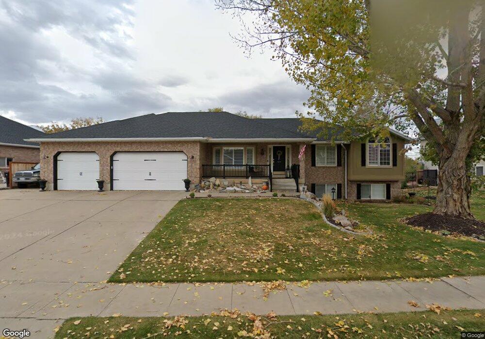
232 Wilkie St Kaysville, UT 84037
West Kaysville NeighborhoodEstimated Value: $828,000 - $885,861
4
Beds
5
Baths
3,950
Sq Ft
$216/Sq Ft
Est. Value
About This Home
This home is located at 232 Wilkie St, Kaysville, UT 84037 and is currently estimated at $853,215, approximately $216 per square foot. 232 Wilkie St is a home located in Davis County with nearby schools including Kay's Creek Elementary School, Shoreline Junior High School, and Davis High School.
Ownership History
Date
Name
Owned For
Owner Type
Purchase Details
Closed on
May 23, 2003
Sold by
Homa Jeff and Jacob Dahlette
Bought by
Gibbs Cory and Gibbs Sheryl
Current Estimated Value
Home Financials for this Owner
Home Financials are based on the most recent Mortgage that was taken out on this home.
Original Mortgage
$218,400
Outstanding Balance
$85,967
Interest Rate
4.5%
Mortgage Type
Purchase Money Mortgage
Estimated Equity
$767,248
Purchase Details
Closed on
Sep 28, 1999
Sold by
Leblanc Dane M and Leblanc Colette G
Bought by
Homa Jeff and Jacob Dahlette
Create a Home Valuation Report for This Property
The Home Valuation Report is an in-depth analysis detailing your home's value as well as a comparison with similar homes in the area
Home Values in the Area
Average Home Value in this Area
Purchase History
| Date | Buyer | Sale Price | Title Company |
|---|---|---|---|
| Gibbs Cory | -- | Mountain View Title & Escrow | |
| Homa Jeff | -- | Security Title Company |
Source: Public Records
Mortgage History
| Date | Status | Borrower | Loan Amount |
|---|---|---|---|
| Open | Gibbs Cory | $218,400 |
Source: Public Records
Tax History Compared to Growth
Tax History
| Year | Tax Paid | Tax Assessment Tax Assessment Total Assessment is a certain percentage of the fair market value that is determined by local assessors to be the total taxable value of land and additions on the property. | Land | Improvement |
|---|---|---|---|---|
| 2025 | $3,959 | $440,550 | $219,464 | $221,086 |
| 2024 | $3,959 | $417,450 | $207,456 | $209,994 |
| 2023 | $3,968 | $741,000 | $366,923 | $374,077 |
| 2022 | $4,074 | $426,800 | $200,243 | $226,557 |
| 2021 | $3,739 | $587,000 | $239,482 | $347,518 |
| 2020 | $3,394 | $519,000 | $204,947 | $314,053 |
| 2019 | $3,270 | $491,000 | $204,260 | $286,740 |
| 2018 | $2,852 | $427,000 | $173,117 | $253,883 |
| 2016 | $2,836 | $223,135 | $80,093 | $143,042 |
| 2015 | $2,778 | $207,515 | $80,093 | $127,422 |
| 2014 | $2,609 | $198,424 | $65,073 | $133,351 |
| 2013 | -- | $188,584 | $52,642 | $135,942 |
Source: Public Records
Map
Nearby Homes
- 256 Seemore Dr
- 71 S Harvs Ln
- 1845 W Sherri Ln
- 129 N Mountain Vistas Rd
- 1429 W Lincoln Way
- 1873 W 75 S
- 51 N Hayfield Cir
- 34 S Preston St
- Brinton Signature Plan at Pintail Estates
- 37 S Preston St Unit 10
- 1566 Pheasant Meadow Dr
- Yalecrest Plan at The Preserve
- Trio Plan at The Preserve
- Timpani Plan at The Preserve
- Tenor Plan at The Preserve
- Octave Plan at The Preserve
- Madrigal Plan at The Preserve
- Interlude Plan at The Preserve
- Harvard Plan at The Preserve
- Harrison Plan at The Preserve