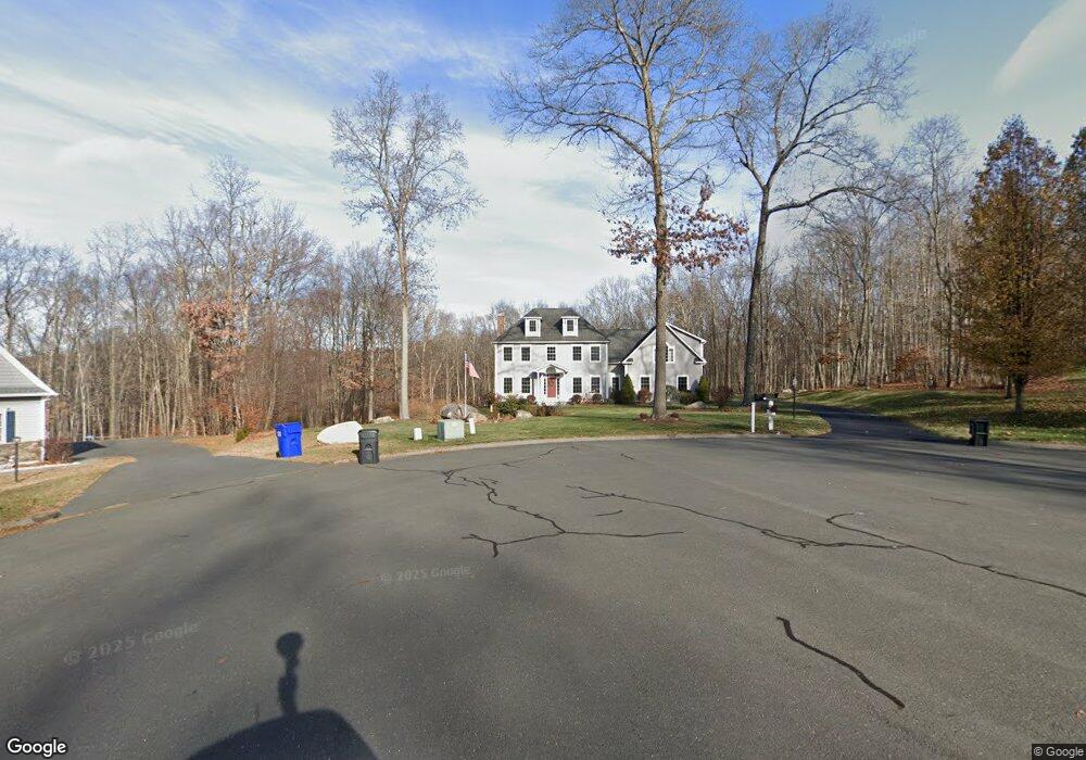
232 Windswept Way Coventry, CT 06238
Estimated Value: $743,878 - $870,000
4
Beds
3
Baths
2,965
Sq Ft
$265/Sq Ft
Est. Value
About This Home
This home is located at 232 Windswept Way, Coventry, CT 06238 and is currently estimated at $784,720, approximately $264 per square foot. 232 Windswept Way is a home located in Tolland County with nearby schools including George Hersey Robertson School, Coventry Grammar School, and Capt. Nathan Hale School.
Ownership History
Date
Name
Owned For
Owner Type
Purchase Details
Closed on
Aug 1, 2007
Sold by
Nordic Bldrs Tolland L
Bought by
Pelletier John P and Pelletier Elizabeth J
Current Estimated Value
Purchase Details
Closed on
Dec 22, 2006
Sold by
Ripley Hill Dev Llc
Bought by
Nordic Bldrs Tolland L
Create a Home Valuation Report for This Property
The Home Valuation Report is an in-depth analysis detailing your home's value as well as a comparison with similar homes in the area
Home Values in the Area
Average Home Value in this Area
Purchase History
| Date | Buyer | Sale Price | Title Company |
|---|---|---|---|
| Pelletier John P | $566,100 | -- | |
| Nordic Bldrs Tolland L | $95,000 | -- | |
| Pelletier John P | $566,100 | -- | |
| Nordic Bldrs Tolland L | $95,000 | -- |
Source: Public Records
Mortgage History
| Date | Status | Borrower | Loan Amount |
|---|---|---|---|
| Open | Nordic Bldrs Tolland L | $393,000 | |
| Closed | Nordic Bldrs Tolland L | $61,500 | |
| Closed | Nordic Bldrs Tolland L | $70,000 |
Source: Public Records
Tax History Compared to Growth
Tax History
| Year | Tax Paid | Tax Assessment Tax Assessment Total Assessment is a certain percentage of the fair market value that is determined by local assessors to be the total taxable value of land and additions on the property. | Land | Improvement |
|---|---|---|---|---|
| 2025 | $12,429 | $523,100 | $99,100 | $424,000 |
| 2024 | $11,718 | $351,800 | $80,600 | $271,200 |
| 2023 | $11,166 | $351,800 | $80,600 | $271,200 |
| 2022 | $10,959 | $351,800 | $80,600 | $271,200 |
| 2021 | $10,959 | $351,800 | $80,600 | $271,200 |
| 2020 | $10,966 | $351,800 | $80,600 | $271,200 |
| 2019 | $11,331 | $351,900 | $80,600 | $271,300 |
| 2018 | $10,967 | $340,600 | $88,900 | $251,700 |
| 2017 | $10,899 | $340,600 | $88,900 | $251,700 |
| 2016 | $10,025 | $321,300 | $88,900 | $232,400 |
| 2015 | $10,012 | $320,900 | $88,900 | $232,000 |
| 2014 | $9,059 | $318,200 | $87,800 | $230,400 |
Source: Public Records
Map
Nearby Homes
- 262 Cooper Ln
- 152 Cheney Ln
- 141 Brigham Tavern Rd
- 220 Buena Vista Rd
- 360 Sam Green Rd
- 36 Cooper Ln
- 367 Riley Mountain Rd
- 30 Knollwood Dr
- 59 Woodland Rd
- 864 Boston Turnpike
- 1365 Main St
- 94 Stonehouse Rd Unit 10
- 48 Lakeview Dr
- 131 Lakewood Dr
- 331 Woodmont Dr
- 83 Morin Ave
- 1902 South St
- 198 Forest Rd
- 39 Wood Trail
- 122 High St
- 241 Windswept Way
- 224 Windswept Way
- 219 Windswept Way
- 207 Windswept Way
- 171 Eastview Dr
- 186 Windswept Way
- 195 Windswept Way
- 183 Windswept Way
- 203 Eastview Dr
- 179 Windswept Way
- 167 Eastview Dr
- 167 Windswept Way
- 113 Lewis Hill Rd
- 221 Eastview Dr
- 127 Lewis Hill Rd
- 170 Eastview Dr
- 153 Eastview Dr
- 162 Eastview Dr
- 188 Eastview Dr
- 155 Windswept Way