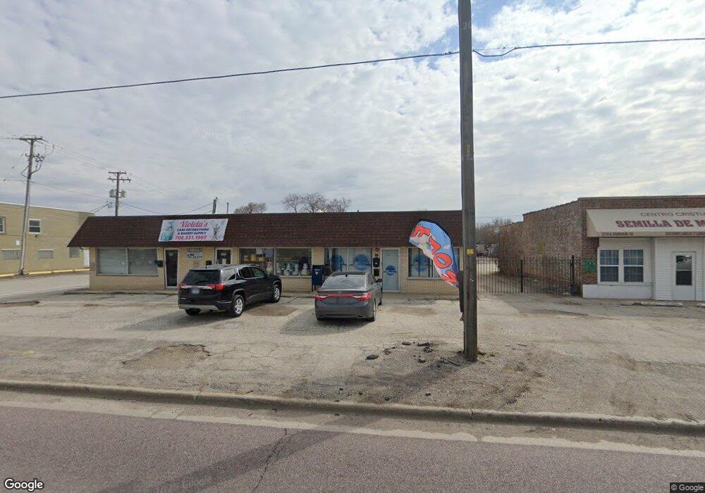
2321 N Mannheim Rd Melrose Park, IL 60164
Estimated Value: $494,000 - $556,000
--
Bed
2
Baths
--
Sq Ft
6,229
Sq Ft Lot
About This Home
This home is located at 2321 N Mannheim Rd, Melrose Park, IL 60164 and is currently estimated at $525,000. 2321 N Mannheim Rd is a home located in Cook County with nearby schools including Scott Elementary School, Mannheim Middle School, and West Leyden High School.
Ownership History
Date
Name
Owned For
Owner Type
Purchase Details
Closed on
Jan 31, 2017
Sold by
Phoenix Reo Llc
Bought by
The North Side Concourse Assn
Current Estimated Value
Purchase Details
Closed on
Apr 22, 2015
Sold by
Phoenix Npl Llc
Bought by
Phoenix Reo Llc
Purchase Details
Closed on
Mar 8, 2015
Sold by
Federal Deposit Insurance Corporation
Bought by
Phoenix Npl Llc
Purchase Details
Closed on
May 16, 2014
Sold by
Lakhia Nina
Bought by
The National Republic Bank Of Chicago
Create a Home Valuation Report for This Property
The Home Valuation Report is an in-depth analysis detailing your home's value as well as a comparison with similar homes in the area
Home Values in the Area
Average Home Value in this Area
Purchase History
| Date | Buyer | Sale Price | Title Company |
|---|---|---|---|
| The North Side Concourse Assn | $260,000 | Fidelity National Title | |
| Phoenix Reo Llc | $128,000 | Accommodation | |
| Phoenix Npl Llc | -- | Accommodation | |
| The National Republic Bank Of Chicago | -- | None Available |
Source: Public Records
Tax History Compared to Growth
Tax History
| Year | Tax Paid | Tax Assessment Tax Assessment Total Assessment is a certain percentage of the fair market value that is determined by local assessors to be the total taxable value of land and additions on the property. | Land | Improvement |
|---|---|---|---|---|
| 2024 | $6,999 | $22,910 | $2,808 | $20,102 |
| 2023 | $6,899 | $22,910 | $2,808 | $20,102 |
| 2022 | $6,899 | $22,910 | $2,808 | $20,102 |
| 2021 | $8,214 | $23,002 | $2,183 | $20,819 |
| 2020 | $8,085 | $23,002 | $2,183 | $20,819 |
| 2019 | $8,892 | $27,426 | $2,183 | $25,243 |
| 2018 | $9,113 | $25,303 | $1,871 | $23,432 |
| 2017 | $9,057 | $25,303 | $1,871 | $23,432 |
| 2016 | $8,526 | $25,303 | $1,871 | $23,432 |
| 2015 | $6,999 | $19,586 | $1,715 | $17,871 |
| 2014 | $6,884 | $19,586 | $1,715 | $17,871 |
| 2013 | -- | $19,586 | $1,715 | $17,871 |
Source: Public Records
Map
Nearby Homes
- 10302 W Palmer Ave
- 10417 W Palmer Ave
- 10510 W Fullerton Ave
- 10213 W Lyndale Ave
- 2118 Fairfield Ave
- 2520 Dora St
- 10131 Nevada Ave
- 10501 Schubert Ave
- 10115 Belden Ave
- 330 Major Dr
- 10459 Diversey Ave
- 2743 Bellwood Ave
- 248 E Lyndale Ave
- 9907 W Fullerton Ave
- 3201 Armitage Ave
- 250 Village Dr
- 2632 Westbrook Dr
- 2749 Scott St
- 10729 W Grand Ave
- 2003 Emerson Ave
- 2317 N Mannheim Rd
- 2317 N Mannheim Rd
- 2506 Mannheim Rd
- 10338 W Medill Ave
- 2340 N Mannheim Rd
- 10330 W Medill Ave
- 2315 N Mannheim Rd
- 2324 N Mannheim Rd
- 2308 N Mannheim Rd
- 10324 W Medill Ave
- 2318 N Mannheim Rd
- 10315 W Medill Ave
- 10320 W Medill Ave
- 10316 Belden Ave
- 10347 W Fullerton Ave
- 10316 W Medill Ave
- 10410 W Medill Ave
- 10312 Belden Ave
- 10407 W Medill Ave