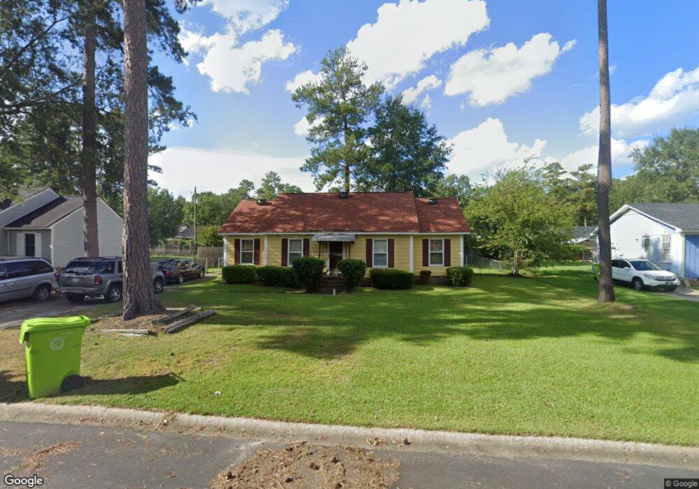
2321 Ramsgate Dr Columbia, SC 29210
Saint Andrews NeighborhoodEstimated Value: $178,000 - $205,698
4
Beds
2
Baths
1,418
Sq Ft
$136/Sq Ft
Est. Value
About This Home
This home is located at 2321 Ramsgate Dr, Columbia, SC 29210 and is currently estimated at $192,675, approximately $135 per square foot. 2321 Ramsgate Dr is a home located in Richland County with nearby schools including Sandel Elementary School, St. Andrews Middle School, and Columbia High School.
Ownership History
Date
Name
Owned For
Owner Type
Purchase Details
Closed on
Feb 2, 2004
Sold by
Fannie Mae
Bought by
Price Rodney N
Current Estimated Value
Home Financials for this Owner
Home Financials are based on the most recent Mortgage that was taken out on this home.
Original Mortgage
$66,400
Outstanding Balance
$36,744
Interest Rate
8.5%
Mortgage Type
Purchase Money Mortgage
Estimated Equity
$155,931
Purchase Details
Closed on
Nov 25, 2003
Sold by
Grant Kendra P and Moore Anne M
Bought by
Federal Mortgage Assn
Purchase Details
Closed on
Apr 25, 2002
Sold by
Moore Annie M and Moore Anne M
Bought by
Grant Kendra P
Home Financials for this Owner
Home Financials are based on the most recent Mortgage that was taken out on this home.
Original Mortgage
$89,900
Interest Rate
7.07%
Create a Home Valuation Report for This Property
The Home Valuation Report is an in-depth analysis detailing your home's value as well as a comparison with similar homes in the area
Home Values in the Area
Average Home Value in this Area
Purchase History
| Date | Buyer | Sale Price | Title Company |
|---|---|---|---|
| Price Rodney N | -- | -- | |
| Federal Mortgage Assn | $85,342 | -- | |
| Grant Kendra P | -- | -- | |
| Grant Kendra P | $89,900 | -- |
Source: Public Records
Mortgage History
| Date | Status | Borrower | Loan Amount |
|---|---|---|---|
| Open | Price Rodney N | $66,400 | |
| Previous Owner | Grant Kendra P | $89,900 |
Source: Public Records
Tax History
| Year | Tax Paid | Tax Assessment Tax Assessment Total Assessment is a certain percentage of the fair market value that is determined by local assessors to be the total taxable value of land and additions on the property. | Land | Improvement |
|---|---|---|---|---|
| 2024 | $897 | $100,600 | $0 | $0 |
| 2023 | $861 | $3,500 | $0 | $0 |
| 2022 | $926 | $87,500 | $9,200 | $78,300 |
| 2021 | $916 | $3,500 | $0 | $0 |
| 2020 | $930 | $3,500 | $0 | $0 |
| 2019 | $901 | $3,500 | $0 | $0 |
| 2018 | $837 | $3,270 | $0 | $0 |
| 2017 | $820 | $3,270 | $0 | $0 |
| 2016 | $817 | $3,270 | $0 | $0 |
| 2015 | $798 | $3,270 | $0 | $0 |
| 2014 | $777 | $81,800 | $0 | $0 |
| 2013 | -- | $3,270 | $0 | $0 |
Source: Public Records
Map
Nearby Homes
- 2309 Hillbeck Dr
- 2717 Diane Dr
- 1917 Chandler Ave
- 2135 Rolling Hills Rd
- 2103 Marley Dr
- 0 Marley Dr Unit 623584
- 1810 Saint Michaels Rd
- 1900 Rolling Hills Rd
- 529 Cambout St
- 1913 Grays Inn Rd
- 1705 Saint Michaels Rd
- 1908 Grays Inn Rd
- 321 Cambout St
- 1533 Westchester Dr
- 6509 Frost Ave
- 108 Waterford Dr
- 1650 Omarest Dr
- 232 Burbank St
- 1204 Old Manor Rd
- 201 Burbank St
- 2325 Ramsgate Dr
- 2317 Ramsgate Dr
- 2328 Hertford Dr
- 2324 Hertford Dr
- 2313 Ramsgate Dr
- 2329 Ramsgate Dr
- 2320 Hertford Dr
- 2332 Hertford Dr
- 2324 Ramsgate Dr
- 2320 Ramsgate Dr
- 2333 Ramsgate Dr
- 2328 Ramsgate Dr
- 2316 Ramsgate Dr
- 2336 Hertford Dr
- 2316 Hertford Dr
- 2309 Ramsgate Dr
- 2332 Ramsgate Dr
- 2312 Ramsgate Dr
- 2400 Hertford Dr
- 2329 Hertford Dr
Your Personal Tour Guide
Ask me questions while you tour the home.