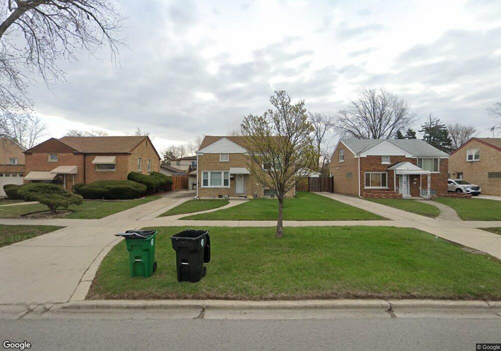
2321 S 25th Ave Broadview, IL 60155
Estimated Value: $280,845 - $327,000
3
Beds
1
Bath
1,265
Sq Ft
$236/Sq Ft
Est. Value
About This Home
This home is located at 2321 S 25th Ave, Broadview, IL 60155 and is currently estimated at $298,461, approximately $235 per square foot. 2321 S 25th Ave is a home located in Cook County with nearby schools including Lindop Elementary School and Proviso East High School.
Ownership History
Date
Name
Owned For
Owner Type
Purchase Details
Closed on
Apr 30, 2009
Sold by
Schneider Jean C
Bought by
Carter Jennifer
Current Estimated Value
Home Financials for this Owner
Home Financials are based on the most recent Mortgage that was taken out on this home.
Original Mortgage
$110,953
Outstanding Balance
$68,811
Interest Rate
4.83%
Mortgage Type
FHA
Estimated Equity
$229,650
Purchase Details
Closed on
Jun 1, 2000
Sold by
Schneider Hazel
Bought by
Schneider Jean C
Create a Home Valuation Report for This Property
The Home Valuation Report is an in-depth analysis detailing your home's value as well as a comparison with similar homes in the area
Home Values in the Area
Average Home Value in this Area
Purchase History
| Date | Buyer | Sale Price | Title Company |
|---|---|---|---|
| Carter Jennifer | $113,000 | First American Title Company | |
| Schneider Jean C | -- | -- |
Source: Public Records
Mortgage History
| Date | Status | Borrower | Loan Amount |
|---|---|---|---|
| Open | Carter Jennifer | $110,953 |
Source: Public Records
Tax History
| Year | Tax Paid | Tax Assessment Tax Assessment Total Assessment is a certain percentage of the fair market value that is determined by local assessors to be the total taxable value of land and additions on the property. | Land | Improvement |
|---|---|---|---|---|
| 2025 | $2,212 | $21,688 | $3,218 | $18,470 |
| 2024 | $2,212 | $21,688 | $3,218 | $18,470 |
| 2023 | $2,827 | $21,688 | $3,218 | $18,470 |
| 2022 | $2,827 | $17,000 | $2,340 | $14,660 |
| 2021 | $4,320 | $17,000 | $2,340 | $14,660 |
| 2020 | $4,111 | $17,000 | $2,340 | $14,660 |
| 2019 | $4,062 | $13,009 | $2,193 | $10,816 |
| 2018 | $4,063 | $13,009 | $2,193 | $10,816 |
| 2017 | $4,027 | $13,009 | $2,193 | $10,816 |
| 2016 | $2,769 | $8,815 | $2,047 | $6,768 |
| 2015 | $2,682 | $8,815 | $2,047 | $6,768 |
| 2014 | $3,147 | $10,004 | $2,047 | $7,957 |
| 2013 | $3,392 | $11,300 | $2,047 | $9,253 |
Source: Public Records
Map
Nearby Homes
- 2341 S 24th Ave
- 2247 S 21st Ave
- 2111 S 24th Ave
- 2116 S 21st Ave
- 1433 Bristol Ave
- 1457 Bristol Ave
- 2007 S 25th Ave
- 1449 Norfolk Ave
- 1926 S 24th Ave
- 1925 S 22nd Ave
- 2510 S 17th Ave
- 2433 S 17th Ave
- 1908 S 23rd Ave
- 1910 S 22nd Ave
- 1643 Manchester Ave
- 1636 Manchester Ave
- 1839 S 22nd Ave
- 1909 S 20th Ave
- 1908 S 18th Ave
- 814 Norfolk Ave
- 2317 S 25th Ave
- 2313 S 25th Ave
- 2329 S 25th Ave
- 2320 S 24th Ave
- 2324 S 24th Ave
- 2316 S 24th Ave
- 2309 S 25th Ave
- 2333 S 25th Ave
- 2328 S 24th Ave
- 2312 S 24th Ave
- 2332 S 24th Ave
- 2308 S 24th Ave
- 2337 S 25th Ave
- 2305 S 25th Ave
- 2336 S 24th Ave
- 2304 S 24th Ave
- 2341 S 25th Ave
- 2301 S 25th Ave
- 2340 S 24th Ave
- 2300 S 24th Ave
Your Personal Tour Guide
Ask me questions while you tour the home.