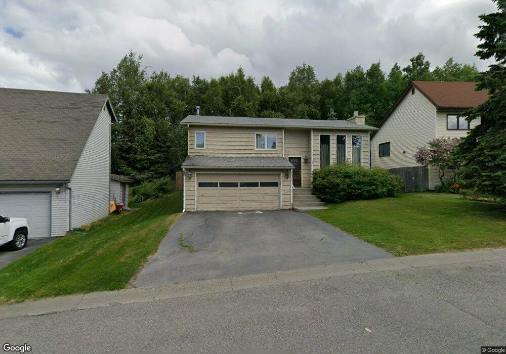
2321 Stonebridge Cir Anchorage, AK 99507
Abbott Loop NeighborhoodEstimated Value: $467,577 - $586,000
4
Beds
2
Baths
2,060
Sq Ft
$250/Sq Ft
Est. Value
About This Home
This home is located at 2321 Stonebridge Cir, Anchorage, AK 99507 and is currently estimated at $514,894, approximately $249 per square foot. 2321 Stonebridge Cir is a home located in Anchorage Municipality with nearby schools including Spring Hill Elementary School, Hanshew Middle School, and Service High School.
Ownership History
Date
Name
Owned For
Owner Type
Purchase Details
Closed on
Sep 24, 2007
Sold by
Blackshear James R and Blackshear Elizabeth
Bought by
Blackshear James W and Blackshear Heather L
Current Estimated Value
Home Financials for this Owner
Home Financials are based on the most recent Mortgage that was taken out on this home.
Original Mortgage
$242,000
Outstanding Balance
$153,218
Interest Rate
6.57%
Mortgage Type
New Conventional
Estimated Equity
$361,676
Purchase Details
Closed on
May 17, 1993
Sold by
Severson William E and Severson Amiel J
Bought by
Luchini Shaun M and Luchini Dawn M
Home Financials for this Owner
Home Financials are based on the most recent Mortgage that was taken out on this home.
Original Mortgage
$126,072
Interest Rate
7.58%
Mortgage Type
FHA
Create a Home Valuation Report for This Property
The Home Valuation Report is an in-depth analysis detailing your home's value as well as a comparison with similar homes in the area
Home Values in the Area
Average Home Value in this Area
Purchase History
| Date | Buyer | Sale Price | Title Company |
|---|---|---|---|
| Blackshear James W | -- | None Available | |
| Luchini Shaun M | -- | -- |
Source: Public Records
Mortgage History
| Date | Status | Borrower | Loan Amount |
|---|---|---|---|
| Open | Blackshear James W | $242,000 | |
| Closed | Luchini Shaun M | $126,072 |
Source: Public Records
Tax History Compared to Growth
Tax History
| Year | Tax Paid | Tax Assessment Tax Assessment Total Assessment is a certain percentage of the fair market value that is determined by local assessors to be the total taxable value of land and additions on the property. | Land | Improvement |
|---|---|---|---|---|
| 2025 | $6,975 | $465,600 | $93,700 | $371,900 |
| 2024 | $6,975 | $432,000 | $93,700 | $338,300 |
| 2023 | $6,754 | $396,600 | $93,700 | $302,900 |
| 2022 | $6,517 | $387,000 | $93,700 | $293,300 |
| 2021 | $6,251 | $346,900 | $93,700 | $253,200 |
| 2020 | $6,040 | $355,300 | $93,700 | $261,600 |
| 2019 | $5,621 | $343,600 | $93,700 | $249,900 |
| 2018 | $5,501 | $335,400 | $89,600 | $245,800 |
| 2017 | $5,489 | $350,500 | $89,600 | $260,900 |
| 2016 | $4,582 | $337,800 | $86,200 | $251,600 |
| 2015 | $4,582 | $329,100 | $86,200 | $242,900 |
| 2014 | $4,582 | $314,600 | $86,200 | $228,400 |
Source: Public Records
Map
Nearby Homes
- 2060 Sturbridge Cir
- 10359 Valley Park Dr
- 1914 Sturbridge Ct Unit 3
- 9730 Vanguard Dr Unit 12
- 8000 Independence Park Dr
- 1917 Colony Place Unit 33
- 10260 Jamestown Dr Unit A8
- 9710 Vanguard Dr Unit 80
- 9700 Vanguard Dr Unit 70
- 1900-1941 Marthas Vineyard Cir
- 10261 Arborvitae Dr
- 10285 Arborvitae Dr
- 1611 Betula Cir
- 9599 Brayton Dr Unit 422
- 9130 Golovin St
- 267 Loop Unit 267
- 1510 Elcadore Dr Unit 134
- 1540 Elcadore Dr Unit 125
- 10009 Thimble Berry Dr
- 9499 Brayton Dr Unit 39
- 2331 Stonebridge Cir
- 2311 Stonebridge Cir
- 2341 Stonebridge Cir
- 2330 Stonebridge Cir
- 9937 Reliance Dr
- 9943 Reliance Dr
- 2340 Stonebridge Cir
- 9931 Reliance Dr
- 2351 Stonebridge Cir
- 2350 Stonebridge Cir
- 9925 Reliance Dr
- 2300 Colony Loop
- 2311 Yorktown Cir
- 2310 Colony Loop
- 2360 Stonebridge Cir
- 2230 Colony Loop
- 9919 Reliance Dr
- 2321 Yorktown Cir
- 2320 Colony Loop
- 2361 Stonebridge Cir