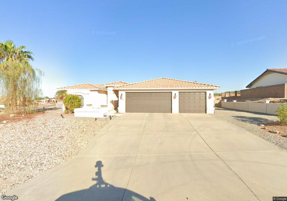
2321 Tee Dr Lake Havasu City, AZ 86406
Estimated Value: $616,651 - $853,000
4
Beds
3
Baths
2,033
Sq Ft
$365/Sq Ft
Est. Value
About This Home
This home is located at 2321 Tee Dr, Lake Havasu City, AZ 86406 and is currently estimated at $741,913, approximately $364 per square foot. 2321 Tee Dr is a home located in Mohave County with nearby schools including Starline Elementary School, Thunderbolt Middle School, and Lake Havasu High School.
Ownership History
Date
Name
Owned For
Owner Type
Purchase Details
Closed on
Jul 28, 2022
Sold by
Raymond Gorman James
Bought by
James Raymond Gorman & Noreen Marie Gorman Re
Current Estimated Value
Purchase Details
Closed on
Apr 8, 2004
Sold by
Sampson Richard L and Sampson Helen C
Bought by
Gorman James R and Gorman Noreen M
Home Financials for this Owner
Home Financials are based on the most recent Mortgage that was taken out on this home.
Original Mortgage
$318,400
Interest Rate
5.5%
Mortgage Type
New Conventional
Create a Home Valuation Report for This Property
The Home Valuation Report is an in-depth analysis detailing your home's value as well as a comparison with similar homes in the area
Home Values in the Area
Average Home Value in this Area
Purchase History
| Date | Buyer | Sale Price | Title Company |
|---|---|---|---|
| James Raymond Gorman & Noreen Marie Gorman Re | -- | Heather C Wellborn Pc | |
| Gorman James R | $398,000 | Transnation Title Ins Co |
Source: Public Records
Mortgage History
| Date | Status | Borrower | Loan Amount |
|---|---|---|---|
| Previous Owner | Gorman James R | $318,400 |
Source: Public Records
Tax History Compared to Growth
Tax History
| Year | Tax Paid | Tax Assessment Tax Assessment Total Assessment is a certain percentage of the fair market value that is determined by local assessors to be the total taxable value of land and additions on the property. | Land | Improvement |
|---|---|---|---|---|
| 2026 | -- | -- | -- | -- |
| 2025 | $2,190 | $55,528 | $0 | $0 |
| 2024 | $2,190 | $59,742 | $0 | $0 |
| 2023 | $2,190 | $49,608 | $0 | $0 |
| 2022 | $2,109 | $44,823 | $0 | $0 |
| 2021 | $2,336 | $39,330 | $0 | $0 |
| 2019 | $2,218 | $36,772 | $0 | $0 |
| 2018 | $2,142 | $34,930 | $0 | $0 |
| 2017 | $2,105 | $34,660 | $0 | $0 |
| 2016 | $1,859 | $30,244 | $0 | $0 |
| 2015 | $1,808 | $25,579 | $0 | $0 |
Source: Public Records
Map
Nearby Homes
- 2371 Stroke Dr
- 2295 Daytona Loop
- 209 Snead Dr
- 2168 Daytona Ln
- 2175 Snead Dr Unit 4
- 2121 Magnolia Dr Unit 1
- 2121 Magnolia Dr Unit 16
- 111 Bunker Dr
- 2100 Swanson Ave Unit 103
- 2100 Swanson Ave Unit 201
- 2100 Swanson Ave Unit 208
- 321 Acoma Blvd S
- 2480 Stroke
- 169 Locust Dr
- 2220 Snead Dr
- 2180 Snead Dr
- 100 Mulberry Ave Unit 210
- 100 Mulberry Ave Unit 113
- 2190 Snead Dr
- 2207 Oliver Ln