Estimated Value: $429,000 - $535,483
3
Beds
1
Bath
3,704
Sq Ft
$129/Sq Ft
Est. Value
About This Home
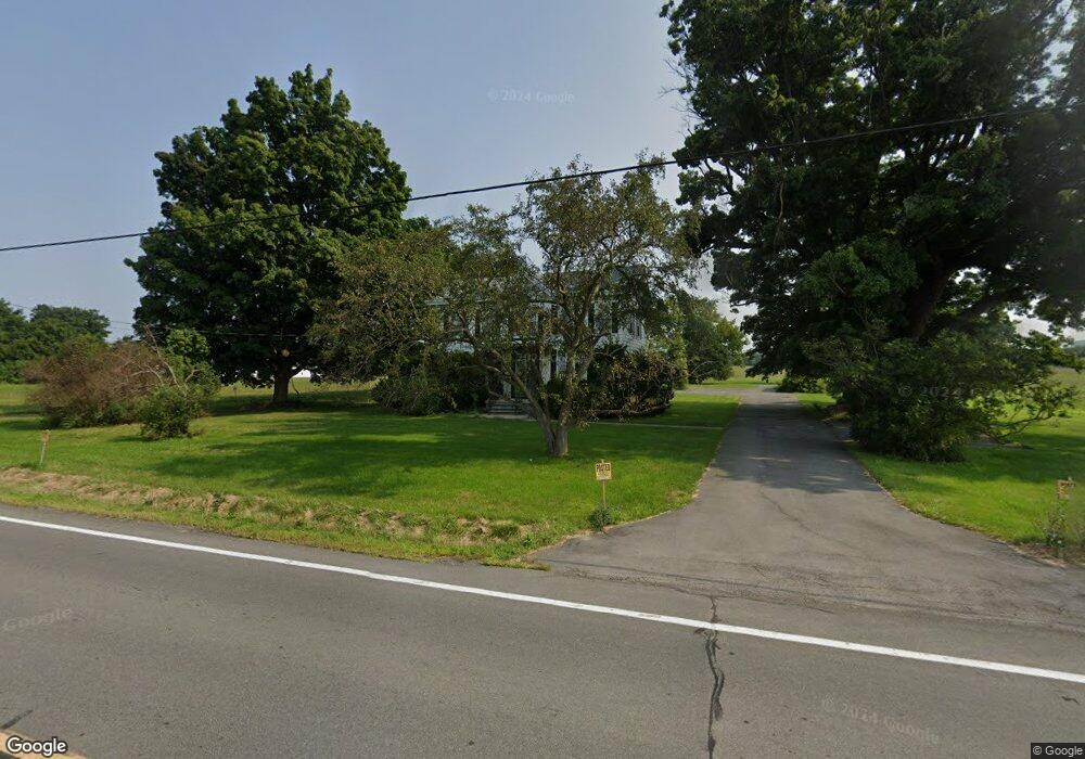
This home is located at 2323 State Route 5, Utica, NY 13502 and is currently estimated at $478,161, approximately $129 per square foot. 2323 State Route 5 is a home located in Herkimer County with nearby schools including Whitesboro High School, Utica Academy of Science Charter School, and Christian Heritage School.
Ownership History
Date
Name
Owned For
Owner Type
Purchase Details
Closed on
Jun 25, 2024
Sold by
Digristina Farm Llc
Bought by
Herkimer Cnty Indu Dev Ag
Current Estimated Value
Purchase Details
Closed on
Nov 3, 2021
Sold by
Digristina Leonard
Bought by
Digristina Farm Llc
Purchase Details
Closed on
Aug 9, 2021
Sold by
Digristina Leonard
Bought by
Digristina Farm Llc
Purchase Details
Closed on
Apr 30, 2009
Sold by
Digristina Leo
Bought by
Digristina Family Trust
Create a Home Valuation Report for This Property
The Home Valuation Report is an in-depth analysis detailing your home's value as well as a comparison with similar homes in the area
Home Values in the Area
Average Home Value in this Area
Purchase History
| Date | Buyer | Sale Price | Title Company |
|---|---|---|---|
| Herkimer Cnty Indu Dev Ag | -- | None Available | |
| Herkimer Cnty Indu Dev Ag | -- | None Available | |
| Digristina Farm Llc | -- | None Available | |
| Digristina Farm Llc | -- | None Available | |
| Digristina Farm Llc | -- | None Available | |
| Digristina Family Trust | -- | -- | |
| Digristina Family Trust | -- | -- |
Source: Public Records
Tax History Compared to Growth
Tax History
| Year | Tax Paid | Tax Assessment Tax Assessment Total Assessment is a certain percentage of the fair market value that is determined by local assessors to be the total taxable value of land and additions on the property. | Land | Improvement |
|---|---|---|---|---|
| 2024 | $8,789 | $256,800 | $86,000 | $170,800 |
| 2023 | $10,063 | $256,800 | $86,000 | $170,800 |
| 2022 | $9,549 | $256,800 | $86,000 | $170,800 |
| 2021 | $9,639 | $256,800 | $86,000 | $170,800 |
| 2020 | $7,007 | $256,800 | $86,000 | $170,800 |
| 2019 | $7,115 | $256,800 | $86,000 | $170,800 |
| 2018 | $7,147 | $256,800 | $86,000 | $170,800 |
| 2017 | $7,081 | $256,800 | $86,000 | $170,800 |
| 2016 | $7,135 | $256,800 | $86,000 | $170,800 |
| 2015 | -- | $256,800 | $86,000 | $170,800 |
| 2014 | -- | $256,800 | $86,000 | $170,800 |
Source: Public Records
Map
Nearby Homes
- 164 Rodeo Dr
- 153 Rodeo Dr
- 617 Kilkenny Dr
- 645 Kilkenny Dr
- 11402 Cosby Manor Rd
- 422 Donegal Dr
- 2702 Southside Rd
- 5635 Mapleton Dr
- 125 Windsor Cir
- 128 Concord Dr
- 5720 Mapleton Dr
- 170 Concord Dr
- 239 Colonial Cir
- 606 Sycamore Ln
- 1071 Center Rd
- 516 Woodburne Dr
- 2810 Southside Rd
- 1506 Bette Rd
- 1427 Fairwood Dr
- 403 Brody Dr
- 2306 State Route 5
- 2297 State Route 5
- 2296 State Route 5
- 106 Newport Rd
- 108 Newport Rd
- 2292 State Route 5
- 2357 State Route 5
- 107 Newport Rd
- 111 Newport Rd
- 105 Newport Rd
- 121 Newport Rd
- 132 Newport Rd
- 2365 State Route 5
- 134 Newport Rd
- 127 Newport Rd
- 131 Newport Rd
- 138 Newport Rd
- 140 Newport Rd
- 142 Newport Rd
- 310 Wood Ln