2324 Buckholt St Unit 963 Pearland, TX 77581
West Friendswood NeighborhoodEstimated Value: $595,000 - $1,044,000
--
Bed
1
Bath
3,629
Sq Ft
$208/Sq Ft
Est. Value
About This Home
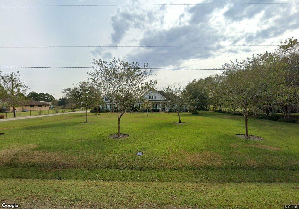
This home is located at 2324 Buckholt St Unit 963, Pearland, TX 77581 and is currently estimated at $754,846, approximately $208 per square foot. 2324 Buckholt St Unit 963 is a home located in Brazoria County with nearby schools including Rustic Oak Elementary School, Alexander Middle School, and Pearland Junior High School East.
Ownership History
Date
Name
Owned For
Owner Type
Purchase Details
Closed on
Dec 28, 2006
Sold by
Burk Della H
Bought by
Burk Billy and Burk Ada
Current Estimated Value
Home Financials for this Owner
Home Financials are based on the most recent Mortgage that was taken out on this home.
Original Mortgage
$332,850
Outstanding Balance
$206,341
Interest Rate
6.1%
Mortgage Type
Purchase Money Mortgage
Estimated Equity
$548,505
Purchase Details
Closed on
Oct 20, 2006
Sold by
Burk Della H
Bought by
Burk Billy and Burk Ada
Create a Home Valuation Report for This Property
The Home Valuation Report is an in-depth analysis detailing your home's value as well as a comparison with similar homes in the area
Home Values in the Area
Average Home Value in this Area
Purchase History
| Date | Buyer | Sale Price | Title Company |
|---|---|---|---|
| Burk Billy | -- | Stewart Title | |
| Burk Billy | -- | None Available |
Source: Public Records
Mortgage History
| Date | Status | Borrower | Loan Amount |
|---|---|---|---|
| Open | Burk Billy | $332,850 |
Source: Public Records
Tax History Compared to Growth
Tax History
| Year | Tax Paid | Tax Assessment Tax Assessment Total Assessment is a certain percentage of the fair market value that is determined by local assessors to be the total taxable value of land and additions on the property. | Land | Improvement |
|---|---|---|---|---|
| 2025 | $3,213 | $679,076 | $312,010 | $439,400 |
| 2023 | $3,213 | $561,220 | $277,260 | $481,300 |
| 2022 | $9,601 | $510,200 | $213,694 | $296,506 |
| 2021 | $7,177 | $366,800 | $97,500 | $269,300 |
| 2020 | $7,009 | $358,200 | $90,000 | $268,200 |
| 2019 | $7,393 | $371,610 | $90,000 | $281,610 |
| 2018 | $6,866 | $343,000 | $97,500 | $245,500 |
| 2017 | $6,865 | $340,000 | $75,000 | $265,000 |
| 2016 | $6,330 | $332,000 | $70,000 | $262,000 |
| 2015 | $4,288 | $285,000 | $50,000 | $235,000 |
| 2014 | $4,288 | $285,000 | $50,000 | $235,000 |
Source: Public Records
Map
Nearby Homes
- 1605 Gatecreek Dr
- 3521 Dixie Farm Rd
- 1540 Hastings Friendswood Rd
- 1809 Oakland Cir
- 1813 Oak Wood Dr E
- 1811 Oakbrook Cir
- 3902 Oak Wood Dr N
- 0 Cr 124 Unit 13541782
- 1814 Oak Cluster Cir
- 1605 Crown Oaks Ct
- 1621 Pine Crest Dr
- 1510 Pine Creek Dr
- 2015 Stonecrest Way
- 3302 Dixie Farm Rd
- 1804 Oakbranch Dr
- 1917 Oak Shire Dr
- 1422 Pine Forest Dr
- 3522 Pine Chase Dr
- 3703 Longherridge Dr
- 17810 County Road 125
- 2320 Buckholt St Unit 963
- 2402 Buckholt St Unit 963
- 3823 Buckholt St
- 2310 Buckholt St
- 3675 Buckholt St Unit 963
- 2403 Buckholt St
- 3774 Buckholt St
- 2226 Buckholt St Unit 963
- 1524 Westfield St Unit 253
- 2311 Buckholt St
- 3820 Buckholt St
- 2223 Buckholt St
- 2323 County Road 391
- 3812 Buckholt St
- 2222 Buckholt St
- 2323 Stevenson Rd Unit 391
- 1514 Westfield St
- 2407 County Road 391
- 2218 Buckholt St Unit 963
- 1534 Westfield St Unit 253