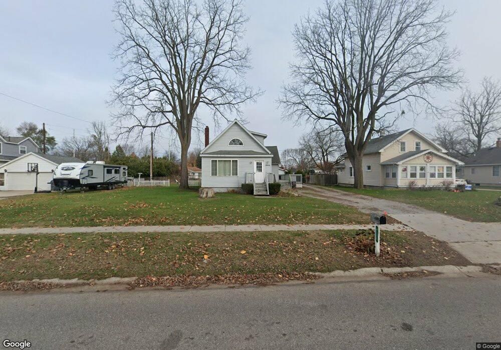
2326 Riverside Dr Port Huron, MI 48060
Estimated Value: $222,322 - $250,000
3
Beds
2
Baths
1,668
Sq Ft
$140/Sq Ft
Est. Value
About This Home
This home is located at 2326 Riverside Dr, Port Huron, MI 48060 and is currently estimated at $233,581, approximately $140 per square foot. 2326 Riverside Dr is a home located in St. Clair County with nearby schools including H.D. Crull Elementary School, Holland Woods Middle School, and Port Huron Northern High School.
Ownership History
Date
Name
Owned For
Owner Type
Purchase Details
Closed on
Jul 24, 2008
Sold by
Snowden Barbara and Staley Mark
Bought by
Deutsche Bank National Trust Company
Current Estimated Value
Purchase Details
Closed on
Jun 2, 2006
Sold by
Snowden Barbara
Bought by
Snowden Barbara and Staley Mark
Home Financials for this Owner
Home Financials are based on the most recent Mortgage that was taken out on this home.
Original Mortgage
$147,600
Interest Rate
8.99%
Mortgage Type
New Conventional
Create a Home Valuation Report for This Property
The Home Valuation Report is an in-depth analysis detailing your home's value as well as a comparison with similar homes in the area
Home Values in the Area
Average Home Value in this Area
Purchase History
| Date | Buyer | Sale Price | Title Company |
|---|---|---|---|
| Deutsche Bank National Trust Company | $88,400 | None Available | |
| Snowden Barbara | -- | Crossroads Title Agency |
Source: Public Records
Mortgage History
| Date | Status | Borrower | Loan Amount |
|---|---|---|---|
| Previous Owner | Snowden Barbara | $147,600 |
Source: Public Records
Tax History Compared to Growth
Tax History
| Year | Tax Paid | Tax Assessment Tax Assessment Total Assessment is a certain percentage of the fair market value that is determined by local assessors to be the total taxable value of land and additions on the property. | Land | Improvement |
|---|---|---|---|---|
| 2025 | $2,892 | $89,900 | $0 | $0 |
| 2024 | $2,571 | $83,200 | $0 | $0 |
| 2023 | $2,435 | $75,200 | $0 | $0 |
| 2022 | $2,476 | $66,900 | $0 | $0 |
| 2021 | $2,364 | $56,300 | $0 | $0 |
| 2020 | $2,374 | $53,500 | $53,500 | $0 |
| 2019 | $2,331 | $40,400 | $0 | $0 |
| 2018 | $2,278 | $40,400 | $0 | $0 |
| 2017 | $2,091 | $36,100 | $0 | $0 |
| 2016 | $1,867 | $36,100 | $0 | $0 |
| 2015 | $1,832 | $35,000 | $35,000 | $0 |
| 2014 | $1,832 | $35,000 | $35,000 | $0 |
| 2013 | -- | $34,400 | $0 | $0 |
Source: Public Records
Map
Nearby Homes
- 2215 Hancock St
- 1907 Riverside Dr
- 1819 Riverside Dr
- 2838 Elmwood St
- 2549 Riverwood Dr
- 2806 Woodstock Dr
- 2812 19th Ave
- 0000 Water St
- 0000 Campau Ave
- V/L #4 Water St
- V/L #6 Water St
- V/L #5 Water St
- V/L #8 Water St
- V/L #3 Water St
- 1649 Whipple St
- 1620 McBrady St
- 2857 Riverside Dr
- 2610 Strawberry Ln
- 1434 Schumaker St
- 1531 Robinson St
- 2224 Riverside Dr
- 2306 Elmwood St
- 2222 Riverside Dr
- 2336 Riverside Dr
- 2316 Elmwood St
- 2318 Elmwood St
- 2230 Elmwood St
- 2220 Riverside Dr
- 2322 Elmwood St
- 2342 Riverside Dr
- 2224 Elmwood St
- 2323 18th Ave Unit Bldg-Unit
- 2323 18th Ave
- 2337 18th Ave
- 2350 Riverside Dr
- 2218 Riverside Dr
- 2341 18th Ave
- 2319 18th Ave
- 2305 Elmwood St
- 2313 18th Ave