Estimated Value: $1,188,376 - $1,711,000
3
Beds
4
Baths
4,788
Sq Ft
$281/Sq Ft
Est. Value
About This Home
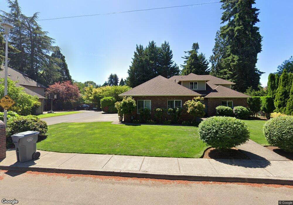
This home is located at 2327 N Maple St, Canby, OR 97013 and is currently estimated at $1,347,594, approximately $281 per square foot. 2327 N Maple St is a home located in Clackamas County with nearby schools including Howard Eccles Elementary School, Baker Prairie Middle School, and Canby High School.
Ownership History
Date
Name
Owned For
Owner Type
Purchase Details
Closed on
Jul 10, 2020
Sold by
Roberts Todd E and Mccauley Connie M
Bought by
Roberts Todd E and Mccauley Connie M
Current Estimated Value
Purchase Details
Closed on
Oct 24, 2005
Sold by
Spencer Wayne S and Spencer Cheryl L
Bought by
Roberts Todd E and Mccauley Connie M
Home Financials for this Owner
Home Financials are based on the most recent Mortgage that was taken out on this home.
Original Mortgage
$450,000
Outstanding Balance
$227,755
Interest Rate
5%
Mortgage Type
Fannie Mae Freddie Mac
Estimated Equity
$1,119,839
Create a Home Valuation Report for This Property
The Home Valuation Report is an in-depth analysis detailing your home's value as well as a comparison with similar homes in the area
Home Values in the Area
Average Home Value in this Area
Purchase History
| Date | Buyer | Sale Price | Title Company |
|---|---|---|---|
| Roberts Todd E | -- | None Available | |
| Roberts Todd E | $740,000 | Fidelity Natl Title Co Of Or |
Source: Public Records
Mortgage History
| Date | Status | Borrower | Loan Amount |
|---|---|---|---|
| Open | Roberts Todd E | $450,000 |
Source: Public Records
Tax History Compared to Growth
Tax History
| Year | Tax Paid | Tax Assessment Tax Assessment Total Assessment is a certain percentage of the fair market value that is determined by local assessors to be the total taxable value of land and additions on the property. | Land | Improvement |
|---|---|---|---|---|
| 2025 | $12,783 | $893,246 | -- | -- |
| 2024 | $12,428 | $867,230 | -- | -- |
| 2023 | $12,428 | $841,971 | $0 | $0 |
| 2022 | $11,363 | $817,448 | $0 | $0 |
| 2021 | $10,920 | $793,639 | $0 | $0 |
| 2020 | $10,755 | $770,524 | $0 | $0 |
| 2019 | $10,193 | $748,082 | $0 | $0 |
| 2018 | $9,983 | $726,293 | $0 | $0 |
| 2017 | $9,740 | $705,139 | $0 | $0 |
| 2016 | $9,404 | $684,601 | $0 | $0 |
| 2015 | $9,070 | $664,661 | $0 | $0 |
| 2014 | $8,692 | $645,302 | $0 | $0 |
Source: Public Records
Map
Nearby Homes
- 2152 N Laurelwood St
- 1200 NE Territorial Rd Unit 93
- 1751 N Laurelwood Loop
- 832 NE 17th Ave
- 838 NE 17th Ave
- 844 NE 17th Ave
- 1762 N Oak St
- 878 NE 17th Ave
- 952 NE 17th Ave
- 853 NE 17th Ave
- 947 NE 17th Ave
- 1009 NE 17th Ave
- 1258 NE 17th Ave
- 312 NE 14th Ave
- 1721 N Hyssop St
- 1422 NE 18th Place
- 860 NE 14th Ave
- 1552 NE 19th Loop
- 1614 NW 16th Ave
- 187 NE 14th Ave
- 2389 N Maple St
- 2319 N Maple St
- 2341 N Maple St
- 2307 N Maple St
- 625 NE 22nd Ave
- 2247 N Maple St
- 2217 N Maple St
- 609 NE 22nd Ave
- 720 NE 23rd Ave
- 690 NE 22nd Ave
- 760 NE 23rd Ave
- 575 NE 22nd Ave
- 715 NE 23rd Ave
- 750 NE 22nd Ave
- 810 NE 23rd Ave
- 785 NE 23rd Ave
- 645 NE 22nd Ave
- 675 NE 22nd Ave
- 695 NE 22nd Ave
- 641 NE 22nd Ave