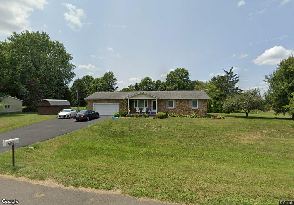
233 Barr Dr SW Lancaster, OH 43130
Estimated Value: $294,540 - $315,000
3
Beds
2
Baths
1,502
Sq Ft
$201/Sq Ft
Est. Value
About This Home
This home is located at 233 Barr Dr SW, Lancaster, OH 43130 and is currently estimated at $302,135, approximately $201 per square foot. 233 Barr Dr SW is a home located in Fairfield County with nearby schools including General Sherman Junior High School, Lancaster High School, and St Mary Elementary School.
Ownership History
Date
Name
Owned For
Owner Type
Purchase Details
Closed on
Jun 13, 2007
Sold by
Butts Dale R and Butts Melva A
Bought by
Kiser Kyle C and Kiser Shannon L
Current Estimated Value
Home Financials for this Owner
Home Financials are based on the most recent Mortgage that was taken out on this home.
Original Mortgage
$116,000
Outstanding Balance
$71,018
Interest Rate
6.2%
Mortgage Type
Purchase Money Mortgage
Estimated Equity
$231,117
Purchase Details
Closed on
Sep 3, 2003
Sold by
Butts Mavis M
Bought by
Butts Dale R and Butts Kenneth G
Create a Home Valuation Report for This Property
The Home Valuation Report is an in-depth analysis detailing your home's value as well as a comparison with similar homes in the area
Home Values in the Area
Average Home Value in this Area
Purchase History
| Date | Buyer | Sale Price | Title Company |
|---|---|---|---|
| Kiser Kyle C | $145,000 | Valmer Land Title Agency | |
| Butts Dale R | -- | None Available |
Source: Public Records
Mortgage History
| Date | Status | Borrower | Loan Amount |
|---|---|---|---|
| Open | Kiser Kyle C | $116,000 |
Source: Public Records
Tax History Compared to Growth
Tax History
| Year | Tax Paid | Tax Assessment Tax Assessment Total Assessment is a certain percentage of the fair market value that is determined by local assessors to be the total taxable value of land and additions on the property. | Land | Improvement |
|---|---|---|---|---|
| 2024 | $5,874 | $63,500 | $8,260 | $55,240 |
| 2023 | $2,378 | $63,500 | $8,260 | $55,240 |
| 2022 | $2,410 | $63,500 | $8,260 | $55,240 |
| 2021 | $1,976 | $48,310 | $8,260 | $40,050 |
| 2020 | $1,854 | $48,310 | $8,260 | $40,050 |
| 2019 | $1,722 | $48,310 | $8,260 | $40,050 |
| 2018 | $1,632 | $40,570 | $8,260 | $32,310 |
| 2017 | $1,633 | $43,260 | $8,260 | $35,000 |
| 2016 | $1,591 | $43,260 | $8,260 | $35,000 |
| 2015 | $1,480 | $41,690 | $8,260 | $33,430 |
| 2014 | $1,405 | $41,690 | $8,260 | $33,430 |
| 2013 | $1,405 | $41,690 | $8,260 | $33,430 |
Source: Public Records
Map
Nearby Homes
- 0 W Fair Ave
- 2412 W Fair Ave
- 842 Lambton Cir W
- 958 Thorn Hill Place
- 957 Governor's Cir
- 2610 Misty Meadows Ave
- 204 Western St
- 185 9th St
- 5701 Lancaster-Circleville Rd SW
- 599 Front St
- 3 1st St
- 371 12th St
- 255 9th St
- 71 3rd St
- 367 12th St
- 282 14th St
- 147 Shawnee Dr
- 331 16th St
- 1829 Shoshone Dr
- 635 Brannon Dr
- 217 Barr Dr SW
- 2867 Thrush Ave SW
- 234 Barr Dr SW
- 311 Barr Dr SW
- 218 Barr Dr SW
- 2866 Thrush Ave SW
- 201 Barr Dr SW
- 2905 Thrush Ave SW
- 310 Barr Dr SW
- 202 Barr Dr SW
- 331 Barr Dr SW
- 2904 Thrush Ave SW
- 328 Barr Dr SW
- 2925 Thrush Ave SW
- 2924 Thrush Ave SW
- 2893 Mountview Dr SW
- 400 Barr Dr SW
- 2915 Mount View Dr SW
- 2915 Mountview Dr SW
- 2951 Thrush Ave SW