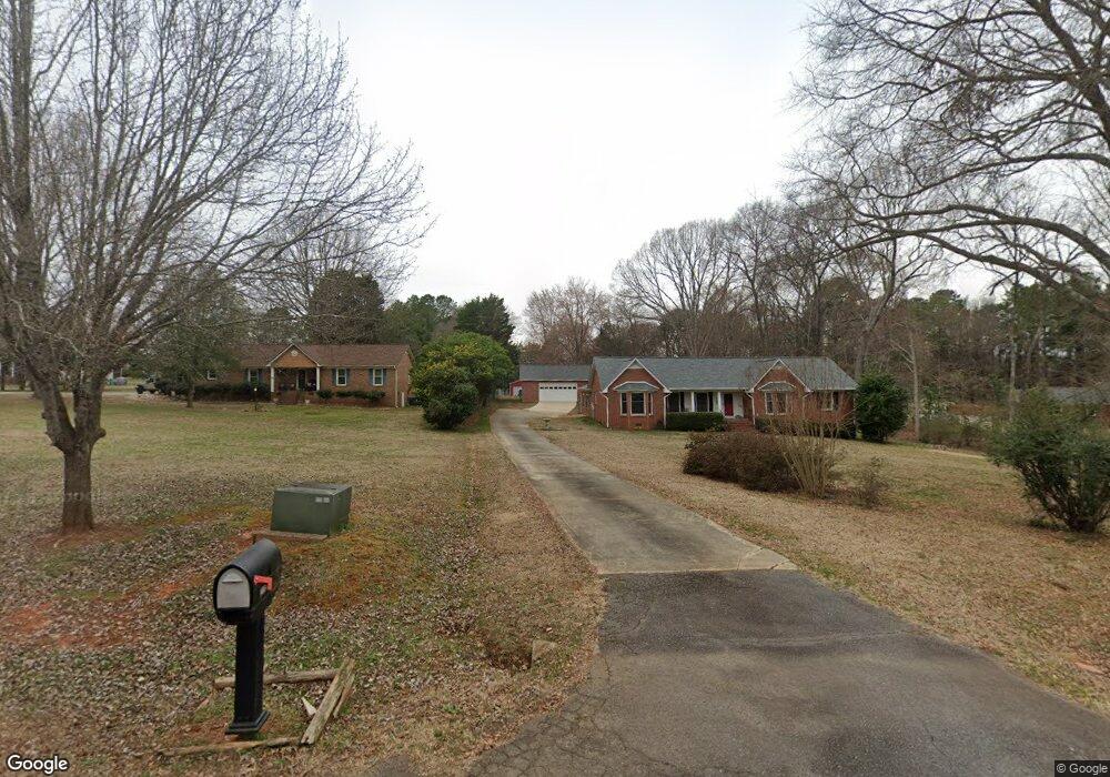
233 Campsite Rd Rock Hill, SC 29732
Estimated Value: $419,000 - $536,000
--
Bed
--
Bath
2,616
Sq Ft
$183/Sq Ft
Est. Value
About This Home
This home is located at 233 Campsite Rd, Rock Hill, SC 29732 and is currently estimated at $477,885, approximately $182 per square foot. 233 Campsite Rd is a home located in York County with nearby schools including Old Pointe Elementary School, Dutchman Creek Middle School, and Northwestern High School.
Ownership History
Date
Name
Owned For
Owner Type
Purchase Details
Closed on
Aug 22, 2005
Sold by
Primacy Closing Corp
Bought by
Woodham Dianna and Woodham Clarence
Current Estimated Value
Home Financials for this Owner
Home Financials are based on the most recent Mortgage that was taken out on this home.
Original Mortgage
$140,000
Outstanding Balance
$73,449
Interest Rate
5.64%
Mortgage Type
New Conventional
Estimated Equity
$404,436
Purchase Details
Closed on
Mar 19, 2003
Sold by
Rice Richard L and Rice Ellen H
Bought by
Clugston John L and Clugston Karen L
Create a Home Valuation Report for This Property
The Home Valuation Report is an in-depth analysis detailing your home's value as well as a comparison with similar homes in the area
Home Values in the Area
Average Home Value in this Area
Purchase History
| Date | Buyer | Sale Price | Title Company |
|---|---|---|---|
| Woodham Dianna | $210,000 | -- | |
| Primacy Closing Corp | $210,000 | -- | |
| Clugston John L | $180,000 | -- |
Source: Public Records
Mortgage History
| Date | Status | Borrower | Loan Amount |
|---|---|---|---|
| Open | Primacy Closing Corp | $140,000 |
Source: Public Records
Tax History Compared to Growth
Tax History
| Year | Tax Paid | Tax Assessment Tax Assessment Total Assessment is a certain percentage of the fair market value that is determined by local assessors to be the total taxable value of land and additions on the property. | Land | Improvement |
|---|---|---|---|---|
| 2024 | $1,138 | $10,119 | $1,564 | $8,555 |
| 2023 | $1,454 | $10,119 | $1,564 | $8,555 |
| 2022 | $1,459 | $10,119 | $1,564 | $8,555 |
| 2021 | -- | $10,119 | $1,564 | $8,555 |
| 2020 | $1,456 | $10,119 | $0 | $0 |
| 2019 | $1,326 | $8,800 | $0 | $0 |
| 2018 | $1,318 | $8,800 | $0 | $0 |
| 2017 | $1,243 | $8,800 | $0 | $0 |
| 2016 | $1,219 | $8,800 | $0 | $0 |
| 2014 | $1,134 | $8,800 | $1,600 | $7,200 |
| 2013 | $1,134 | $8,900 | $1,600 | $7,300 |
Source: Public Records
Map
Nearby Homes
- 4531 Deer Run
- 5092 Matthews Simril Rd
- 4356 Wood Forest Dr
- 550 Rustlewood Way
- 1736 Rhynes Trail
- 1161 Bannockburn Ave
- 1148 Bannockburn Ave
- 973 Roxburgh Ave
- 4937 Post Oak Ln
- 4989 Post Oak Ln
- 4169 Thomas Sam Dr
- 5216 Crystal Lakes Dr
- 314 Challis Ct
- 352 Nantucket Way
- 3060 Rocket Rd
- 3056 Rocket Rd
- 0000 Miller Pond Rd
- 217 Otman Ct
- 736 Creekbridge Dr
- 4674 Hannah Dr
- 217 Campsite Rd
- 224 Campsite Rd
- 216 Campsite Rd
- 209 Campsite Rd
- 230 Campsite Rd
- 4736 Pennington Meadows Cir
- 4708 Pennington Meadows Cir
- 4628 Pennington Meadows Cir
- 4700 Pennington Meadows Cir
- 4636 Pennington Meadows Cir
- 4644 Pennington Meadows Cir
- 4790 Pennington Meadows Cir
- 4714 Pennington Meadows Cir
- 4714 Pennington Meadows Cir
- 4692 Pennington Meadows Cir
- 4722 Pennington Meadows Cir
- 221 Pennington Rd
- 244 Pennington Rd
- 220 Pennington Rd
- 4863 Pennington Meadows Cir