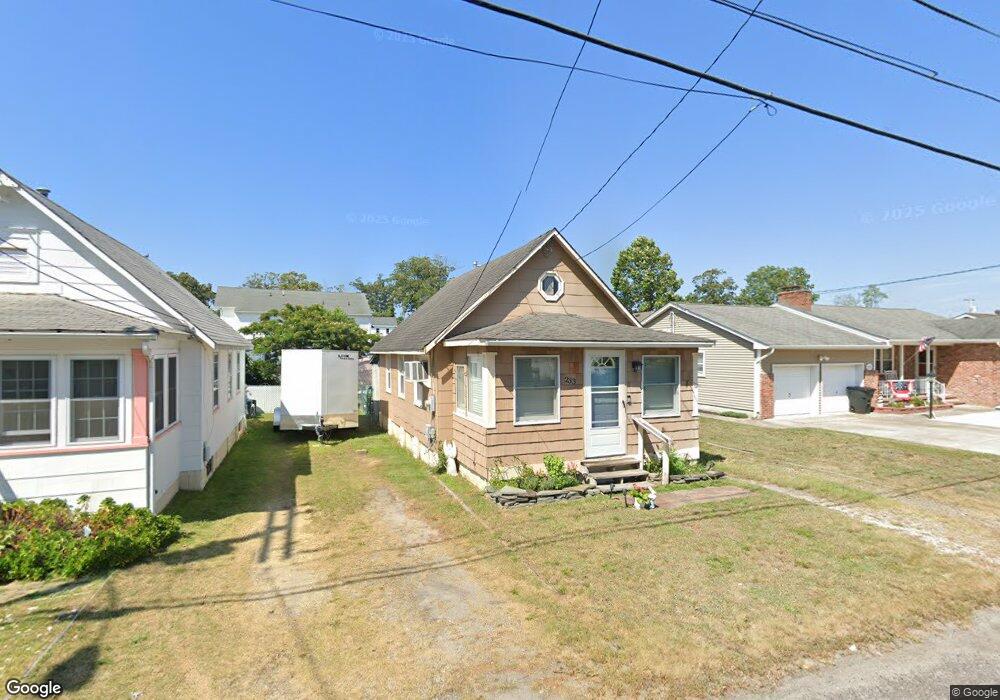
233 E Long Branch Ave Ocean Gate, NJ 08740
Estimated Value: $235,698 - $319,000
1
Bed
1
Bath
512
Sq Ft
$548/Sq Ft
Est. Value
About This Home
This home is located at 233 E Long Branch Ave, Ocean Gate, NJ 08740 and is currently estimated at $280,425, approximately $547 per square foot. 233 E Long Branch Ave is a home located in Ocean County with nearby schools including Ocean Gate Elementary School, Central Regional Middle School, and Central Regional High School.
Ownership History
Date
Name
Owned For
Owner Type
Purchase Details
Closed on
Oct 26, 2006
Sold by
Mcglaughlin G Donald and Mcglaughlin Darleen
Bought by
Pallante Marianne
Current Estimated Value
Home Financials for this Owner
Home Financials are based on the most recent Mortgage that was taken out on this home.
Original Mortgage
$135,000
Outstanding Balance
$80,302
Interest Rate
6.31%
Mortgage Type
Purchase Money Mortgage
Estimated Equity
$200,123
Purchase Details
Closed on
Aug 15, 1994
Sold by
Huffnagle Marylou
Bought by
Mcglaughlin G Donald
Create a Home Valuation Report for This Property
The Home Valuation Report is an in-depth analysis detailing your home's value as well as a comparison with similar homes in the area
Home Values in the Area
Average Home Value in this Area
Purchase History
| Date | Buyer | Sale Price | Title Company |
|---|---|---|---|
| Pallante Marianne | $150,000 | Pegasus Title Agency Llc | |
| Mcglaughlin G Donald | $32,000 | -- |
Source: Public Records
Mortgage History
| Date | Status | Borrower | Loan Amount |
|---|---|---|---|
| Open | Pallante Marianne | $135,000 |
Source: Public Records
Tax History
| Year | Tax Paid | Tax Assessment Tax Assessment Total Assessment is a certain percentage of the fair market value that is determined by local assessors to be the total taxable value of land and additions on the property. | Land | Improvement |
|---|---|---|---|---|
| 2025 | $3,467 | $210,900 | $132,400 | $78,500 |
| 2024 | $3,034 | $210,900 | $132,400 | $78,500 |
Source: Public Records
Map
Nearby Homes
- 318 E Cape May Ave
- 375 E Barnegat Ave
- 32 E Long Branch Ave
- 207 Ocean Gate Ave
- 521 E Point Pleasant Ave
- 24 W Point Pleasant Ave
- 36 W Point Pleasant Ave
- 409 Newport Ave
- 700 Navesink Ave
- 553 Ocean Gate Dr
- 117 W Arverne Ave
- 639 E Bayview Ave
- 0 Jane Ave
- 3 Sheila Ct
- 39 Ivy Ct
- 277 Bayville Ave
- 803 Ocean Gate Dr
- 20 Fairwood Dr
- 243 Lakewood Ave
- 131 Veeder Ln
- 229 E Long Branch Ave
- 235 E Long Branch Ave
- 225 E Long Branch Ave
- 230 E Lakewood Ave
- 234 E Lakewood Ave
- 238 E Lakewood Ave
- 220 E Lakewood Ave
- 221 E Long Branch Ave
- 244 E Lakewood Ave
- 245 E Long Branch Ave
- 224 E Long Branch Ave
- 30 E Long Branch Ave
- 246 E Lakewood Ave
- 240 E Long Branch Ave
- 212 E Lakewood Ave
- 220 E Long Branch Ave
- 211 E Long Branch Ave
- 242 E Long Branch Ave
- 512 Stone Harbor Ave
- 244 E Long Branch Ave
Your Personal Tour Guide
Ask me questions while you tour the home.