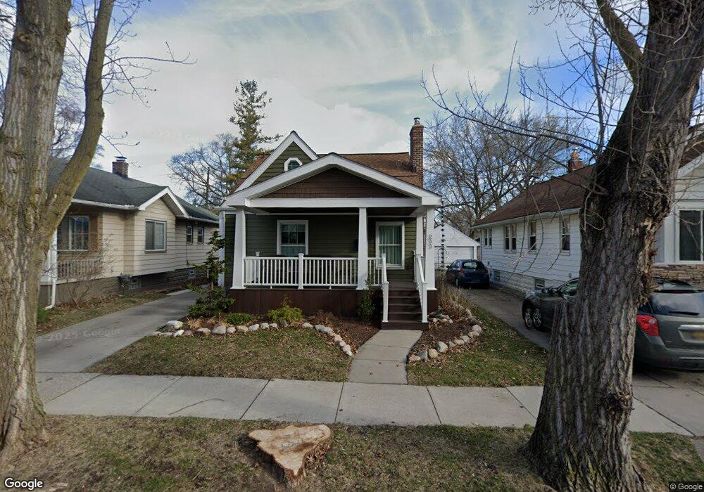
233 E Woodland St Ferndale, MI 48220
Estimated Value: $274,100 - $306,000
2
Beds
2
Baths
985
Sq Ft
$299/Sq Ft
Est. Value
About This Home
This home is located at 233 E Woodland St, Ferndale, MI 48220 and is currently estimated at $294,775, approximately $299 per square foot. 233 E Woodland St is a home located in Oakland County with nearby schools including Ferndale Lower Elementary Campus, Ferndale Upper Elementary Campus, and Ferndale Middle School.
Ownership History
Date
Name
Owned For
Owner Type
Purchase Details
Closed on
Jan 3, 2001
Sold by
Medve Karen C
Bought by
Miller Sharon M
Current Estimated Value
Home Financials for this Owner
Home Financials are based on the most recent Mortgage that was taken out on this home.
Original Mortgage
$136,818
Outstanding Balance
$50,078
Interest Rate
7.43%
Estimated Equity
$244,697
Purchase Details
Closed on
Jul 8, 1996
Sold by
Medve Karen C
Bought by
Medve Karen C
Create a Home Valuation Report for This Property
The Home Valuation Report is an in-depth analysis detailing your home's value as well as a comparison with similar homes in the area
Home Values in the Area
Average Home Value in this Area
Purchase History
| Date | Buyer | Sale Price | Title Company |
|---|---|---|---|
| Miller Sharon M | $137,900 | -- | |
| Medve Karen C | -- | -- |
Source: Public Records
Mortgage History
| Date | Status | Borrower | Loan Amount |
|---|---|---|---|
| Open | Miller Sharon M | $136,818 |
Source: Public Records
Tax History Compared to Growth
Tax History
| Year | Tax Paid | Tax Assessment Tax Assessment Total Assessment is a certain percentage of the fair market value that is determined by local assessors to be the total taxable value of land and additions on the property. | Land | Improvement |
|---|---|---|---|---|
| 2024 | $2,286 | $122,630 | $0 | $0 |
| 2023 | $2,218 | $115,140 | $0 | $0 |
| 2022 | $2,225 | $105,850 | $0 | $0 |
| 2021 | $2,238 | $99,320 | $0 | $0 |
| 2020 | $2,124 | $95,930 | $0 | $0 |
| 2019 | $2,157 | $87,210 | $0 | $0 |
| 2018 | $2,165 | $63,840 | $0 | $0 |
| 2017 | $2,137 | $62,620 | $0 | $0 |
| 2016 | $2,107 | $57,300 | $0 | $0 |
| 2015 | -- | $52,460 | $0 | $0 |
| 2014 | -- | $43,520 | $0 | $0 |
| 2011 | -- | $45,940 | $0 | $0 |
Source: Public Records
Map
Nearby Homes
- 271 E Maplehurst St
- 203 E Lewiston Ave
- 573 E Oakridge St
- 317 E Cambourne St
- 600 E Oakridge St
- 500 E Maplehurst St
- 545 E Maplehurst St
- 392 E Cambourne St
- 256 Withington St
- 3 Fairwood Blvd
- 367 W Cambourne St
- 464 E Cambourne St
- 475 W Breckenridge St
- 211 E 9 Mile Rd Unit 311
- 478 E Breckenridge St
- 437 W Drayton St
- 20 Oxford Blvd
- 550 E Breckenridge St
- 1143 Woodward Heights Unit 15
- 2814 Burdette St
- 241 E Woodland St
- 225 E Woodland St
- 247 E Woodland St
- 215 E Woodland St
- 257 E Woodland St
- 334 E Drayton St
- 348 E Drayton St
- 324 E Drayton St
- 201 E Woodland St
- 356 E Drayton St
- 340 E Drayton St
- 340 E Drayton St
- 271 E Woodland St
- 240 E Woodland St
- 318 E Drayton St
- 310 E Drayton St
- 310 E Drayton St
- 232 E Woodland St
- 248 E Woodland St
- 224 E Woodland St