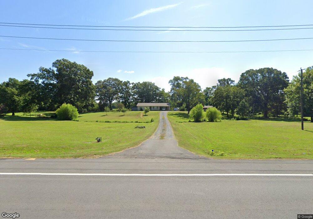
233 Hwy 365 Conway, AR 72032
Estimated Value: $123,000 - $194,548
3
Beds
1
Bath
1,516
Sq Ft
$109/Sq Ft
Est. Value
About This Home
This home is located at 233 Hwy 365, Conway, AR 72032 and is currently estimated at $165,637, approximately $109 per square foot. 233 Hwy 365 is a home located in Faulkner County with nearby schools including Preston & Florence Mattison Elementary School, Bob Courtway Middle School, and Conway Junior High School.
Ownership History
Date
Name
Owned For
Owner Type
Purchase Details
Closed on
May 19, 2017
Sold by
Harper James R and Harper John P
Bought by
Caldwell Russell and Caldwell Diana
Current Estimated Value
Home Financials for this Owner
Home Financials are based on the most recent Mortgage that was taken out on this home.
Original Mortgage
$114,750
Outstanding Balance
$94,971
Interest Rate
4.1%
Mortgage Type
New Conventional
Estimated Equity
$70,666
Purchase Details
Closed on
Mar 18, 2013
Sold by
Harper J D and Harper Pauline
Bought by
Harper James R
Purchase Details
Closed on
Feb 25, 2005
Bought by
Wastewater Line Easement
Purchase Details
Closed on
Nov 9, 2004
Bought by
Wastewater Line Esmt
Purchase Details
Closed on
Apr 7, 1994
Bought by
Loux Too Harper
Create a Home Valuation Report for This Property
The Home Valuation Report is an in-depth analysis detailing your home's value as well as a comparison with similar homes in the area
Home Values in the Area
Average Home Value in this Area
Purchase History
| Date | Buyer | Sale Price | Title Company |
|---|---|---|---|
| Caldwell Russell | $135,000 | Faulkner County Title Compan | |
| Caldwell Russell | $50,000 | Faulkner County Title Compan | |
| Harper James R | -- | None Available | |
| Wastewater Line Easement | -- | -- | |
| Wastewater Line Esmt | -- | -- | |
| Loux Too Harper | -- | -- |
Source: Public Records
Mortgage History
| Date | Status | Borrower | Loan Amount |
|---|---|---|---|
| Open | Caldwell Russell | $114,750 |
Source: Public Records
Tax History
| Year | Tax Paid | Tax Assessment Tax Assessment Total Assessment is a certain percentage of the fair market value that is determined by local assessors to be the total taxable value of land and additions on the property. | Land | Improvement |
|---|---|---|---|---|
| 2025 | $1,248 | $36,130 | $7,140 | $28,990 |
| 2024 | $1,192 | $36,130 | $7,140 | $28,990 |
| 2023 | $1,230 | $27,310 | $8,820 | $18,490 |
| 2022 | $1,246 | $27,310 | $8,820 | $18,490 |
| 2021 | $1,118 | $27,310 | $8,820 | $18,490 |
| 2020 | $1,019 | $21,210 | $6,620 | $14,590 |
| 2019 | $1,019 | $21,210 | $6,620 | $14,590 |
| 2018 | $1,019 | $21,210 | $6,620 | $14,590 |
| 2017 | $586 | $21,210 | $6,620 | $14,590 |
| 2016 | $186 | $10,790 | $6,620 | $4,170 |
| 2015 | $501 | $21,390 | $6,620 | $14,770 |
| 2014 | $186 | $21,390 | $6,620 | $14,770 |
Source: Public Records
Map
Nearby Homes
- 60 Wilhelmina Cove
- 63 Wilhelmina Cove Rd
- 260 Sturgis Rd
- 237 Sturgis Rd
- 6 Round Mountain Rd
- 5 Round Mountain Rd
- 30 Round Mountain Rd
- 000 Bream Nest Rd
- 25 Fred Ln
- 104 Lawrence Landing Rd
- 256 Caney Creek Rd
- 000 Black Rd
- 25 Caney Hill Rd
- 4 Jessilea Rd
- 74 Happy Valley Dr
- 98 Waterfront Cove
- 1610 Stanley Russ Rd
- 6 N Deer Ln
- 1660 Carillon Ln
- 1360 Stanley Russ Rd
- 233 Hwy 365
- 233 Hwy 365
- 233 Highway 365
- 229 Highway 365
- 223 Highway 365
- 227 Highway 365
- 225 Highway 365
- 241 Highway 365
- 241 Hwy 365 S
- 9 Brannon Landing Rd
- 236 Highway 365
- 234 Highway 365
- 19 Gold Creek Landing Rd
- 238 Highway 365
- 14 Gold Creek Landing Rd
- 18 Gold Creek Landing Rd
- 228 Highway 365
- 7 Gold Creek Landing Rd
- 7 Gold Creek Landing Rd Unit A
- 8 E Brannon Dr
Your Personal Tour Guide
Ask me questions while you tour the home.