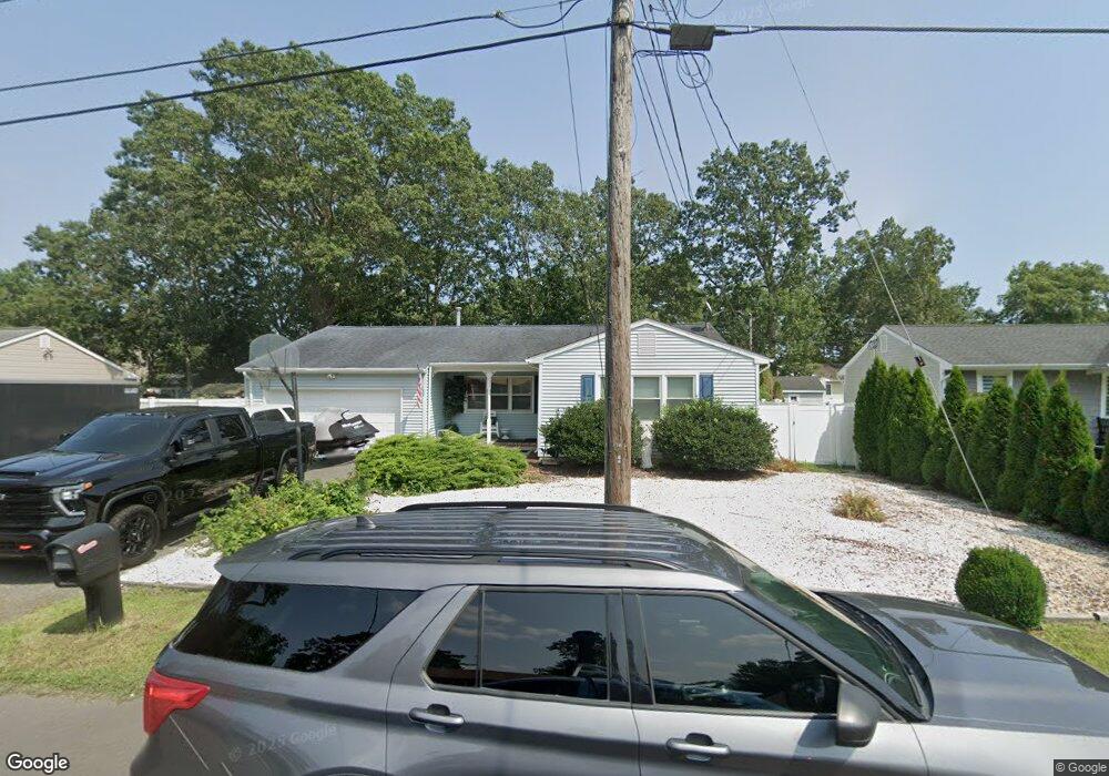
233 Maple Ln Forked River, NJ 08731
Estimated Value: $453,000 - $515,000
4
Beds
3
Baths
1,739
Sq Ft
$279/Sq Ft
Est. Value
About This Home
This home is located at 233 Maple Ln, Forked River, NJ 08731 and is currently estimated at $485,410, approximately $279 per square foot. 233 Maple Ln is a home located in Ocean County with nearby schools including Lacey Township High School.
Ownership History
Date
Name
Owned For
Owner Type
Purchase Details
Closed on
Feb 10, 2016
Sold by
Whitt Stephen and Whitt Sharon
Bought by
Whitt Stephen
Current Estimated Value
Home Financials for this Owner
Home Financials are based on the most recent Mortgage that was taken out on this home.
Original Mortgage
$244,200
Outstanding Balance
$191,385
Interest Rate
3.44%
Mortgage Type
FHA
Estimated Equity
$294,025
Purchase Details
Closed on
Jan 30, 2008
Sold by
Saban Eli
Bought by
Whitt Stephen and Whitt Sharon
Home Financials for this Owner
Home Financials are based on the most recent Mortgage that was taken out on this home.
Original Mortgage
$298,308
Interest Rate
6.2%
Mortgage Type
FHA
Purchase Details
Closed on
Jan 20, 2005
Sold by
Crooks Agnes T
Bought by
Saban Eli
Home Financials for this Owner
Home Financials are based on the most recent Mortgage that was taken out on this home.
Original Mortgage
$225,000
Interest Rate
7%
Mortgage Type
New Conventional
Create a Home Valuation Report for This Property
The Home Valuation Report is an in-depth analysis detailing your home's value as well as a comparison with similar homes in the area
Home Values in the Area
Average Home Value in this Area
Purchase History
| Date | Buyer | Sale Price | Title Company |
|---|---|---|---|
| Whitt Stephen | -- | -- | |
| Whitt Stephen | $303,000 | Transnation Title Ins Co | |
| Saban Eli | $250,000 | -- |
Source: Public Records
Mortgage History
| Date | Status | Borrower | Loan Amount |
|---|---|---|---|
| Open | Whitt Stephen | $244,200 | |
| Closed | Whitt Stephen | $298,308 | |
| Previous Owner | Saban Eli | $225,000 |
Source: Public Records
Tax History
| Year | Tax Paid | Tax Assessment Tax Assessment Total Assessment is a certain percentage of the fair market value that is determined by local assessors to be the total taxable value of land and additions on the property. | Land | Improvement |
|---|---|---|---|---|
| 2025 | $6,239 | $246,200 | $97,000 | $149,200 |
| 2024 | $5,832 | $246,200 | $97,000 | $149,200 |
| 2023 | $5,572 | $246,200 | $97,000 | $149,200 |
| 2022 | $5,572 | $246,200 | $97,000 | $149,200 |
| 2021 | $5,478 | $246,200 | $97,000 | $149,200 |
| 2020 | $5,303 | $246,200 | $97,000 | $149,200 |
| 2019 | $5,210 | $246,200 | $97,000 | $149,200 |
| 2018 | $5,148 | $246,200 | $97,000 | $149,200 |
| 2017 | $5,030 | $246,200 | $97,000 | $149,200 |
| 2016 | $5,010 | $246,200 | $97,000 | $149,200 |
| 2015 | $4,786 | $246,200 | $97,000 | $149,200 |
| 2014 | $4,718 | $274,300 | $117,000 | $157,300 |
Source: Public Records
Map
Nearby Homes
Your Personal Tour Guide
Ask me questions while you tour the home.