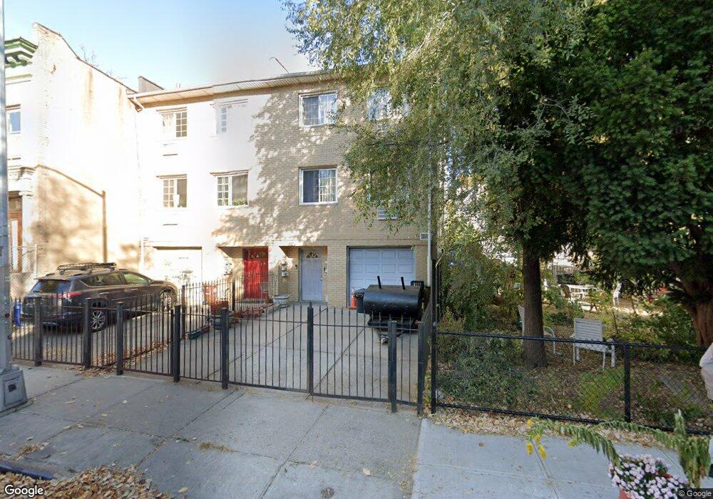
233 Maple St Brooklyn, NY 11225
Prospect Lefferts Gardens NeighborhoodEstimated Value: $1,725,000 - $2,244,000
Studio
--
Bath
3,000
Sq Ft
$669/Sq Ft
Est. Value
About This Home
This home is located at 233 Maple St, Brooklyn, NY 11225 and is currently estimated at $2,005,667, approximately $668 per square foot. 233 Maple St is a home located in Kings County with nearby schools including P.S. 91 The Albany Avenue School, M.S. 61 Dr. Gladstone H. Atwell Middle School, and Brooklyn Ascend Charter School.
Ownership History
Date
Name
Owned For
Owner Type
Purchase Details
Closed on
Nov 6, 2023
Sold by
Palmer Arkland
Bought by
Stephenson Sophia L
Current Estimated Value
Purchase Details
Closed on
Aug 31, 1999
Sold by
Bq Construction Inc
Bought by
Palmer Arkland and Palmer Dorrett
Home Financials for this Owner
Home Financials are based on the most recent Mortgage that was taken out on this home.
Original Mortgage
$281,678
Interest Rate
7.84%
Mortgage Type
FHA
Purchase Details
Closed on
Aug 10, 1999
Sold by
Bq Construction Inc
Bought by
Robinson Karlene K
Home Financials for this Owner
Home Financials are based on the most recent Mortgage that was taken out on this home.
Original Mortgage
$281,678
Interest Rate
7.84%
Mortgage Type
FHA
Purchase Details
Closed on
Sep 26, 1997
Sold by
Adogu Festus A
Bought by
B Q Construction Inc
Create a Home Valuation Report for This Property
The Home Valuation Report is an in-depth analysis detailing your home's value as well as a comparison with similar homes in the area
Home Values in the Area
Average Home Value in this Area
Purchase History
We collect this data history from publicly available records. To have your information removed, we recommend requesting removal directly through your county’s website.
| Date | Buyer | Sale Price | Title Company |
|---|---|---|---|
| Stephenson Sophia L | -- | -- | |
| Palmer Arkland | $284,000 | First American Title Ins Co | |
| Robinson Karlene K | $279,000 | First American Title Ins Co | |
| B Q Construction Inc | $50,000 | -- |
Source: Public Records
Mortgage History
We collect this data history from publicly available records. To have your information removed, we recommend requesting removal directly through your county’s website.
| Date | Status | Borrower | Loan Amount |
|---|---|---|---|
| Previous Owner | Palmer Arkland | $281,678 |
Source: Public Records
Tax History
| Year | Tax Paid | Tax Assessment Tax Assessment Total Assessment is a certain percentage of the fair market value that is determined by local assessors to be the total taxable value of land and additions on the property. | Land | Improvement |
|---|---|---|---|---|
| 2026 | $10,495 | $99,660 | $20,040 | $79,620 |
| 2025 | $10,495 | $114,420 | $20,040 | $94,380 |
| 2024 | $10,495 | $100,200 | $20,040 | $80,160 |
| 2023 | $9,908 | $93,960 | $20,040 | $73,920 |
| 2022 | $9,165 | $76,920 | $20,040 | $56,880 |
| 2021 | $9,105 | $67,800 | $20,040 | $47,760 |
| 2019 | $8,816 | $88,260 | $20,040 | $68,220 |
| 2018 | $8,228 | $41,823 | $9,803 | $32,020 |
| 2017 | $7,744 | $39,457 | $14,594 | $24,863 |
| 2016 | $7,132 | $37,224 | $11,707 | $25,517 |
| 2015 | $4,270 | $36,288 | $13,918 | $22,370 |
| 2014 | $4,270 | $36,288 | $16,710 | $19,578 |
Source: Public Records
Map
Nearby Homes
- 246 Maple St Unit 3A
- 265 Maple St
- 291 Lincoln Rd Unit HSE
- 277 Maple St
- 250 Midwood St
- 340 Lincoln Rd
- 224 Lefferts Ave Unit 14
- 237 Rutland Rd Unit 1 B
- 251 Rutland Rd
- 347 Lincoln Rd
- 426 Rogers Ave
- 1074 Nostrand Ave
- 195 Rutland Rd
- 1105 Nostrand Ave
- 212 Lincoln Rd
- 185 Lefferts Ave
- 393 Rogers Ave
- 139 Midwood St
- 312 Fenimore St
- 336 Maple St Unit 338
- 229 Maple St
- 225 Maple St
- 237 Maple St
- 469 Rogers Ave
- 473 Rogers Ave
- 467 Rogers Ave
- 221 Maple St
- 221 Maple St Unit 3
- 249 Maple St
- 465 Rogers Ave
- 286 Lincoln Rd
- 296 Lincoln Rd
- 463 Rogers Ave
- 463 Rogers Ave Unit Store Front
- 300 Lincoln Rd
- 300 Lincoln Rd
- 300 Lincoln Rd Unit 4
- 300 Lincoln Rd Unit 3-C
- 300 Lincoln Rd Unit 1
- 300 Lincoln Rd Unit 4 D
Your Personal Tour Guide
Ask me questions while you tour the home.