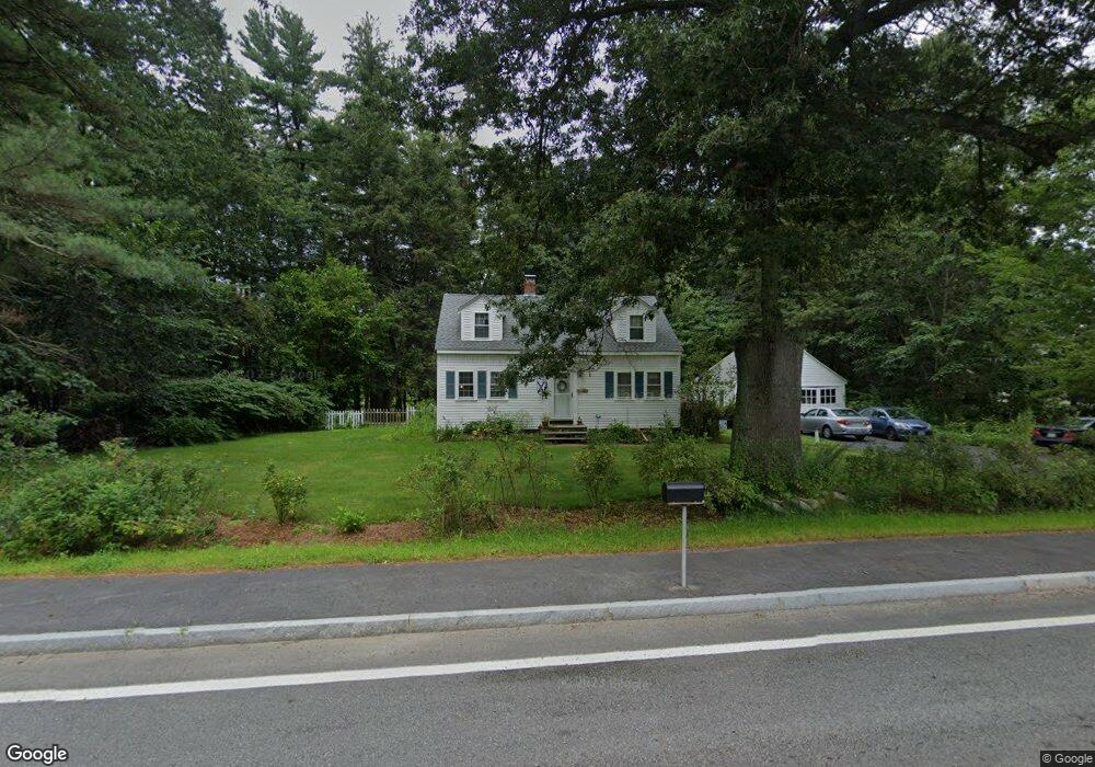
233 Massachusetts Ave Boxborough, MA 01719
Estimated Value: $605,193 - $715,000
3
Beds
1
Bath
1,613
Sq Ft
$421/Sq Ft
Est. Value
About This Home
This home is located at 233 Massachusetts Ave, Boxborough, MA 01719 and is currently estimated at $678,298, approximately $420 per square foot. 233 Massachusetts Ave is a home located in Middlesex County with nearby schools including Acton-Boxborough Regional High School.
Ownership History
Date
Name
Owned For
Owner Type
Purchase Details
Closed on
Jun 25, 2018
Sold by
Blanchard Lucinda W
Bought by
Blanchard Benjamin A and Blanchard Lucinda
Current Estimated Value
Purchase Details
Closed on
Jun 29, 2001
Sold by
Mozer Joel B and Mozer Lynne A
Bought by
Erikson Lucinda W
Home Financials for this Owner
Home Financials are based on the most recent Mortgage that was taken out on this home.
Original Mortgage
$240,000
Interest Rate
7.14%
Mortgage Type
Purchase Money Mortgage
Purchase Details
Closed on
Apr 2, 1996
Sold by
Est Steele Isla H and Albertson Joy S
Bought by
Mozer Joel B and Mozer Lynne A
Home Financials for this Owner
Home Financials are based on the most recent Mortgage that was taken out on this home.
Original Mortgage
$159,500
Interest Rate
6.9%
Mortgage Type
Purchase Money Mortgage
Create a Home Valuation Report for This Property
The Home Valuation Report is an in-depth analysis detailing your home's value as well as a comparison with similar homes in the area
Home Values in the Area
Average Home Value in this Area
Purchase History
| Date | Buyer | Sale Price | Title Company |
|---|---|---|---|
| Blanchard Benjamin A | -- | -- | |
| Erikson Lucinda W | $300,000 | -- | |
| Mozer Joel B | $167,900 | -- |
Source: Public Records
Mortgage History
| Date | Status | Borrower | Loan Amount |
|---|---|---|---|
| Previous Owner | Mozer Joel B | $240,000 | |
| Previous Owner | Mozer Joel B | $159,500 | |
| Closed | Mozer Joel B | $10,000 |
Source: Public Records
Tax History Compared to Growth
Tax History
| Year | Tax Paid | Tax Assessment Tax Assessment Total Assessment is a certain percentage of the fair market value that is determined by local assessors to be the total taxable value of land and additions on the property. | Land | Improvement |
|---|---|---|---|---|
| 2025 | $7,700 | $508,600 | $272,500 | $236,100 |
| 2024 | $7,338 | $489,500 | $261,500 | $228,000 |
| 2023 | $6,320 | $407,200 | $224,600 | $182,600 |
| 2022 | $6,466 | $371,200 | $224,600 | $146,600 |
| 2020 | $0 | $346,500 | $224,600 | $121,900 |
| 2019 | $5,690 | $346,500 | $224,600 | $121,900 |
| 2018 | $5,369 | $326,600 | $214,100 | $112,500 |
| 2017 | $5,510 | $327,800 | $214,100 | $113,700 |
| 2016 | $5,240 | $320,300 | $214,100 | $106,200 |
| 2015 | $4,835 | $290,400 | $181,400 | $109,000 |
| 2014 | $4,863 | $274,900 | $176,200 | $98,700 |
Source: Public Records
Map
Nearby Homes
- 134 Russet Ln
- 68 Macintosh Ln
- 96 Cedarwood Rd
- 777 Depot Rd
- 5 Elm St Unit 1
- 9 Elm St Unit 1
- 285 Central St Unit 285
- 12 Olde Lantern Rd
- 92 Willow St Unit 3
- 92 Willow St Unit 2
- 90 Willow St Unit 1
- 31 Mohawk Dr
- 89 Windsor Ave
- 3 Heather Hill Rd
- 139 Picnic St
- 4,7,8 Crestwood Ln
- 62 Waite Rd
- 4 Huron Rd
- 1155 Burroughs Rd
- 207 Boxboro Rd
- 6 Kendall Rd
- 8 Kendall Rd
- 10 Kendall Rd
- 12 Kendall Rd
- 3 Kendall Rd
- 5 Kendall Rd
- 226 Massachusetts Ave
- 18 Kendall Rd
- 9 Kendall Rd
- 11 Kendall Rd
- 22 Kendall Rd
- 15 Kendall Rd
- Lot 1 Burroughs Rd
- 240 Massachusetts Ave
- 240 Massachusetts Ave Unit 240
- 24 Kendall Rd
- Lot 172.2 Massachusets Ave
- 21 Kendall Rd
- 28 Kendall Rd
- 7 Burroughs Rd