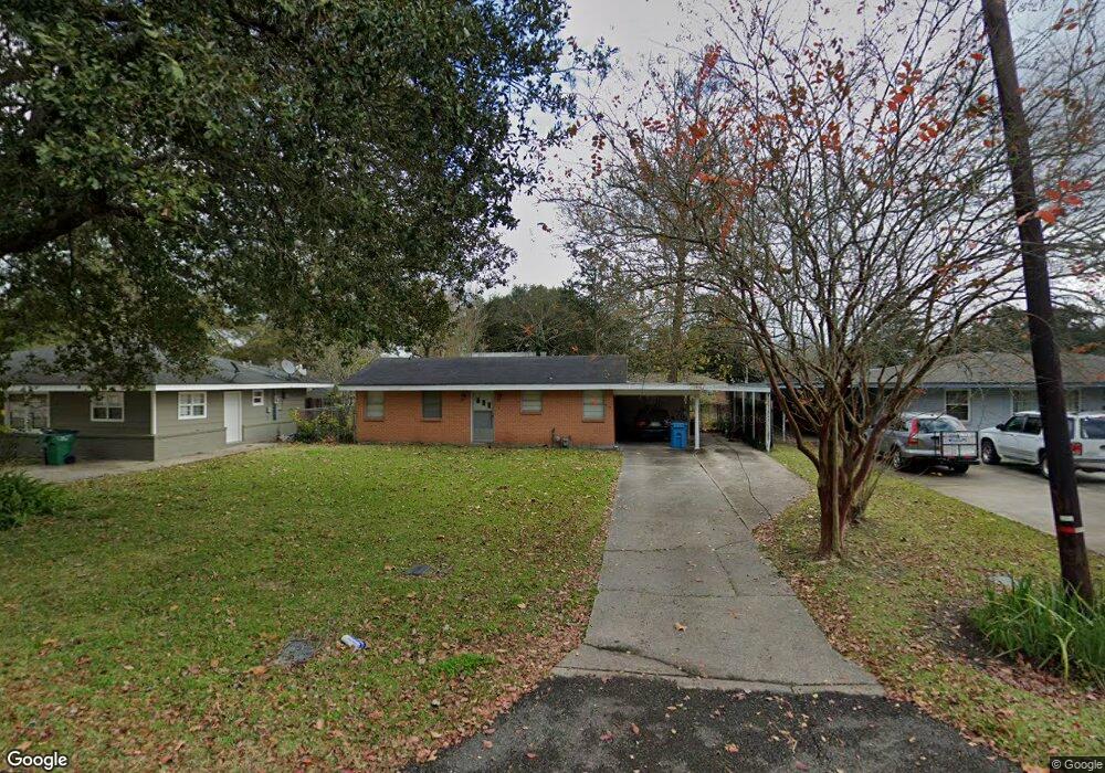
233 Mimosa Ave Luling, LA 70070
Estimated Value: $203,296 - $255,000
3
Beds
1
Bath
1,495
Sq Ft
$152/Sq Ft
Est. Value
About This Home
This home is located at 233 Mimosa Ave, Luling, LA 70070 and is currently estimated at $227,074, approximately $151 per square foot. 233 Mimosa Ave is a home located in St. Charles Parish with nearby schools including Mimosa Park Elementary School, Lakewood Elementary School, and J.B. Martin Middle School.
Ownership History
Date
Name
Owned For
Owner Type
Purchase Details
Closed on
Jun 29, 2009
Sold by
Steib Myrna Loup and Steib Lucien J
Bought by
Crawford Chad E and Steib Bryan J
Current Estimated Value
Home Financials for this Owner
Home Financials are based on the most recent Mortgage that was taken out on this home.
Original Mortgage
$152,192
Outstanding Balance
$95,533
Interest Rate
4.97%
Mortgage Type
FHA
Estimated Equity
$131,541
Create a Home Valuation Report for This Property
The Home Valuation Report is an in-depth analysis detailing your home's value as well as a comparison with similar homes in the area
Home Values in the Area
Average Home Value in this Area
Purchase History
| Date | Buyer | Sale Price | Title Company |
|---|---|---|---|
| Crawford Chad E | $155,000 | Metro Title Group Llc |
Source: Public Records
Mortgage History
| Date | Status | Borrower | Loan Amount |
|---|---|---|---|
| Open | Crawford Chad E | $152,192 |
Source: Public Records
Tax History
| Year | Tax Paid | Tax Assessment Tax Assessment Total Assessment is a certain percentage of the fair market value that is determined by local assessors to be the total taxable value of land and additions on the property. | Land | Improvement |
|---|---|---|---|---|
| 2025 | $1,038 | $17,770 | $6,770 | $11,000 |
| 2024 | $1,038 | $17,770 | $6,770 | $11,000 |
| 2023 | $1,054 | $12,435 | $4,400 | $8,035 |
| 2022 | $1,454 | $12,435 | $4,400 | $8,035 |
| 2021 | $1,149 | $9,746 | $3,960 | $5,786 |
| 2020 | $1,469 | $12,435 | $4,400 | $8,035 |
| 2019 | $1,385 | $11,676 | $3,900 | $7,776 |
| 2018 | $1,374 | $11,676 | $3,900 | $7,776 |
| 2017 | $1,372 | $11,676 | $3,900 | $7,776 |
| 2016 | $1,378 | $11,676 | $3,900 | $7,776 |
| 2015 | $314 | $10,174 | $1,923 | $8,251 |
| 2014 | $303 | $10,174 | $1,923 | $8,251 |
| 2013 | $304 | $10,174 | $1,923 | $8,251 |
Source: Public Records
Map
Nearby Homes
- 231 Mimosa Ave
- 235 Mimosa Ave
- 229 Mimosa Ave
- 239 Mimosa Ave
- 230 Wanda St
- 236 Wanda St
- 228 Wanda St
- 234 Mimosa Ave
- 225 Mimosa Ave
- 228 Mimosa Ave
- 238 Mimosa Ave
- 240 Wanda St
- 243 Mimosa Ave
- 224 Wanda St
- 226 Mimosa Ave
- 223 Mimosa Ave
- 240 Mimosa Ave
- 224 Mimosa Ave
- 222 Wanda St
- 0 W Heather Oaks Dr Unit 2460087
Your Personal Tour Guide
Ask me questions while you tour the home.