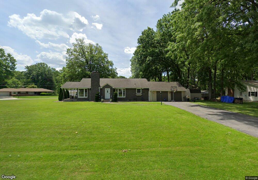
233 Moreland Dr Canfield, OH 44406
Estimated Value: $256,435 - $283,000
3
Beds
2
Baths
1,435
Sq Ft
$190/Sq Ft
Est. Value
About This Home
This home is located at 233 Moreland Dr, Canfield, OH 44406 and is currently estimated at $272,359, approximately $189 per square foot. 233 Moreland Dr is a home located in Mahoning County with nearby schools including Canfield Village Middle School and Canfield High School.
Ownership History
Date
Name
Owned For
Owner Type
Purchase Details
Closed on
Sep 29, 2025
Sold by
Santell William J
Bought by
Santell Debra J and Mumaw Debra J
Current Estimated Value
Purchase Details
Closed on
Jun 30, 2012
Sold by
Kapalko Debra J and Mumaw Debra J
Bought by
Mumaw Debra J and Santell William J
Home Financials for this Owner
Home Financials are based on the most recent Mortgage that was taken out on this home.
Original Mortgage
$120,720
Interest Rate
3.64%
Mortgage Type
New Conventional
Purchase Details
Closed on
Sep 10, 2005
Sold by
Miller Argentina B
Bought by
Kapalko Debra J
Home Financials for this Owner
Home Financials are based on the most recent Mortgage that was taken out on this home.
Original Mortgage
$129,900
Interest Rate
5.93%
Mortgage Type
Purchase Money Mortgage
Purchase Details
Closed on
May 24, 1989
Bought by
Wrynn Susan P
Create a Home Valuation Report for This Property
The Home Valuation Report is an in-depth analysis detailing your home's value as well as a comparison with similar homes in the area
Home Values in the Area
Average Home Value in this Area
Purchase History
| Date | Buyer | Sale Price | Title Company |
|---|---|---|---|
| Santell Debra J | -- | None Listed On Document | |
| Mumaw Debra J | -- | Attorney | |
| Kapalko Debra J | $129,900 | -- | |
| Wrynn Susan P | -- | -- |
Source: Public Records
Mortgage History
| Date | Status | Borrower | Loan Amount |
|---|---|---|---|
| Previous Owner | Mumaw Debra J | $120,720 | |
| Previous Owner | Kapalko Debra J | $129,900 |
Source: Public Records
Tax History
| Year | Tax Paid | Tax Assessment Tax Assessment Total Assessment is a certain percentage of the fair market value that is determined by local assessors to be the total taxable value of land and additions on the property. | Land | Improvement |
|---|---|---|---|---|
| 2025 | $3,210 | $74,470 | $17,240 | $57,230 |
| 2024 | $3,210 | $74,470 | $17,240 | $57,230 |
| 2023 | $3,159 | $74,470 | $17,240 | $57,230 |
| 2022 | $2,583 | $48,440 | $15,730 | $32,710 |
| 2021 | $2,507 | $48,440 | $15,730 | $32,710 |
| 2020 | $2,517 | $48,440 | $15,730 | $32,710 |
| 2019 | $2,433 | $42,480 | $13,790 | $28,690 |
| 2018 | $2,403 | $42,480 | $13,790 | $28,690 |
| 2017 | $2,258 | $42,480 | $13,790 | $28,690 |
| 2016 | $2,116 | $38,140 | $12,810 | $25,330 |
| 2015 | $2,069 | $38,140 | $12,810 | $25,330 |
| 2014 | $2,078 | $38,140 | $12,810 | $25,330 |
| 2013 | $2,002 | $38,140 | $12,810 | $25,330 |
Source: Public Records
Map
Nearby Homes
- 317 Verdant Ln
- 492 Hickory Hollow Dr
- 675 Blueberry Hill Dr
- 91 Villa Theresa Ln
- 81 Villa Theresa Ln
- 71 Villa Theresa Ln
- 90 Villa Theresa Ln
- 61 Villa Theresa Ln
- 80 Villa Theresa Ln
- 51 Villa Theresa Ln
- 9 Willow Way
- 41 Villa Theresa Ln
- 31 Villa Theresa Ln
- 21 Villa Theresa Ln
- 30 Villa Theresa Ln
- 20 Villa Theresa Ln
- 36 Hilltop Blvd
- 10 Villa Theresa Ln
- 264 W Main St
- 71 Hilltop Blvd
- 236 Bradford Dr
- 239 Moreland Dr
- 236 Moreland Dr
- 230 Moreland Dr
- 215 Bradford Dr
- 242 Bradford Dr
- 245 Moreland Dr
- 221 Bradford Dr
- 209 Bradford Dr
- 242 Moreland Dr
- 222 Moreland Dr
- 227 Bradford Dr
- 215 Moreland Dr
- 248 Bradford Dr
- 248 Moreland Dr
- 251 Moreland Dr
- 233 Bradford Dr
- 254 Bradford Dr
- 254 Moreland Dr
- 265 Deer Trail Ave
Your Personal Tour Guide
Ask me questions while you tour the home.