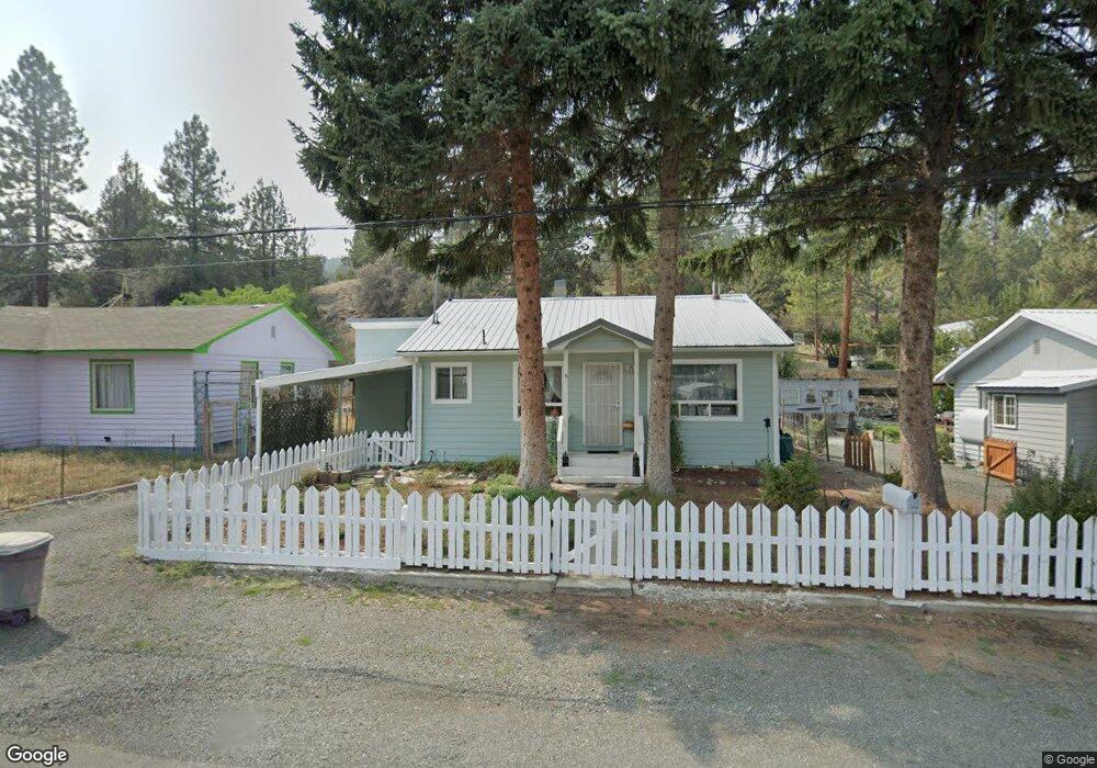
233 N Humbolt St Canyon City, OR 97820
Estimated Value: $190,000 - $212,899
2
Beds
1
Bath
840
Sq Ft
$245/Sq Ft
Est. Value
About This Home
This home is located at 233 N Humbolt St, Canyon City, OR 97820 and is currently estimated at $205,725, approximately $244 per square foot. 233 N Humbolt St is a home located in Grant County with nearby schools including Grant Union Junior/Senior High School.
Ownership History
Date
Name
Owned For
Owner Type
Purchase Details
Closed on
May 13, 2025
Sold by
Bloom Debra Joan
Bought by
Debra Joan Bloom Living Trust and Bloom
Current Estimated Value
Purchase Details
Closed on
Jul 30, 2013
Sold by
Vanvliet Jan M
Bought by
Bloom Debra J
Home Financials for this Owner
Home Financials are based on the most recent Mortgage that was taken out on this home.
Original Mortgage
$85,714
Interest Rate
3.92%
Mortgage Type
New Conventional
Create a Home Valuation Report for This Property
The Home Valuation Report is an in-depth analysis detailing your home's value as well as a comparison with similar homes in the area
Home Values in the Area
Average Home Value in this Area
Purchase History
| Date | Buyer | Sale Price | Title Company |
|---|---|---|---|
| Debra Joan Bloom Living Trust | -- | None Listed On Document | |
| Bloom Debra J | $84,000 | None Available |
Source: Public Records
Mortgage History
| Date | Status | Borrower | Loan Amount |
|---|---|---|---|
| Previous Owner | Bloom Debra J | $85,714 |
Source: Public Records
Tax History Compared to Growth
Tax History
| Year | Tax Paid | Tax Assessment Tax Assessment Total Assessment is a certain percentage of the fair market value that is determined by local assessors to be the total taxable value of land and additions on the property. | Land | Improvement |
|---|---|---|---|---|
| 2024 | $1,317 | $83,717 | $24,381 | $59,336 |
| 2023 | $1,278 | $81,279 | $23,670 | $57,609 |
| 2022 | $1,241 | $78,912 | $22,979 | $55,933 |
| 2021 | $1,205 | $76,614 | $22,315 | $54,299 |
| 2020 | $1,257 | $74,383 | $21,661 | $52,722 |
| 2019 | $1,221 | $72,217 | $20,037 | $52,180 |
| 2018 | $1,214 | $70,114 | $19,453 | $50,661 |
| 2017 | $1,224 | $68,072 | $18,890 | $49,182 |
| 2016 | $1,194 | $66,090 | $18,337 | $47,753 |
| 2015 | $1,167 | $62,298 | $17,285 | $45,013 |
| 2014 | $1,167 | $62,298 | $17,285 | $45,013 |
| 2013 | $768 | $60,484 | $16,550 | $43,934 |
Source: Public Records
Map
Nearby Homes
- 0 Elkview Dr Unit 22158071
- 0 Elkview Dr Unit 24255395
- 0 Elkview Dr Unit 195119069
- 0 Elkview Dr Unit 362870233
- 0 Elkview Dr Unit 24441871
- 217 Elkview Dr
- 4035 Patterson Dr
- 1500 Elk View Dr
- 2709 Elk View Dr
- 4008 Patterson Dr
- 338 Inland Dr
- 2700 Elkview Dr
- 216 Elkview Dr
- 265 Elk View Dr
- 60625 Three Point Rd
- 206 S Washington St
- 60408 Marysville Ln
- 107 Rebel Hill Rd
- 26113 W Bench Rd
- 204 Adam Dr
- 231 N Humbolt St
- 235 N Humbolt St
- 0 N Humbolt St Unit 7400
- 230 N Humbolt St
- 228 N Humbolt St
- 232 N Humbolt St
- 227 N Humbolt St
- 226 N Humbolt St
- 226 Scenic Dr
- 234 N Humbolt St
- 236 N Humbolt St
- 223 N Humbolt St
- 224 N Humbolt St
- 101 Weber Ln
- 239 N Humbolt St
- 222 N Humbolt St
- 241 N Humbolt St
- 100 Weber Ln
- 238 N Humbolt St
- 240 N Humbolt St