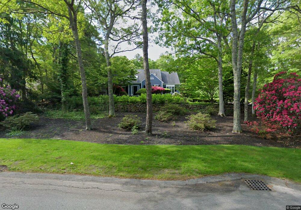
233 Oakmont Rd Yarmouth Port, MA 2675
Barnstable Village NeighborhoodEstimated Value: $986,188 - $1,229,000
3
Beds
3
Baths
2,715
Sq Ft
$412/Sq Ft
Est. Value
About This Home
This home is located at 233 Oakmont Rd, Yarmouth Port, MA 2675 and is currently estimated at $1,117,297, approximately $411 per square foot. 233 Oakmont Rd is a home located in Barnstable County with nearby schools including West Barnstable Elementary School, Barnstable United Elementary School, and Barnstable Intermediate School.
Ownership History
Date
Name
Owned For
Owner Type
Purchase Details
Closed on
Nov 25, 2024
Sold by
Freeman Peter L
Bought by
233 Oakmont T and 233 Freeman
Current Estimated Value
Purchase Details
Closed on
Dec 13, 2005
Sold by
Warren L Price T
Bought by
Freeman Catherine A
Home Financials for this Owner
Home Financials are based on the most recent Mortgage that was taken out on this home.
Original Mortgage
$400,000
Interest Rate
6.17%
Mortgage Type
Purchase Money Mortgage
Purchase Details
Closed on
Feb 20, 2004
Sold by
Price Warren L
Bought by
Warren L Price T L and Warren Price
Purchase Details
Closed on
Nov 13, 1998
Sold by
Lisa Lane Nt
Bought by
Price Warren L
Purchase Details
Closed on
Aug 31, 1993
Sold by
Hogan Nt Joanne O and Quinn Hogan J
Bought by
Amesbury Eileen H
Create a Home Valuation Report for This Property
The Home Valuation Report is an in-depth analysis detailing your home's value as well as a comparison with similar homes in the area
Home Values in the Area
Average Home Value in this Area
Purchase History
| Date | Buyer | Sale Price | Title Company |
|---|---|---|---|
| 233 Oakmont T | -- | None Available | |
| 233 Oakmont T | -- | None Available | |
| Freeman Catherine A | $570,000 | -- | |
| Warren L Price T L | -- | -- | |
| Price Warren L | $348,000 | -- | |
| Amesbury Eileen H | $256,000 | -- | |
| Freeman Catherine A | $570,000 | -- | |
| Warren L Price T L | -- | -- | |
| Price Warren L | $348,000 | -- | |
| Amesbury Eileen H | $256,000 | -- |
Source: Public Records
Mortgage History
| Date | Status | Borrower | Loan Amount |
|---|---|---|---|
| Previous Owner | Freeman Catherine A | $400,000 | |
| Previous Owner | Freeman Catherine A | $112,950 |
Source: Public Records
Tax History Compared to Growth
Tax History
| Year | Tax Paid | Tax Assessment Tax Assessment Total Assessment is a certain percentage of the fair market value that is determined by local assessors to be the total taxable value of land and additions on the property. | Land | Improvement |
|---|---|---|---|---|
| 2025 | $8,739 | $945,800 | $203,300 | $742,500 |
| 2024 | $7,859 | $897,100 | $203,300 | $693,800 |
| 2023 | $7,320 | $815,200 | $200,900 | $614,300 |
| 2022 | $7,404 | $663,400 | $143,000 | $520,400 |
| 2021 | $6,918 | $590,800 | $143,000 | $447,800 |
| 2020 | $2,273 | $604,800 | $167,600 | $437,200 |
| 2019 | $6,910 | $565,500 | $177,800 | $387,700 |
| 2018 | $2,144 | $543,900 | $207,200 | $336,700 |
| 2017 | $6,591 | $527,300 | $207,200 | $320,100 |
| 2016 | $6,567 | $532,600 | $212,500 | $320,100 |
| 2015 | $5,480 | $452,500 | $198,000 | $254,500 |
Source: Public Records
Map
Nearby Homes
- 44 Iris Ln
- 92 Brentwood Dr
- 92 Brentwood Ln
- 41 Dromoland Ln
- 65 Oakmont Rd
- 67 Spy Glass Hill Rd
- 17 Indian Trail
- 30 Indian Trail
- 21 Indian Trail
- 33 Midpine Rd
- 81 Desert Sands Ln
- 294 Salt Rock Rd
- 25 Congressional Dr
- 83 Sisters Cir
- 83 Sisters Cir
- 4390 Main St
- 240 Braggs Ln
- 99 Old Hyannis Rd
- 111 Old Hyannis Rd
- 3528 Main St