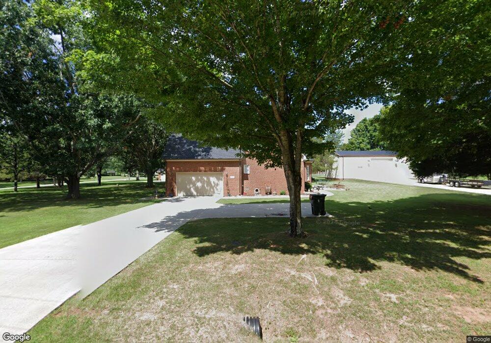
233 Powell St Gurley, AL 35748
Estimated Value: $431,000 - $492,000
--
Bed
--
Bath
2,913
Sq Ft
$162/Sq Ft
Est. Value
About This Home
This home is located at 233 Powell St, Gurley, AL 35748 and is currently estimated at $470,764, approximately $161 per square foot. 233 Powell St is a home with nearby schools including Central School and Madison County High School.
Create a Home Valuation Report for This Property
The Home Valuation Report is an in-depth analysis detailing your home's value as well as a comparison with similar homes in the area
Home Values in the Area
Average Home Value in this Area
Tax History Compared to Growth
Tax History
| Year | Tax Paid | Tax Assessment Tax Assessment Total Assessment is a certain percentage of the fair market value that is determined by local assessors to be the total taxable value of land and additions on the property. | Land | Improvement |
|---|---|---|---|---|
| 2024 | $1,677 | $46,060 | $3,500 | $42,560 |
| 2023 | $1,623 | $46,060 | $3,500 | $42,560 |
| 2022 | $1,405 | $40,020 | $2,500 | $37,520 |
| 2021 | $1,158 | $33,260 | $2,500 | $30,760 |
| 2020 | $1,046 | $30,180 | $2,500 | $27,680 |
| 2019 | $1,009 | $29,160 | $2,500 | $26,660 |
| 2018 | $964 | $27,920 | $0 | $0 |
| 2017 | $936 | $27,160 | $0 | $0 |
| 2016 | $936 | $27,160 | $0 | $0 |
| 2015 | $936 | $27,160 | $0 | $0 |
| 2014 | $926 | $26,900 | $0 | $0 |
Source: Public Records
Map
Nearby Homes
- 102 Peyton Cir
- 2906 Gurley Pike
- 211 Powell St
- 218 Powell St
- 107 Nolan Dr
- 216 Grasslands Rd
- 172 Day Dr
- 221 Grasslands Rd
- 235 Grasslands Rd
- 1519 Ryland Pike
- 309 Gilliam Rd
- 0 Gilliam Rd
- 3608 Maysville Rd NE
- 111 Cool Cir
- 483 Moontown Rd
- 477 Moontown Rd
- PPin#507136 Moontown Rd
- 362 Moontown Rd
- 350 Moontown Rd
- 123 Delta Pine Dr