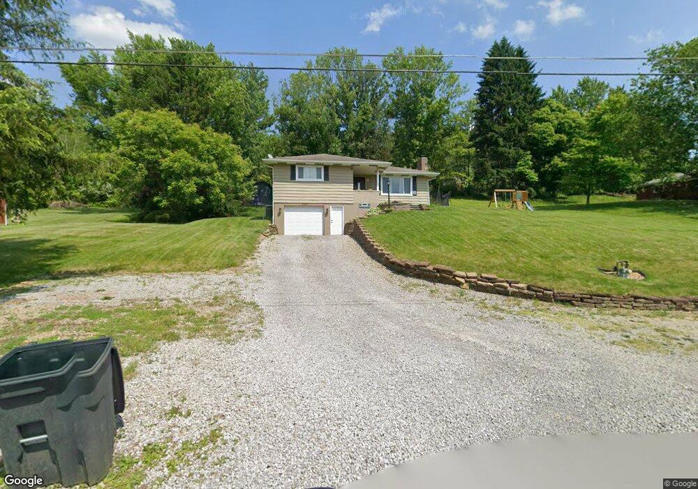
233 Rovel St Apollo, PA 15613
Estimated Value: $194,563 - $220,000
3
Beds
2
Baths
--
Sq Ft
19,558
Sq Ft Lot
About This Home
This home is located at 233 Rovel St, Apollo, PA 15613 and is currently estimated at $208,391. 233 Rovel St is a home located in Westmoreland County with nearby schools including Kiski Area High School.
Ownership History
Date
Name
Owned For
Owner Type
Purchase Details
Closed on
Apr 7, 2017
Sold by
Opaska Brian E and Opaska Carly A
Bought by
Dombroski Jacob B and Shannon Jennifer L
Current Estimated Value
Home Financials for this Owner
Home Financials are based on the most recent Mortgage that was taken out on this home.
Original Mortgage
$4,110,854
Outstanding Balance
$3,369,163
Interest Rate
4.1%
Mortgage Type
FHA
Estimated Equity
-$3,160,772
Purchase Details
Closed on
Jul 12, 2010
Sold by
Blakley Lois L and Blakley Daniel
Bought by
Opaska Brian E and Opaska Carly A
Home Financials for this Owner
Home Financials are based on the most recent Mortgage that was taken out on this home.
Original Mortgage
$69,200
Interest Rate
4.76%
Mortgage Type
New Conventional
Purchase Details
Closed on
Mar 22, 2010
Sold by
Baum Walter G
Bought by
Blakley Lois L
Purchase Details
Closed on
Aug 2, 2005
Sold by
Baum Walter G
Bought by
Blakley Lois L
Create a Home Valuation Report for This Property
The Home Valuation Report is an in-depth analysis detailing your home's value as well as a comparison with similar homes in the area
Home Values in the Area
Average Home Value in this Area
Purchase History
| Date | Buyer | Sale Price | Title Company |
|---|---|---|---|
| Dombroski Jacob B | $112,900 | None Available | |
| Opaska Brian E | $86,500 | None Available | |
| Blakley Lois L | -- | None Available | |
| Blakley Lois L | -- | -- |
Source: Public Records
Mortgage History
| Date | Status | Borrower | Loan Amount |
|---|---|---|---|
| Open | Dombroski Jacob B | $4,110,854 | |
| Previous Owner | Opaska Brian E | $69,200 |
Source: Public Records
Tax History
| Year | Tax Paid | Tax Assessment Tax Assessment Total Assessment is a certain percentage of the fair market value that is determined by local assessors to be the total taxable value of land and additions on the property. | Land | Improvement |
|---|---|---|---|---|
| 2026 | $2,951 | $18,890 | $3,620 | $15,270 |
| 2025 | $2,865 | $18,890 | $3,620 | $15,270 |
| 2024 | $2,718 | $18,890 | $3,620 | $15,270 |
| 2023 | $2,485 | $18,890 | $3,620 | $15,270 |
| 2022 | $2,429 | $18,890 | $3,620 | $15,270 |
| 2021 | $2,429 | $18,890 | $3,620 | $15,270 |
| 2020 | $2,423 | $18,890 | $3,620 | $15,270 |
| 2019 | $2,413 | $18,890 | $3,620 | $15,270 |
| 2018 | $2,376 | $18,890 | $3,620 | $15,270 |
| 2017 | $2,319 | $18,890 | $3,620 | $15,270 |
| 2016 | $2,285 | $18,890 | $3,620 | $15,270 |
| 2015 | $2,285 | $18,890 | $3,620 | $15,270 |
| 2014 | $2,273 | $18,890 | $3,620 | $15,270 |
Source: Public Records
Map
Nearby Homes
- 501 Pennsylvania 356
- 716 Pennsylvania 356
- 519 Dogwood Ct
- 110 Markle Rd
- 0 Orr Ave
- 262 Vista Dr
- 217 Karen Dr
- 127 Lily St
- 1738 Hancock Ave
- 1673 Hancock Ave
- 150 Watson Rd
- 115 Acadia Ln
- 1119 Hancock Ave
- 231 Whittier St
- 322 N 4th St
- 924 Wallace St
- 444 N Pennsylvania Ave
- 208 Whittier St
- 411a N Pennsylvania Ave
- 1020 Poe St
- 233 Mount Vernon Dr
- 233 Mt Vernon Dr
- 237 Mount Vernon Dr
- 237 Mt Vernon Dr
- 237 Rovel St
- 229 Rovel St
- 229 Mt Vernon St
- 241 Rovel St
- 361 Mount Vernon Dr
- 223 Rovel St
- 232 Rovel St
- 365 Mount Vernon Dr
- 369 Mount Vernon Dr
- 245 Rovel St
- 240 Rovel St
- 226 Rovel St
- 219 Rovel St
- 303 Mount Vernon Dr
- 222 Rovel St
- 319 Mount Vernon Dr
Your Personal Tour Guide
Ask me questions while you tour the home.