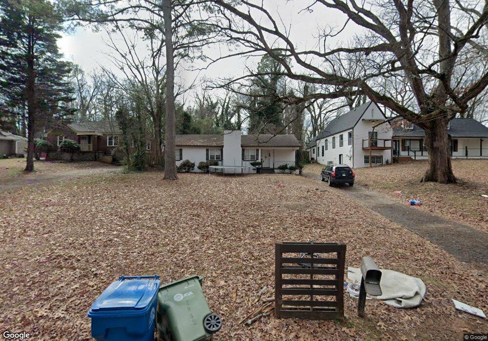
2332 Highview Rd SW Atlanta, GA 30311
Beecher Hills NeighborhoodEstimated Value: $239,271 - $365,000
2
Beds
1
Bath
1,486
Sq Ft
$189/Sq Ft
Est. Value
About This Home
This home is located at 2332 Highview Rd SW, Atlanta, GA 30311 and is currently estimated at $281,568, approximately $189 per square foot. 2332 Highview Rd SW is a home located in Fulton County with nearby schools including Beecher Hills Elementary School, Young Middle School, and Mays High School.
Ownership History
Date
Name
Owned For
Owner Type
Purchase Details
Closed on
Jul 21, 2011
Sold by
Nmj Financial Llc
Bought by
Enoumas & Lake Llc
Current Estimated Value
Purchase Details
Closed on
Jul 29, 2010
Sold by
Giles Roosevelt
Bought by
Nmj Financial Llc
Purchase Details
Closed on
Feb 5, 2008
Sold by
Us Bank Na
Bought by
Giles Roosevelt
Home Financials for this Owner
Home Financials are based on the most recent Mortgage that was taken out on this home.
Original Mortgage
$59,600
Interest Rate
6.17%
Mortgage Type
New Conventional
Purchase Details
Closed on
May 1, 2007
Sold by
Boney William
Bought by
Us Bank Na
Purchase Details
Closed on
Dec 29, 2005
Sold by
Amab Inc
Bought by
Boney William D
Home Financials for this Owner
Home Financials are based on the most recent Mortgage that was taken out on this home.
Original Mortgage
$154,700
Interest Rate
7.25%
Mortgage Type
New Conventional
Purchase Details
Closed on
Oct 27, 2005
Sold by
Neighborhood Inv Group Llc
Bought by
Amab Inc
Home Financials for this Owner
Home Financials are based on the most recent Mortgage that was taken out on this home.
Original Mortgage
$153,950
Interest Rate
5.71%
Mortgage Type
Balloon
Purchase Details
Closed on
Oct 18, 2005
Sold by
Wells Fargo Bank Na
Bought by
Neighborhood Inv Group Llc
Home Financials for this Owner
Home Financials are based on the most recent Mortgage that was taken out on this home.
Original Mortgage
$153,950
Interest Rate
5.71%
Mortgage Type
Balloon
Purchase Details
Closed on
May 20, 2003
Sold by
Paragon Asset Management Grp
Bought by
Burns Patricia
Home Financials for this Owner
Home Financials are based on the most recent Mortgage that was taken out on this home.
Original Mortgage
$37,500
Interest Rate
5.81%
Mortgage Type
New Conventional
Purchase Details
Closed on
Apr 19, 2000
Sold by
Reid Jonathan B and Reid Sharon
Bought by
10450 Oxford Mill Land Trust
Home Financials for this Owner
Home Financials are based on the most recent Mortgage that was taken out on this home.
Original Mortgage
$73,150
Interest Rate
8.23%
Mortgage Type
New Conventional
Create a Home Valuation Report for This Property
The Home Valuation Report is an in-depth analysis detailing your home's value as well as a comparison with similar homes in the area
Home Values in the Area
Average Home Value in this Area
Purchase History
| Date | Buyer | Sale Price | Title Company |
|---|---|---|---|
| Enoumas & Lake Llc | -- | -- | |
| Nmj Financial Llc | -- | -- | |
| Giles Roosevelt | $74,500 | -- | |
| Us Bank Na | $164,027 | -- | |
| Boney William D | $238,000 | -- | |
| Amab Inc | $150,000 | -- | |
| Neighborhood Inv Group Llc | $125,000 | -- | |
| Burns Patricia | $250,000 | -- | |
| 10450 Oxford Mill Land Trust | -- | -- |
Source: Public Records
Mortgage History
| Date | Status | Borrower | Loan Amount |
|---|---|---|---|
| Previous Owner | Giles Roosevelt | $59,600 | |
| Previous Owner | Boney William D | $154,700 | |
| Previous Owner | Amab Inc | $153,950 | |
| Previous Owner | Burns Patricia | $37,500 | |
| Previous Owner | 10450 Oxford Mill Land Trust | $73,150 |
Source: Public Records
Tax History Compared to Growth
Tax History
| Year | Tax Paid | Tax Assessment Tax Assessment Total Assessment is a certain percentage of the fair market value that is determined by local assessors to be the total taxable value of land and additions on the property. | Land | Improvement |
|---|---|---|---|---|
| 2025 | $582 | $86,960 | $42,480 | $44,480 |
| 2023 | $3,600 | $86,960 | $42,480 | $44,480 |
| 2022 | $2,530 | $62,520 | $23,560 | $38,960 |
| 2021 | $2,000 | $49,360 | $14,800 | $34,560 |
| 2020 | $1,998 | $48,760 | $14,600 | $34,160 |
| 2019 | $492 | $32,160 | $5,960 | $26,200 |
| 2018 | $609 | $14,720 | $7,000 | $7,720 |
| 2017 | $549 | $12,720 | $5,880 | $6,840 |
| 2016 | $551 | $12,720 | $5,880 | $6,840 |
| 2015 | $1,049 | $12,720 | $5,880 | $6,840 |
| 2014 | $577 | $12,720 | $5,880 | $6,840 |
Source: Public Records
Map
Nearby Homes
- 2340 Highview Rd SW
- 2249 Beecher Rd SW
- 2255 Beecher Rd SW
- 2418 Bolling Brook Dr SW
- 2222 Beecher Rd SW
- 2383 Edgewater Dr SW
- 2221 Highview Rd SW
- 2242 Beecher Cir SW
- 2174 Beecher Rd SW
- 0 Audubon Cir SW Unit 7618210
- 0 Audubon Cir SW Unit 10567383
- 2352 Herring Rd SW
- 2230 Beecher Cir SW
- 1108 Flamingo Dr SW
- 2377 Beecher Rd SW
- 2200 Beecher Cir SW
- 2096 Snow Rd SW
- 1168 Dolphin Dr SW
- 2201 Bollingbrook Dr SW
- 2201 Bolling Brook Dr SW
- 2324 Highview Rd SW
- 2318 Highview Rd SW
- 2312 Highview Rd SW
- 966 Mount Airy Dr SW
- 972 Mount Airy Dr SW
- 958 Mount Airy Dr SW
- 2343 Highview Rd SW
- 950 Mount Airy Dr SW
- 2306 Highview Rd SW
- 984 Mount Airy Dr SW
- 2353 Highview Rd SW
- 2335 Highview Rd SW
- 2325 Highview Rd SW
- 2319 Highview Rd SW
- 1000 Mouny Airy
- 932 Mt Airy Dr SW
- 932 Mount Airy Dr SW
- 1000 Mount Airy Dr SW
- 2300 Highview Rd SW
- 2311 Highview Rd SW