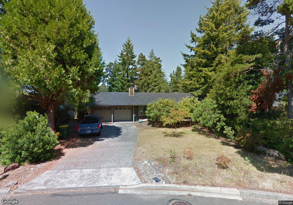
2333 20th St Florence, OR 97439
Estimated Value: $346,000 - $390,000
2
Beds
2
Baths
1,152
Sq Ft
$325/Sq Ft
Est. Value
About This Home
This home is located at 2333 20th St, Florence, OR 97439 and is currently estimated at $374,502, approximately $325 per square foot. 2333 20th St is a home located in Lane County with nearby schools including Siuslaw Elementary School, Siuslaw Middle School, and Siuslaw High School.
Ownership History
Date
Name
Owned For
Owner Type
Purchase Details
Closed on
May 9, 2023
Sold by
Brown Roy David
Bought by
Carroll Jane Susan Kathle
Current Estimated Value
Purchase Details
Closed on
Nov 14, 2017
Sold by
Carroll Michaelia M
Bought by
Brown Roy D and Carroll Jane Susan
Home Financials for this Owner
Home Financials are based on the most recent Mortgage that was taken out on this home.
Original Mortgage
$173,655
Interest Rate
3.85%
Mortgage Type
VA
Purchase Details
Closed on
Nov 4, 2009
Sold by
Graves Donna M
Bought by
Carroll Michaelia M
Home Financials for this Owner
Home Financials are based on the most recent Mortgage that was taken out on this home.
Original Mortgage
$161,224
Interest Rate
5.02%
Mortgage Type
New Conventional
Purchase Details
Closed on
Nov 5, 2004
Sold by
Jenkins Robert C
Bought by
Graves Virgil F and Virgil F Graves Revocable Living Trust
Purchase Details
Closed on
Mar 18, 2003
Sold by
Jenkins Robert C
Bought by
Jenkins Robert C and Robert C Jenkins Living Trust
Create a Home Valuation Report for This Property
The Home Valuation Report is an in-depth analysis detailing your home's value as well as a comparison with similar homes in the area
Home Values in the Area
Average Home Value in this Area
Purchase History
| Date | Buyer | Sale Price | Title Company |
|---|---|---|---|
| Carroll Jane Susan Kathle | -- | None Listed On Document | |
| Brown Roy D | $170,000 | Cascade Title Co | |
| Carroll Michaelia M | $158,000 | Western Title | |
| Graves Virgil F | $190,000 | Western Title & Escrow Co | |
| Jenkins Robert C | -- | Western Pioneer Title Co |
Source: Public Records
Mortgage History
| Date | Status | Borrower | Loan Amount |
|---|---|---|---|
| Previous Owner | Brown Roy D | $173,655 | |
| Previous Owner | Carroll Michaelia M | $161,224 |
Source: Public Records
Tax History Compared to Growth
Tax History
| Year | Tax Paid | Tax Assessment Tax Assessment Total Assessment is a certain percentage of the fair market value that is determined by local assessors to be the total taxable value of land and additions on the property. | Land | Improvement |
|---|---|---|---|---|
| 2025 | $2,757 | $202,069 | -- | -- |
| 2024 | $2,677 | $196,184 | -- | -- |
| 2023 | $2,677 | $190,470 | $0 | $0 |
| 2022 | $2,498 | $184,923 | $0 | $0 |
| 2021 | $2,447 | $179,537 | $0 | $0 |
| 2020 | $2,382 | $174,308 | $0 | $0 |
| 2019 | $2,293 | $169,232 | $0 | $0 |
| 2018 | $2,298 | $159,517 | $0 | $0 |
| 2017 | $2,216 | $159,517 | $0 | $0 |
| 2016 | $2,153 | $154,871 | $0 | $0 |
| 2015 | $2,107 | $150,360 | $0 | $0 |
| 2014 | $2,085 | $145,981 | $0 | $0 |
Source: Public Records
Map
Nearby Homes
- 2385 19th St
- 1925 Upas St
- 2270 Upas Place
- 1868 Tamarack St
- 2045 19th St
- 2131 Willow Loop E
- 2040 23rd St
- 0 23rd St Unit 283174168
- 2215 24th St
- 151 Outer Dr
- 2332 Rosemary Ct
- 154 Outer Dr
- 253 Outer Dr
- 2148 Willow Loop E
- 248 Horseshoe Bend
- 0 Tamarack St
- 238 Horseshoe Bend
- 223 Azalea St
- 231 Horseshoe Bend
- 2184 13th St