Estimated Value: $238,000 - $253,697
3
Beds
2
Baths
1,346
Sq Ft
$182/Sq Ft
Est. Value
About This Home
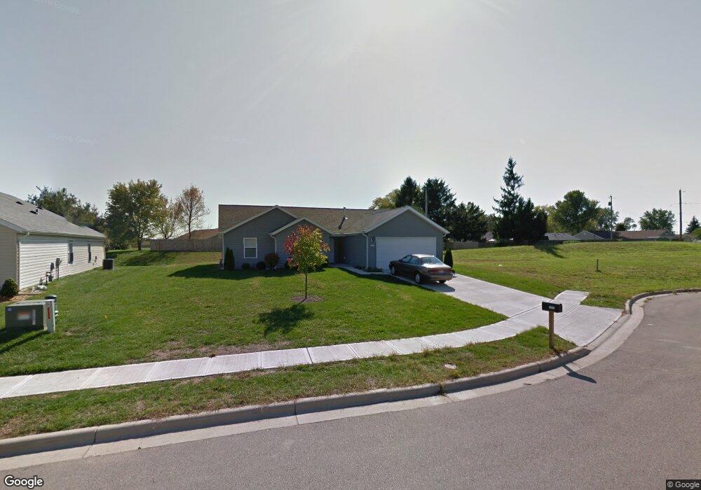
This home is located at 2333 Commonwealth Dr, Xenia, OH 45385 and is currently estimated at $245,424, approximately $182 per square foot. 2333 Commonwealth Dr is a home located in Greene County with nearby schools including Xenia High School, Summit Academy Community School for Alternative Learners - Xenia, and Legacy Christian Academy.
Ownership History
Date
Name
Owned For
Owner Type
Purchase Details
Closed on
Apr 26, 2019
Sold by
Santos Kenneth Stephen
Bought by
Hardy Jon Michael
Current Estimated Value
Purchase Details
Closed on
Nov 5, 2010
Sold by
Sensible Shelter Inc
Bought by
Santos Brenda A
Home Financials for this Owner
Home Financials are based on the most recent Mortgage that was taken out on this home.
Original Mortgage
$78,500
Interest Rate
4.27%
Mortgage Type
New Conventional
Create a Home Valuation Report for This Property
The Home Valuation Report is an in-depth analysis detailing your home's value as well as a comparison with similar homes in the area
Home Values in the Area
Average Home Value in this Area
Purchase History
| Date | Buyer | Sale Price | Title Company |
|---|---|---|---|
| Hardy Jon Michael | -- | None Available | |
| Santos Kenneth Stephen | -- | None Available | |
| Santos Brenda A | $135,000 | Attorney |
Source: Public Records
Mortgage History
| Date | Status | Borrower | Loan Amount |
|---|---|---|---|
| Previous Owner | Santos Brenda A | $78,500 |
Source: Public Records
Tax History
| Year | Tax Paid | Tax Assessment Tax Assessment Total Assessment is a certain percentage of the fair market value that is determined by local assessors to be the total taxable value of land and additions on the property. | Land | Improvement |
|---|---|---|---|---|
| 2025 | $2,913 | $66,880 | $19,120 | $47,760 |
| 2024 | $2,913 | $66,880 | $19,120 | $47,760 |
| 2023 | $2,862 | $66,880 | $19,120 | $47,760 |
| 2022 | $2,997 | $49,880 | $12,750 | $37,130 |
| 2021 | $2,536 | $49,880 | $12,750 | $37,130 |
| 2020 | $2,430 | $49,880 | $12,750 | $37,130 |
| 2019 | $2,089 | $40,380 | $9,580 | $30,800 |
| 2018 | $2,098 | $40,380 | $9,580 | $30,800 |
| 2017 | $2,049 | $40,380 | $9,580 | $30,800 |
| 2016 | $2,050 | $38,720 | $9,580 | $29,140 |
| 2015 | $2,055 | $38,720 | $9,580 | $29,140 |
| 2014 | $1,968 | $38,720 | $9,580 | $29,140 |
Source: Public Records
Map
Nearby Homes
- 2352 Pembury Dr
- 0 Berkshire Dr Unit 949217
- 1321 Massachusetts Dr
- 1955 Roxbury Dr
- 938 Wright Ave
- 1001 Glen Kegley Dr
- 2238 Tandem Dr
- 2936 W Barnhill Place
- 2813 Raxit Ct
- 2096 Alabama Dr
- 2102 High Wheel Dr
- 1254 Prem Place
- 920 Wright Cycle Blvd
- 926 Wright Cycle Blvd
- 624 Georgia Dr
- 1299 Baybury Ave
- 1198 Prem Place
- 1298 Baybury Ave
- 2795 Kingman Dr
- 1282 Baybury Ave
- 2325 Commonwealth Dr
- 2132 Windsor Dr
- 2116 Windsor Dr
- 2146 Windsor Dr
- 2317 Commonwealth Dr
- 2320 Commonwealth Dr
- 2160 Windsor Dr
- 2309 Commonwealth Dr
- 2174 Windsor Dr
- 2304 Commonwealth Dr
- 2441 Cornwall Dr
- 2427 Cornwall Dr
- 2145 Windsor Dr
- 2129 Dundee Dr
- 2145 Dundee Dr
- 2188 Windsor Dr
- 2159 Dundee Dr
- 2301 Commonwealth Dr
- 2399 Cornwall Dr
- 2159 Windsor Dr
Your Personal Tour Guide
Ask me questions while you tour the home.