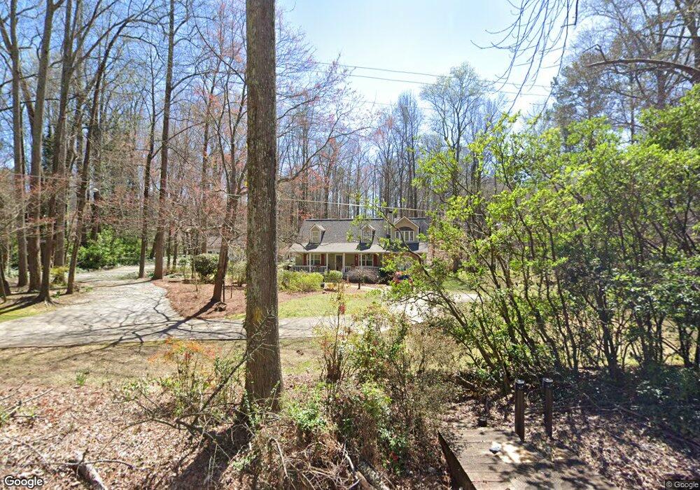
2333 Mcduffie Rd Austell, GA 30106
Estimated Value: $358,000 - $431,000
5
Beds
3
Baths
3,210
Sq Ft
$121/Sq Ft
Est. Value
About This Home
This home is located at 2333 Mcduffie Rd, Austell, GA 30106 and is currently estimated at $389,001, approximately $121 per square foot. 2333 Mcduffie Rd is a home located in Cobb County with nearby schools including Deerwood Elementary School, Clarkdale Elementary School, and Garrett Middle School.
Ownership History
Date
Name
Owned For
Owner Type
Purchase Details
Closed on
Apr 14, 2003
Sold by
Merritt Brandon D and Merritt Stacy L
Bought by
Riney Donald C and Riney Leslie
Current Estimated Value
Home Financials for this Owner
Home Financials are based on the most recent Mortgage that was taken out on this home.
Original Mortgage
$140,000
Interest Rate
5.56%
Mortgage Type
New Conventional
Purchase Details
Closed on
Nov 18, 1997
Sold by
Davis Glenn R
Bought by
Merritt Brandon D and Merritt Stacy Lee
Home Financials for this Owner
Home Financials are based on the most recent Mortgage that was taken out on this home.
Original Mortgage
$74,616
Interest Rate
7.27%
Mortgage Type
FHA
Create a Home Valuation Report for This Property
The Home Valuation Report is an in-depth analysis detailing your home's value as well as a comparison with similar homes in the area
Home Values in the Area
Average Home Value in this Area
Purchase History
| Date | Buyer | Sale Price | Title Company |
|---|---|---|---|
| Riney Donald C | $189,900 | -- | |
| Merritt Brandon D | $75,000 | -- |
Source: Public Records
Mortgage History
| Date | Status | Borrower | Loan Amount |
|---|---|---|---|
| Previous Owner | Riney Donald C | $140,000 | |
| Previous Owner | Merritt Brandon D | $74,616 |
Source: Public Records
Tax History Compared to Growth
Tax History
| Year | Tax Paid | Tax Assessment Tax Assessment Total Assessment is a certain percentage of the fair market value that is determined by local assessors to be the total taxable value of land and additions on the property. | Land | Improvement |
|---|---|---|---|---|
| 2025 | $899 | $157,492 | $38,184 | $119,308 |
| 2024 | $902 | $157,492 | $38,184 | $119,308 |
| 2023 | $598 | $124,732 | $36,172 | $88,560 |
| 2022 | $769 | $113,036 | $24,116 | $88,920 |
| 2021 | $692 | $87,452 | $18,088 | $69,364 |
| 2020 | $2,156 | $87,452 | $18,088 | $69,364 |
| 2019 | $2,086 | $84,236 | $14,872 | $69,364 |
| 2018 | $1,966 | $78,756 | $13,664 | $65,092 |
| 2017 | $1,799 | $74,740 | $9,648 | $65,092 |
| 2016 | $1,801 | $74,740 | $9,648 | $65,092 |
| 2015 | $1,843 | $74,740 | $9,648 | $65,092 |
| 2014 | $1,581 | $62,396 | $0 | $0 |
Source: Public Records
Map
Nearby Homes
- 2241 Mcduffie Rd
- 4526 Driftwood Dr
- 4526 Driftwood Dr Unit 5
- 2355 Mcduffie Rd
- 2215 Mcduffie Rd
- 2260 Mcduffie Rd
- 2160 Plum Ln
- 4546 Driftwood Dr
- 2327 Anderson Mill Rd
- 2161 Plum Ln
- 2203 Mcduffie Rd Unit 4
- 2321 Anderson Mill Rd
- 2150 Plum Ln
- 2170 Mcduffie Rd
- 2332 Shire Ct Unit 11
- 2335 Shire Ct
- 2399 Mcduffie Rd
- 4566 Driftwood Dr
- 2151 Plum Ln Unit 5
- 2315 Anderson Mill Rd