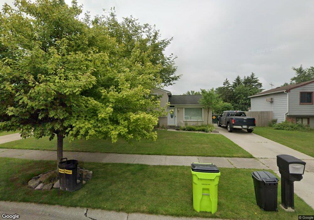
23335 Whitby Ave Flat Rock, MI 48134
Estimated Value: $218,637 - $291,000
Studio
1
Bath
1,308
Sq Ft
$199/Sq Ft
Est. Value
About This Home
This home is located at 23335 Whitby Ave, Flat Rock, MI 48134 and is currently estimated at $259,659, approximately $198 per square foot. 23335 Whitby Ave is a home located in Wayne County with nearby schools including Ethel C. Bobcean Elementary School, John M. Barnes Elementary School, and Thomas Simpson Middle School.
Ownership History
Date
Name
Owned For
Owner Type
Purchase Details
Closed on
Nov 1, 1994
Sold by
Fuller Roger G
Bought by
Majlinger Christine A
Current Estimated Value
Home Financials for this Owner
Home Financials are based on the most recent Mortgage that was taken out on this home.
Original Mortgage
$74,000
Interest Rate
8.75%
Mortgage Type
New Conventional
Create a Home Valuation Report for This Property
The Home Valuation Report is an in-depth analysis detailing your home's value as well as a comparison with similar homes in the area
Home Values in the Area
Average Home Value in this Area
Purchase History
| Date | Buyer | Sale Price | Title Company |
|---|---|---|---|
| Majlinger Christine A | $84,000 | -- |
Source: Public Records
Mortgage History
| Date | Status | Borrower | Loan Amount |
|---|---|---|---|
| Closed | Majlinger Christine A | $74,000 |
Source: Public Records
Tax History
| Year | Tax Paid | Tax Assessment Tax Assessment Total Assessment is a certain percentage of the fair market value that is determined by local assessors to be the total taxable value of land and additions on the property. | Land | Improvement |
|---|---|---|---|---|
| 2025 | $3,068 | $107,100 | $0 | $0 |
| 2024 | $2,979 | $100,700 | $0 | $0 |
| 2023 | $2,840 | $89,200 | $0 | $0 |
| 2022 | $3,439 | $79,900 | $0 | $0 |
| 2021 | $3,229 | $76,800 | $0 | $0 |
| 2020 | $3,186 | $72,700 | $0 | $0 |
| 2019 | $3,126 | $62,500 | $0 | $0 |
| 2018 | $2,429 | $62,100 | $0 | $0 |
| 2017 | $1,281 | $62,800 | $0 | $0 |
| 2016 | $2,943 | $59,800 | $0 | $0 |
| 2015 | $5,412 | $58,600 | $0 | $0 |
| 2013 | $5,243 | $52,700 | $0 | $0 |
| 2012 | $2,008 | $51,200 | $11,300 | $39,900 |
Source: Public Records
Map
Nearby Homes
- 23376 Port St
- 23827 Romero
- 23841 Romero
- 23814 Meadows Ave
- 23869 Romero
- 23838 Meadows Ave
- 23883 Romero
- 23911 Romero
- 23855 Romero
- 23897 Romero
- 0 Woodruff Unit 20251062264
- VL Gibraltar Rd
- 00 Gibraltar Rd
- 23965 Gibraltar Rd
- 24943 Mayfair St
- 24664 E Huron River Dr
- 23452 Astrid Ln
- 31629 Sweetbriar
- 31664 Sweetbriar
- 31733 E Ditner Dr
- 23321 Whitby Ave
- 23349 Whitby Ave
- 23307 Whitby Ave
- 23348 Meadows Ave
- 23359 Whitby Ave
- 23364 Meadows Ave
- 23332 Meadows Ave
- 29758 Sussex Ave
- 23316 Meadows Ave
- 23380 Meadows Ave
- 29771 Cambridge St
- 23253 Whitby Ave
- 23367 Whitby Ave
- 23308 Meadows Ave
- 23396 Meadows Ave
- 23239 Whitby Ave
- 29742 Sussex Ave
- 29751 Cambridge St
- 29790 Cambridge St
- 23192 Meadows Ave
Your Personal Tour Guide
Ask me questions while you tour the home.