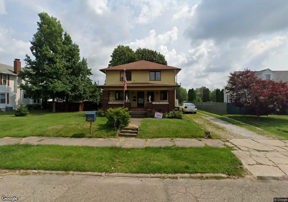
2334 Shunk Ave Alliance, OH 44601
Estimated Value: $192,000 - $228,000
3
Beds
3
Baths
2,792
Sq Ft
$74/Sq Ft
Est. Value
About This Home
This home is located at 2334 Shunk Ave, Alliance, OH 44601 and is currently estimated at $207,454, approximately $74 per square foot. 2334 Shunk Ave is a home located in Stark County with nearby schools including Alliance Elementary School at Rockhill, Alliance Intermediate School at Northside, and Alliance Middle School.
Ownership History
Date
Name
Owned For
Owner Type
Purchase Details
Closed on
Feb 4, 2021
Sold by
Harry Janet Louise and Harry Jesse Curtis
Bought by
Harry Janet L
Current Estimated Value
Home Financials for this Owner
Home Financials are based on the most recent Mortgage that was taken out on this home.
Original Mortgage
$133,500
Outstanding Balance
$130,308
Interest Rate
2.69%
Mortgage Type
Reverse Mortgage Home Equity Conversion Mortgage
Estimated Equity
$77,146
Purchase Details
Closed on
Sep 27, 2005
Sold by
Estate Of Jesse Harry Jr
Bought by
Harry Janet L
Create a Home Valuation Report for This Property
The Home Valuation Report is an in-depth analysis detailing your home's value as well as a comparison with similar homes in the area
Home Values in the Area
Average Home Value in this Area
Purchase History
We collect this data history from publicly available records. To have your information removed, we recommend requesting removal directly through your county’s website.
| Date | Buyer | Sale Price | Title Company |
|---|---|---|---|
| Harry Janet L | -- | Fnc Title Services Llc | |
| Harry Janet L | -- | -- |
Source: Public Records
Mortgage History
We collect this data history from publicly available records. To have your information removed, we recommend requesting removal directly through your county’s website.
| Date | Status | Borrower | Loan Amount |
|---|---|---|---|
| Open | Harry Janet L | $133,500 |
Source: Public Records
Tax History
| Year | Tax Paid | Tax Assessment Tax Assessment Total Assessment is a certain percentage of the fair market value that is determined by local assessors to be the total taxable value of land and additions on the property. | Land | Improvement |
|---|---|---|---|---|
| 2025 | -- | $65,870 | $15,960 | $49,910 |
| 2024 | -- | $65,870 | $15,960 | $49,910 |
| 2023 | $1,697 | $50,930 | $12,390 | $38,540 |
| 2022 | $1,725 | $50,930 | $12,390 | $38,540 |
| 2021 | $1,737 | $51,140 | $12,390 | $38,750 |
| 2020 | $1,557 | $44,240 | $10,780 | $33,460 |
| 2019 | $1,536 | $44,250 | $10,780 | $33,470 |
| 2018 | $1,543 | $44,250 | $10,780 | $33,470 |
| 2017 | $1,459 | $41,730 | $9,980 | $31,750 |
| 2016 | $1,374 | $39,530 | $7,780 | $31,750 |
| 2015 | $1,386 | $39,530 | $7,780 | $31,750 |
| 2014 | $1,291 | $36,030 | $7,110 | $28,920 |
| 2013 | $644 | $36,030 | $7,110 | $28,920 |
Source: Public Records
Map
Nearby Homes
- 2144 Ridgewood Ave
- 2616 Ridgewood Ave
- 2625 Belleflower Dr
- 2031 Ridgewood Ave
- 2145 Cherry Ave
- 2135 Cherry Ave
- 392 Maplewood Dr
- 421 Linwood Dr
- 2520 Pleasant Place
- 2138 Watson Ave
- 2417 S Arch Ave
- 2435 Eastern Ave
- 3116 Ridgehill Ave
- 1539 Parkway Blvd
- 1120 W Milton St
- 2206 S Linden Ave
- 2540 Edgewood Ave
- 1794 Lilly Ln
- 1038 Vincent Blvd
- 622 Overlook Dr
- 2348 Shunk Ave
- 2324 Shunk Ave
- 2304 Shunk Ave
- 2370 Shunk Ave
- 2343 Shunk Ave
- 2333 Shunk Ave
- 2349 Shunk Ave
- 2325 Shunk Ave
- 2357 Shunk Ave
- 2305 Shunk Ave
- 2380 Shunk Ave
- 2365 Shunk Ave
- 2246 Shunk Ave
- 2383 Shunk Ave
- 2400 Shunk Ave
- 2245 Shunk Ave
- 2234 Shunk Ave
- 2401 Shunk Ave
- 2350 Belleflower Dr
- 2306 Belleflower Dr
Your Personal Tour Guide
Ask me questions while you tour the home.