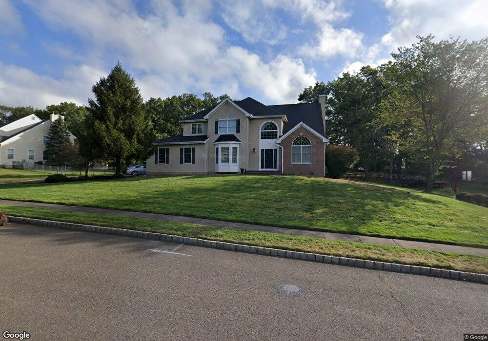
2337 Apple Ridge Cir Manasquan, NJ 08736
Estimated Value: $1,210,556 - $1,578,000
4
Beds
3
Baths
2,746
Sq Ft
$509/Sq Ft
Est. Value
About This Home
This home is located at 2337 Apple Ridge Cir, Manasquan, NJ 08736 and is currently estimated at $1,397,389, approximately $508 per square foot. 2337 Apple Ridge Cir is a home located in Monmouth County with nearby schools including Wall High School and The Brookside School.
Ownership History
Date
Name
Owned For
Owner Type
Purchase Details
Closed on
Aug 2, 2004
Sold by
Barnes Richard
Bought by
Evers Wwilliam and Evers Michelle
Current Estimated Value
Home Financials for this Owner
Home Financials are based on the most recent Mortgage that was taken out on this home.
Original Mortgage
$612,000
Outstanding Balance
$304,087
Interest Rate
6.03%
Estimated Equity
$1,093,302
Purchase Details
Closed on
Nov 17, 1993
Sold by
Matzel
Bought by
Barnes Richard and Barnes Brenda
Create a Home Valuation Report for This Property
The Home Valuation Report is an in-depth analysis detailing your home's value as well as a comparison with similar homes in the area
Home Values in the Area
Average Home Value in this Area
Purchase History
| Date | Buyer | Sale Price | Title Company |
|---|---|---|---|
| Evers Wwilliam | $765,000 | -- | |
| Barnes Richard | $274,900 | -- |
Source: Public Records
Mortgage History
| Date | Status | Borrower | Loan Amount |
|---|---|---|---|
| Open | Evers Wwilliam | $612,000 |
Source: Public Records
Tax History Compared to Growth
Tax History
| Year | Tax Paid | Tax Assessment Tax Assessment Total Assessment is a certain percentage of the fair market value that is determined by local assessors to be the total taxable value of land and additions on the property. | Land | Improvement |
|---|---|---|---|---|
| 2025 | $13,723 | $650,400 | $263,300 | $387,100 |
| 2024 | $13,314 | $650,400 | $263,300 | $387,100 |
| 2023 | $13,314 | $650,400 | $263,300 | $387,100 |
| 2022 | $12,988 | $650,400 | $263,300 | $387,100 |
| 2021 | $12,988 | $650,400 | $263,300 | $387,100 |
| 2020 | $12,832 | $650,400 | $263,300 | $387,100 |
| 2019 | $12,676 | $650,400 | $263,300 | $387,100 |
| 2018 | $12,566 | $650,400 | $263,300 | $387,100 |
| 2017 | $12,319 | $650,400 | $263,300 | $387,100 |
| 2016 | $12,058 | $650,400 | $263,300 | $387,100 |
| 2015 | $12,700 | $430,500 | $175,800 | $254,700 |
| 2014 | $12,338 | $427,800 | $173,100 | $254,700 |
Source: Public Records
Map
Nearby Homes
- 2378 Orchard Crest Blvd
- 1422 Lakewood Rd
- 1347 Winter View Rd
- 2412 Greentree Dr
- 1412 Winesap Dr
- 1215 Church St
- 1551 Holly Blvd
- 1210 Bayberry Rd
- 1207 Bayberry Rd
- 1590 Holly Blvd
- 1307 W Union Ln Unit A4
- 142 Oval Rd
- 1209 Lenape Trail
- 203 Lenape Trail
- 1919 Atlantic Ave Unit 26
- 1919 Atlantic Ave Unit 15
- 2573 Curriers Place
- 2311 Camden Ave
- 2338 Ramshorn Dr
- 2511 Morningstar Rd
- 2335 Apple Ridge Cir
- 2345 Apple Ridge Cir
- 1355 Tamarack Rd
- 2338 Apple Ridge Cir
- 2340 Apple Ridge Cir
- 1357 Tamarack Rd
- 2421 Apple Ridge Cir
- 1359 Tamarack Rd
- 2423 Jodi Ct
- 1361 Tamarack Rd
- 1351 Tamarack Rd
- 2342 Apple Ridge Cir
- 2344 Apple Ridge Cir
- 2425 Jodi Ct
- 2346 Apple Ridge Cir
- 2408 Colts Foot Trail
- 2420 Apple Ridge Cir
- 2422 Apple Ridge Cir
- 2413 Apple Ridge Cir
- 2407 Colts Foot Trail