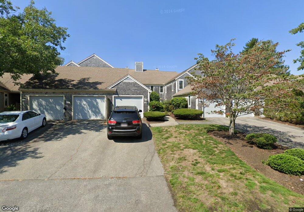
234 Kates Path Yarmouth Port, MA 02675
Yarmouth Port NeighborhoodEstimated Value: $439,000 - $480,000
2
Beds
2
Baths
1,164
Sq Ft
$390/Sq Ft
Est. Value
About This Home
This home is located at 234 Kates Path, Yarmouth Port, MA 02675 and is currently estimated at $453,906, approximately $389 per square foot. 234 Kates Path is a home located in Barnstable County with nearby schools including Dennis-Yarmouth Regional High School.
Ownership History
Date
Name
Owned For
Owner Type
Purchase Details
Closed on
Aug 28, 2017
Sold by
Peters William and Peters Alicia
Bought by
Peters Ft
Current Estimated Value
Purchase Details
Closed on
Sep 10, 2015
Sold by
E Q Flanagan T
Bought by
Peters William
Purchase Details
Closed on
Jun 9, 2010
Sold by
Corcoran Rt
Bought by
E Q Flanagan T
Create a Home Valuation Report for This Property
The Home Valuation Report is an in-depth analysis detailing your home's value as well as a comparison with similar homes in the area
Home Values in the Area
Average Home Value in this Area
Purchase History
| Date | Buyer | Sale Price | Title Company |
|---|---|---|---|
| Peters Ft | -- | -- | |
| Peters William | -- | -- | |
| E Q Flanagan T | $248,000 | -- |
Source: Public Records
Tax History Compared to Growth
Tax History
| Year | Tax Paid | Tax Assessment Tax Assessment Total Assessment is a certain percentage of the fair market value that is determined by local assessors to be the total taxable value of land and additions on the property. | Land | Improvement |
|---|---|---|---|---|
| 2025 | $2,723 | $384,600 | $0 | $384,600 |
| 2024 | $3,045 | $412,600 | $0 | $412,600 |
| 2023 | $2,596 | $320,100 | $0 | $320,100 |
| 2022 | $2,806 | $305,700 | $0 | $305,700 |
| 2021 | $2,728 | $285,400 | $0 | $285,400 |
| 2020 | $2,752 | $275,200 | $0 | $275,200 |
| 2019 | $2,579 | $255,300 | $0 | $255,300 |
| 2018 | $2,421 | $235,300 | $0 | $235,300 |
| 2017 | $2,258 | $225,300 | $0 | $225,300 |
| 2016 | $2,150 | $215,400 | $0 | $215,400 |
| 2015 | $2,251 | $224,200 | $0 | $224,200 |
Source: Public Records
Map
Nearby Homes
- 228 Kates Path
- 17 Kates Path Unit A
- 64 Kates Path
- 158 Kates Path
- 19 John Halls Cartpath Village Unit E
- 19 John Hall Cartway Unit E
- 50 John Hall Cartway
- 50 John Hall Cartway Unit 50
- 42 John Hall Cartway Unit 42
- 43 Canterbury Rd
- 28 Oak Glen
- 17 Nottingham Dr
- 44 Stratford Ln
- 25 Oak Glen Village Unit 25
- 25 Oak Glen
- 30 W Woods
- 30 W Woods Cir Unit 30
- 2 Pine Grove
- 800 Route 6a
- 800 Route 6a
- 136 Kates Path Unit C
- 246 Kates Path
- 244 Kates Path
- 232 Kates Path
- 230 Kates Path
- 224 Kates Path
- 222 Kates Path
- 220 Kates Path
- 218 Kates Path
- 214 Kates Path
- 212 Kates Path
- 138 Kates Path
- 136 Kates Path
- 134 Kates Path
- 132 Kates Path
- 130 Kates Path
- 77 Kates Path
- 75 Kates Path
- 73 Kates Path
- 71 Kates Path