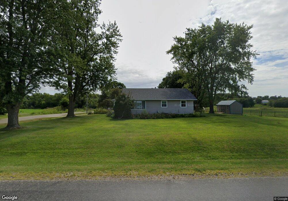
234 Knox Highway 5 Abingdon, IL 61410
Estimated Value: $107,256 - $140,000
--
Bed
--
Bath
1,200
Sq Ft
$102/Sq Ft
Est. Value
About This Home
This home is located at 234 Knox Highway 5, Abingdon, IL 61410 and is currently estimated at $121,814, approximately $101 per square foot. 234 Knox Highway 5 is a home located in Knox County with nearby schools including Hedding Grade School, Avon Elementary School, and Abingdon-Avon Middle School.
Ownership History
Date
Name
Owned For
Owner Type
Purchase Details
Closed on
May 22, 2009
Sold by
Batson Jared H and Batson Rebecca L
Bought by
Welty Tristen S
Current Estimated Value
Home Financials for this Owner
Home Financials are based on the most recent Mortgage that was taken out on this home.
Original Mortgage
$80,444
Outstanding Balance
$50,963
Interest Rate
4.9%
Mortgage Type
New Conventional
Estimated Equity
$70,851
Create a Home Valuation Report for This Property
The Home Valuation Report is an in-depth analysis detailing your home's value as well as a comparison with similar homes in the area
Home Values in the Area
Average Home Value in this Area
Purchase History
| Date | Buyer | Sale Price | Title Company |
|---|---|---|---|
| Welty Tristen S | $80,000 | Attorney Only |
Source: Public Records
Mortgage History
| Date | Status | Borrower | Loan Amount |
|---|---|---|---|
| Open | Welty Tristen S | $80,444 |
Source: Public Records
Tax History Compared to Growth
Tax History
| Year | Tax Paid | Tax Assessment Tax Assessment Total Assessment is a certain percentage of the fair market value that is determined by local assessors to be the total taxable value of land and additions on the property. | Land | Improvement |
|---|---|---|---|---|
| 2024 | $1,598 | $28,540 | $1,870 | $26,670 |
| 2023 | $1,598 | $25,760 | $1,690 | $24,070 |
| 2022 | $1,388 | $24,490 | $1,610 | $22,880 |
| 2021 | $1,336 | $23,550 | $1,550 | $22,000 |
| 2020 | $1,267 | $22,640 | $1,490 | $21,150 |
| 2019 | $1,766 | $28,230 | $1,480 | $26,750 |
| 2018 | $1,695 | $27,410 | $1,440 | $25,970 |
| 2017 | $1,680 | $26,870 | $1,410 | $25,460 |
| 2015 | -- | $26,340 | $1,380 | $24,960 |
| 2013 | $1,694 | $26,080 | $1,370 | $24,710 |
Source: Public Records
Map
Nearby Homes
- 405 W Memorial Dr
- 204 E Adams St
- 500 N Monroe St
- 704 N Cherry St
- 306 N Harshbarger St
- 106 E Jackson St
- 108 W Jackson St
- 205 N Austin Ave
- 103 N Swarts St
- 407 W Martin St
- 204 S Washington St
- 206 W Lower St
- 403 1/2 E Jared St
- 211 S Froelich Ln
- 103 W Givens St
- 369 Knox Highway 23
- 1077 Knox Road 500 E
- 1196 160th St
- 572 Knox Highway 26
- 569 Knox Road 1250 N
- 924 N Main St
- 922 N Main St
- 230 Knox Highway 5
- 920 N Main St
- 222 Knox Highway 5
- 1465 N Monroe St
- 918 N Main St
- 216 Knox Highway 5
- 922 N Monroe St
- 214 Knox Highway 5
- 917 N Monroe St
- 916 N Main St
- 210 Knox Highway 5
- 920 N Monroe St
- 917 N Main St
- 914 N Main St
- 206 Knox Highway 5
- 918 N Monroe St
- 915 N Main St
- 915 N Monroe St