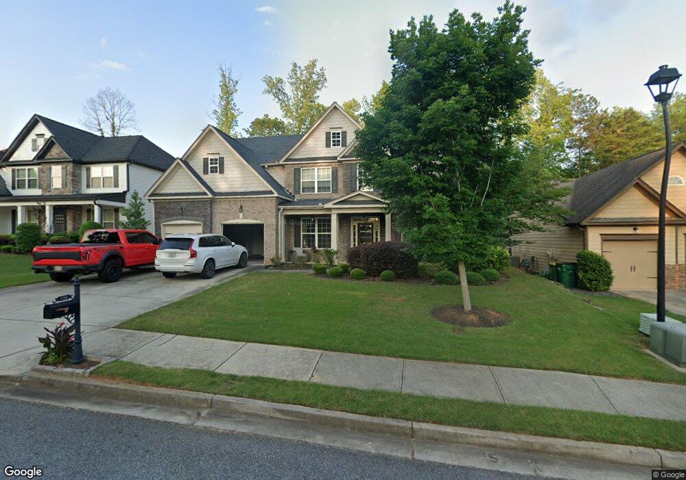
234 Lakestone Pkwy Woodstock, GA 30188
Estimated Value: $738,780 - $740,000
4
Beds
4
Baths
3,254
Sq Ft
$227/Sq Ft
Est. Value
About This Home
This home is located at 234 Lakestone Pkwy, Woodstock, GA 30188 and is currently estimated at $739,390, approximately $227 per square foot. 234 Lakestone Pkwy is a home with nearby schools including Little River Elementary, Mill Creek Middle School, and River Ridge High School.
Ownership History
Date
Name
Owned For
Owner Type
Purchase Details
Closed on
May 13, 2015
Sold by
Sharp Residential Llc
Bought by
Whinery Jonathan Paul and Whinery Josefina
Current Estimated Value
Home Financials for this Owner
Home Financials are based on the most recent Mortgage that was taken out on this home.
Original Mortgage
$322,826
Outstanding Balance
$248,968
Interest Rate
3.79%
Mortgage Type
New Conventional
Estimated Equity
$490,422
Create a Home Valuation Report for This Property
The Home Valuation Report is an in-depth analysis detailing your home's value as well as a comparison with similar homes in the area
Home Values in the Area
Average Home Value in this Area
Purchase History
| Date | Buyer | Sale Price | Title Company |
|---|---|---|---|
| Whinery Jonathan Paul | $358,696 | -- |
Source: Public Records
Mortgage History
| Date | Status | Borrower | Loan Amount |
|---|---|---|---|
| Open | Whinery Jonathan Paul | $322,826 |
Source: Public Records
Tax History Compared to Growth
Tax History
| Year | Tax Paid | Tax Assessment Tax Assessment Total Assessment is a certain percentage of the fair market value that is determined by local assessors to be the total taxable value of land and additions on the property. | Land | Improvement |
|---|---|---|---|---|
| 2025 | $6,549 | $280,560 | $60,800 | $219,760 |
| 2024 | $6,398 | $273,880 | $60,800 | $213,080 |
| 2023 | $699 | $254,440 | $58,000 | $196,440 |
| 2022 | $5,427 | $212,760 | $46,800 | $165,960 |
| 2021 | $4,030 | $167,560 | $33,200 | $134,360 |
| 2020 | $5,008 | $164,840 | $33,200 | $131,640 |
| 2019 | $3,755 | $153,840 | $33,200 | $120,640 |
| 2018 | $3,648 | $147,320 | $33,200 | $114,120 |
| 2017 | $3,677 | $360,300 | $33,200 | $110,920 |
| 2016 | $3,693 | $358,700 | $33,200 | $110,280 |
| 2015 | $862 | $83,000 | $33,200 | $0 |
Source: Public Records
Map
Nearby Homes
- 3025 S Cherokee Ln
- 209 Lakestone Pkwy
- 2697 S Cherokee Ln
- 383 Tillman Pass
- 1013 Liberty Springs Dr
- 274 Lakestone Pkwy
- 141 Bevington Ln
- 2874 S Cherokee Ln
- 120 Bevington Ln
- 317 Lakestone Landing
- 202 Roseman Way
- 310 Lauren Ln
- 328 Lauren Ln
- The Arlington Plan at
- The Alston A Plan at
- 208 Marlow Dr
- 4899 Hawk Trail NE
- 461 Maypop Ln
- 2768 Hawk Trace Ct NE
- 449 Maypop Ln
- 232 Lakestone Pkwy
- 230 Lakestone Pkwy
- 238 Lakestone Pkwy
- 235 Lakestone Pkwy
- 231 Lakestone Pkwy
- 228 Lakestone Pkwy
- 240 Lakestone Pkwy
- 226 Lakestone Pkwy
- 817 Turnstone Dr
- 242 Lakestone Pkwy
- 241 Lakestone Pkwy
- 224 Lakestone Pkwy
- 815 Turnstone Dr
- 819 Turnstone Dr
- 244 Lakestone Pkwy
- 335 Tillman Pass
- 350 Tillman Pass
- 374 Tillman Pass
- 310 Tillman Pass
- 379 Tillman Pass