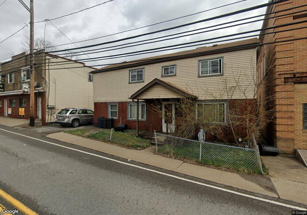
234 Mccoy Rd Mc Kees Rocks, PA 15136
Stowe Township NeighborhoodEstimated Value: $96,977 - $153,000
2
Beds
1
Bath
891
Sq Ft
$136/Sq Ft
Est. Value
About This Home
This home is located at 234 Mccoy Rd, Mc Kees Rocks, PA 15136 and is currently estimated at $120,994, approximately $135 per square foot. 234 Mccoy Rd is a home located in Allegheny County with nearby schools including Sto-Rox Upper Elementary School, Sto-Rox Primary Center, and Sto-Rox Junior/Senior High School.
Ownership History
Date
Name
Owned For
Owner Type
Purchase Details
Closed on
Dec 19, 1994
Sold by
Anderson Debra R
Bought by
Whitcomb James H and Whitcomb Judy H
Current Estimated Value
Create a Home Valuation Report for This Property
The Home Valuation Report is an in-depth analysis detailing your home's value as well as a comparison with similar homes in the area
Home Values in the Area
Average Home Value in this Area
Purchase History
| Date | Buyer | Sale Price | Title Company |
|---|---|---|---|
| Whitcomb James H | $41,000 | -- |
Source: Public Records
Tax History Compared to Growth
Tax History
| Year | Tax Paid | Tax Assessment Tax Assessment Total Assessment is a certain percentage of the fair market value that is determined by local assessors to be the total taxable value of land and additions on the property. | Land | Improvement |
|---|---|---|---|---|
| 2025 | $1,340 | $31,000 | $19,000 | $12,000 |
| 2024 | $1,288 | $31,000 | $19,000 | $12,000 |
| 2023 | $1,288 | $31,000 | $19,000 | $12,000 |
| 2022 | $1,247 | $31,000 | $19,000 | $12,000 |
| 2021 | $1,218 | $31,000 | $19,000 | $12,000 |
| 2020 | $1,218 | $31,000 | $19,000 | $12,000 |
| 2019 | $1,218 | $31,000 | $19,000 | $12,000 |
| 2018 | $147 | $31,000 | $19,000 | $12,000 |
| 2017 | $1,190 | $31,000 | $19,000 | $12,000 |
| 2016 | $147 | $31,000 | $19,000 | $12,000 |
| 2015 | $147 | $31,000 | $19,000 | $12,000 |
| 2014 | $1,190 | $31,000 | $19,000 | $12,000 |
Source: Public Records
Map
Nearby Homes
- 82 Harlem Ave
- 125 Frazier Ave
- 813 8th St
- 810 Woodward Ave
- 837 Benwood Ave
- 45 Harlem Ave
- 705 Broadway Ave
- 22 Harlem Ave
- 19 Shaw Ave
- 634 Broadway Ave
- 620 Broadway Ave
- 815 Broadway Ave
- 815 10th St
- 813 10th St
- 802 10th St
- 705 Russellwood Ave
- 713 Russellwood Ave
- 810 10th St
- 27 Highland Ave
- 533 Woodward Ave