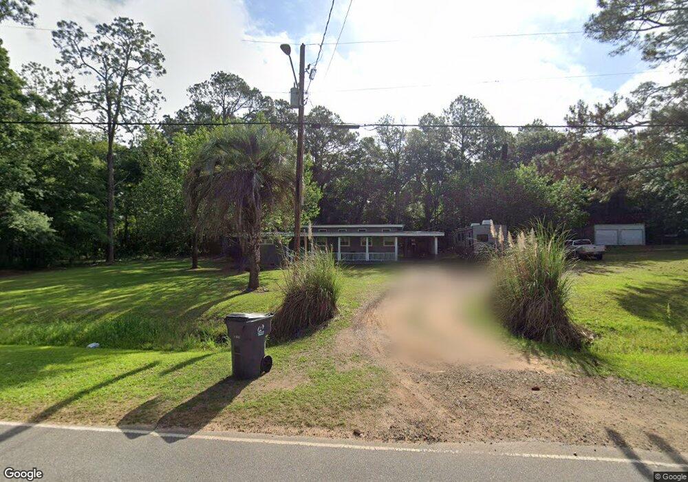
234 N Manning St Moultrie, GA 31768
Estimated Value: $95,000 - $162,000
--
Bed
2
Baths
1,272
Sq Ft
$95/Sq Ft
Est. Value
About This Home
This home is located at 234 N Manning St, Moultrie, GA 31768 and is currently estimated at $121,269, approximately $95 per square foot. 234 N Manning St is a home located in Colquitt County with nearby schools including Funston Elementary School, C.A. Gray Junior High School, and Willie J. Williams Middle School.
Ownership History
Date
Name
Owned For
Owner Type
Purchase Details
Closed on
Feb 6, 2018
Sold by
Allen Donna
Bought by
Moore Shana Allen and Moore Robert G
Current Estimated Value
Home Financials for this Owner
Home Financials are based on the most recent Mortgage that was taken out on this home.
Original Mortgage
$8,000
Interest Rate
3.99%
Mortgage Type
New Conventional
Purchase Details
Closed on
Nov 3, 2005
Sold by
Suber Marjorie D
Bought by
Allen Donna
Create a Home Valuation Report for This Property
The Home Valuation Report is an in-depth analysis detailing your home's value as well as a comparison with similar homes in the area
Home Values in the Area
Average Home Value in this Area
Purchase History
| Date | Buyer | Sale Price | Title Company |
|---|---|---|---|
| Moore Shana Allen | $8,000 | -- | |
| Allen Donna | -- | -- |
Source: Public Records
Mortgage History
| Date | Status | Borrower | Loan Amount |
|---|---|---|---|
| Closed | Moore Shana Allen | $8,000 |
Source: Public Records
Tax History Compared to Growth
Tax History
| Year | Tax Paid | Tax Assessment Tax Assessment Total Assessment is a certain percentage of the fair market value that is determined by local assessors to be the total taxable value of land and additions on the property. | Land | Improvement |
|---|---|---|---|---|
| 2024 | $753 | $31,896 | $2,400 | $29,496 |
| 2023 | $658 | $26,741 | $2,400 | $24,341 |
| 2022 | $544 | $22,476 | $2,400 | $20,076 |
| 2021 | $486 | $20,016 | $2,400 | $17,616 |
| 2020 | $458 | $18,606 | $2,400 | $16,206 |
| 2019 | $493 | $18,220 | $2,400 | $15,820 |
| 2018 | $527 | $17,514 | $2,400 | $15,114 |
| 2017 | $523 | $17,514 | $2,400 | $15,114 |
| 2016 | $526 | $17,514 | $2,400 | $15,114 |
| 2015 | $528 | $17,514 | $2,400 | $15,114 |
| 2014 | $545 | $17,514 | $2,400 | $15,114 |
| 2013 | -- | $17,513 | $2,400 | $15,113 |
Source: Public Records
Map
Nearby Homes
- 0 Fox Trot Dr
- LOT 30 Merganser Ln
- 372 Westwoods Dr Unit 21
- LOT 23 Westwoods Dr
- 198 Westwoods Dr
- 00 Rossman Dairy Rd
- 2393 Georgia 37
- 1791 Funston Sigsbee Rd
- 219 Cox Dairy Rd
- 102 Schley Church Rd
- 1485 Bay Rd
- 0 Kendallwood Dr Unit 1652301
- 216 Circle Rd
- 0 Sam Sells Rd
- 410 West Bypass NW
- 1321 Hallmark Dr
- 410 W Bypass Pass NW
- 722 Martin Luther King jr Dr
- 178 Cool Breeze Dr
- 218 Gusty Rd
- 218 N Manning St
- 204 N Manning St
- 194 N Manning St
- 118 Duffell Dr
- 223 N Manning St
- 136 Duffell Dr
- 182 N Manning St
- 154 Duffell Dr
- 362 Funston Sigsbee Rd
- 362 Funston Sigsbee Rd
- 185 Duffell Dr
- 200 Spivey Dr
- 150 N Manning St
- 141 S Church St NW
- 137 N Manning St
- 183 Spivey Dr NW
- 136 N Manning St
- 183 Spivey Dr
- 197 Duffell Dr NE
- 126 Academy St NW