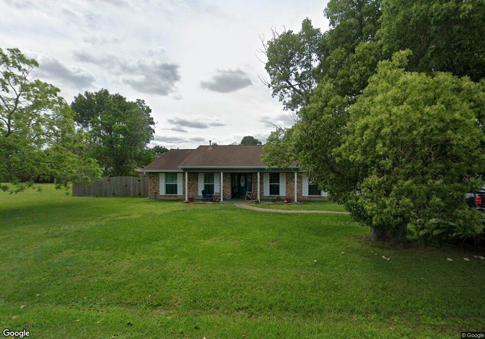
234 Pecan Dr Brazoria, TX 77422
Estimated Value: $197,973 - $299,000
3
Beds
2
Baths
2,016
Sq Ft
$129/Sq Ft
Est. Value
About This Home
This home is located at 234 Pecan Dr, Brazoria, TX 77422 and is currently estimated at $260,743, approximately $129 per square foot. 234 Pecan Dr is a home located in Brazoria County.
Ownership History
Date
Name
Owned For
Owner Type
Purchase Details
Closed on
Apr 19, 2002
Sold by
Marshall Charles P and Marshall Loretta M
Bought by
Hall James C and Hall Laura L
Current Estimated Value
Home Financials for this Owner
Home Financials are based on the most recent Mortgage that was taken out on this home.
Original Mortgage
$117,161
Interest Rate
7.09%
Mortgage Type
FHA
Purchase Details
Closed on
Aug 15, 1995
Sold by
Greenwood Michael M and Greenwood Annette K
Bought by
Marshall Charles P and Marshall Loretta M
Home Financials for this Owner
Home Financials are based on the most recent Mortgage that was taken out on this home.
Original Mortgage
$45,500
Interest Rate
7.6%
Purchase Details
Closed on
Feb 2, 1995
Sold by
Stricklin Billie T and Stricklin Billie Sue Thompson
Bought by
Greenwood Michael M and Greenwood Annette K
Home Financials for this Owner
Home Financials are based on the most recent Mortgage that was taken out on this home.
Original Mortgage
$63,900
Interest Rate
9.13%
Create a Home Valuation Report for This Property
The Home Valuation Report is an in-depth analysis detailing your home's value as well as a comparison with similar homes in the area
Home Values in the Area
Average Home Value in this Area
Purchase History
| Date | Buyer | Sale Price | Title Company |
|---|---|---|---|
| Hall James C | -- | -- | |
| Marshall Charles P | -- | Texas American Title Company | |
| Greenwood Michael M | -- | -- |
Source: Public Records
Mortgage History
| Date | Status | Borrower | Loan Amount |
|---|---|---|---|
| Closed | Hall James C | $117,161 | |
| Previous Owner | Marshall Charles P | $45,500 | |
| Previous Owner | Greenwood Michael M | $63,900 |
Source: Public Records
Tax History Compared to Growth
Tax History
| Year | Tax Paid | Tax Assessment Tax Assessment Total Assessment is a certain percentage of the fair market value that is determined by local assessors to be the total taxable value of land and additions on the property. | Land | Improvement |
|---|---|---|---|---|
| 2025 | $921 | $137,310 | $14,990 | $122,320 |
| 2023 | $921 | $223,630 | $13,570 | $210,060 |
| 2022 | $4,940 | $218,691 | $11,970 | $241,260 |
| 2021 | $4,686 | $198,810 | $10,370 | $188,440 |
| 2020 | $5,182 | $209,480 | $9,580 | $199,900 |
| 2019 | $4,879 | $192,020 | $7,980 | $184,040 |
| 2018 | $4,460 | $173,750 | $9,580 | $164,170 |
| 2017 | $4,840 | $182,340 | $9,580 | $172,760 |
| 2016 | $4,757 | $188,670 | $7,980 | $180,690 |
| 2014 | $3,371 | $145,970 | $7,980 | $137,990 |
Source: Public Records
Map
Nearby Homes
- 0 Pecan Dr
- 232 Magnolia St
- 229 Yaupon Dr
- 1208 S Brooks St
- 409 Carlton St
- 523 Lazy Ln
- 34654 Fm 521 Rd
- 8922 Fm 521 Rd
- 230 E New York St
- 307 Avenue G
- 706 E New York St
- 4773 County Road 652
- 549 E New York St
- 206 S Market St
- 310 E Texas St
- 0 Cr-747a
- TBD Cr-318
- 320 Cr-320
- 0 Cr-318 Unit 18304666
- TBD Cr-318 Tract 7c