Estimated Value: $859,882 - $1,010,000
4
Beds
3
Baths
3,713
Sq Ft
$249/Sq Ft
Est. Value
About This Home
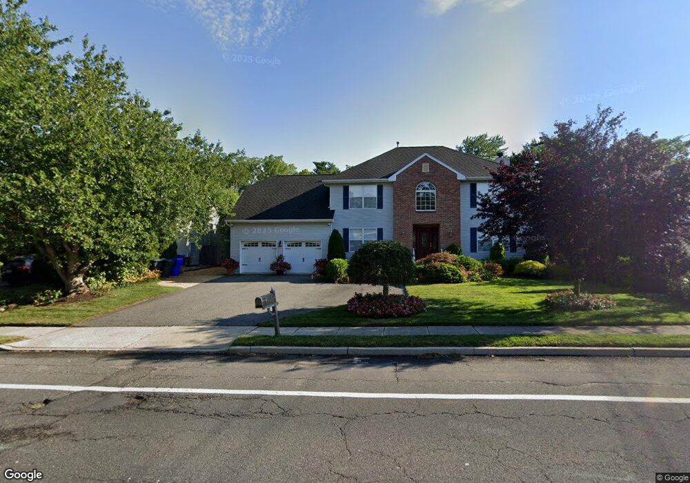
This home is located at 234 Princeton Ave, Brick, NJ 08724 and is currently estimated at $925,721, approximately $249 per square foot. 234 Princeton Ave is a home located in Ocean County with nearby schools including Midstreams Elementary School, Veterans Memorial Middle School, and Brick Township Memorial High School.
Ownership History
Date
Name
Owned For
Owner Type
Purchase Details
Closed on
Nov 25, 2002
Current Estimated Value
Purchase Details
Closed on
Dec 14, 2000
Sold by
Rgh Homes
Bought by
Rippon Richard and Rippon Kathryn
Home Financials for this Owner
Home Financials are based on the most recent Mortgage that was taken out on this home.
Original Mortgage
$160,000
Interest Rate
7.69%
Create a Home Valuation Report for This Property
The Home Valuation Report is an in-depth analysis detailing your home's value as well as a comparison with similar homes in the area
Home Values in the Area
Average Home Value in this Area
Purchase History
| Date | Buyer | Sale Price | Title Company |
|---|---|---|---|
| -- | -- | -- | |
| Rippon Richard | $289,900 | -- | |
| Rippon Richard | $289,900 | -- |
Source: Public Records
Mortgage History
| Date | Status | Borrower | Loan Amount |
|---|---|---|---|
| Previous Owner | Rippon Richard | $160,000 |
Source: Public Records
Tax History Compared to Growth
Tax History
| Year | Tax Paid | Tax Assessment Tax Assessment Total Assessment is a certain percentage of the fair market value that is determined by local assessors to be the total taxable value of land and additions on the property. | Land | Improvement |
|---|---|---|---|---|
| 2025 | $11,800 | $452,100 | $153,500 | $298,600 |
| 2024 | $11,199 | $452,100 | $153,500 | $298,600 |
| 2023 | $11,036 | $452,100 | $153,500 | $298,600 |
| 2022 | $11,036 | $452,100 | $153,500 | $298,600 |
| 2021 | $10,805 | $452,100 | $153,500 | $298,600 |
| 2020 | $10,665 | $452,100 | $153,500 | $298,600 |
| 2019 | $10,475 | $452,100 | $153,500 | $298,600 |
| 2018 | $10,236 | $452,100 | $153,500 | $298,600 |
| 2017 | $9,960 | $452,100 | $153,500 | $298,600 |
| 2016 | $9,906 | $452,100 | $153,500 | $298,600 |
| 2015 | $9,648 | $452,100 | $153,500 | $298,600 |
| 2014 | $9,566 | $452,100 | $153,500 | $298,600 |
Source: Public Records
Map
Nearby Homes
- 113 Elizabeth Ave
- 288 Princeton Ave
- 16 Mallard Dr
- 17 Mallard Dr
- 27 Greenhill Dr
- 74 Fairview Ave
- 16 Wayside Dr
- 313 Shawnee Dr
- 5 Island Dr
- 7 Brant Dr
- 103 Sleepy Hollow Dr
- 2 Brant Dr Unit Lot 5.01
- 17 Brant Dr
- 100 Sleepy Hollow Dr
- 0 Island Ct
- 49 N Cherokee Ln
- 337 Osage Dr
- 65 Sleepy Hollow Dr
- 24 Mayapple Dr
- 53 Lenape Trail
- 230 Princeton Ave
- 238 Princeton Ave
- 226 Princeton Ave
- 239 Princeton Ave
- 235 Princeton Ave
- 231 Princeton Ave
- 1 Brushy Neck Dr
- 229 Princeton Ave
- 243 Princeton Ave
- 220 Princeton Ave
- 8 Johnson St
- 245 Princeton Ave
- 3 Brushy Neck Dr
- 5 Brushy Neck Dr
- 108 Elizabeth Ave
- 106 Elizabeth Ave
- 223 Princeton Ave
- 7 Elizabeth Ave
- 252 Princeton Ave
- 7 Brushy Neck Dr