Estimated Value: $277,134 - $298,000
3
Beds
2
Baths
1,821
Sq Ft
$157/Sq Ft
Est. Value
About This Home
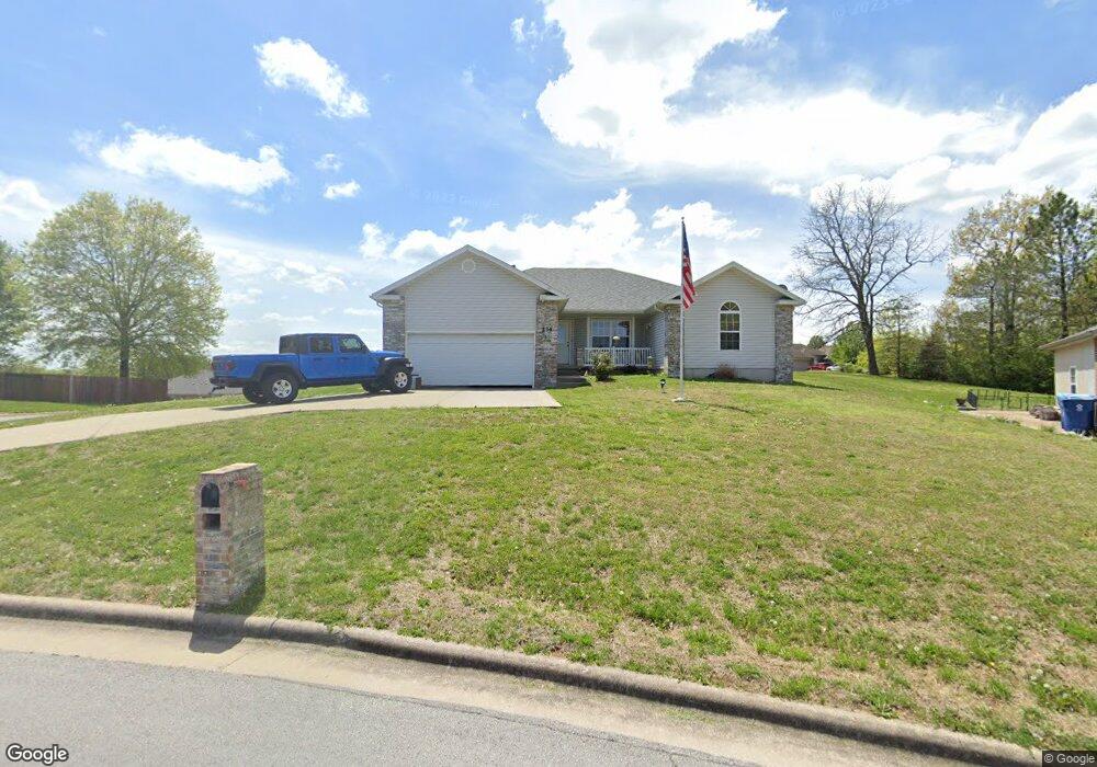
This home is located at 234 Shady Acres Cir, Nixa, MO 65714 and is currently estimated at $285,034, approximately $156 per square foot. 234 Shady Acres Cir is a home located in Christian County with nearby schools including Deauville Gardens Elementary School, Hugh W. Gregg Elementary School, and Century Elementary School.
Ownership History
Date
Name
Owned For
Owner Type
Purchase Details
Closed on
Dec 27, 2011
Sold by
Moyna Patrick D and Moyna Kimberly K
Bought by
Moyna Patrick D and Moyna Kimberly K
Current Estimated Value
Purchase Details
Closed on
Oct 3, 2008
Sold by
Teague Willard D and Teague Jerlene K
Bought by
Moyna Patrick D and Roebuck Kimberly K
Home Financials for this Owner
Home Financials are based on the most recent Mortgage that was taken out on this home.
Original Mortgage
$124,913
Outstanding Balance
$82,745
Interest Rate
6.35%
Mortgage Type
FHA
Estimated Equity
$202,289
Create a Home Valuation Report for This Property
The Home Valuation Report is an in-depth analysis detailing your home's value as well as a comparison with similar homes in the area
Home Values in the Area
Average Home Value in this Area
Purchase History
| Date | Buyer | Sale Price | Title Company |
|---|---|---|---|
| Moyna Patrick D | -- | Meridian Title Company | |
| Moyna Patrick D | -- | None Available |
Source: Public Records
Mortgage History
| Date | Status | Borrower | Loan Amount |
|---|---|---|---|
| Open | Moyna Patrick D | $124,913 |
Source: Public Records
Tax History Compared to Growth
Tax History
| Year | Tax Paid | Tax Assessment Tax Assessment Total Assessment is a certain percentage of the fair market value that is determined by local assessors to be the total taxable value of land and additions on the property. | Land | Improvement |
|---|---|---|---|---|
| 2024 | $1,580 | $25,350 | -- | -- |
| 2023 | $1,580 | $25,350 | $0 | $0 |
| 2022 | $1,582 | $25,350 | $0 | $0 |
| 2021 | $1,583 | $25,350 | $0 | $0 |
| 2020 | $1,414 | $21,620 | $0 | $0 |
| 2019 | $1,414 | $21,620 | $0 | $0 |
| 2018 | $1,317 | $21,620 | $0 | $0 |
| 2017 | $1,317 | $21,620 | $0 | $0 |
| 2016 | $1,297 | $21,620 | $0 | $0 |
| 2015 | $1,299 | $21,620 | $21,620 | $0 |
| 2014 | $1,264 | $21,570 | $0 | $0 |
| 2013 | $13 | $21,570 | $0 | $0 |
| 2011 | $13 | $43,140 | $0 | $0 |
Source: Public Records
Map
Nearby Homes
- 209 Shady Acres Cir
- 287 Sunrise Dr
- 111 Daleview Cir
- 000 Citydel Rd W
- 000 Old Riverdale Rd
- 000 Croley Blvd Unit Lots 12,13, 14
- 138 W Silver Oak St
- 643 W Brook Hollow Rd
- 653 W Brook Hollow Rd
- 621 W Arbor Glenn Dr
- 609 W Arbor Glenn Dr
- 656 W Castor Loop
- 662 W Castor Loop
- 689 W Castor Loop
- 955 S Silverwood Ln
- 915 S Silverwood Ln
- 911 S Silverwood Ln
- 919 S Silverwood Ln
- 965 S Silverwood Ln
- 959 S Silverwood Ln
- 192 Shady Acres Cir
- 231 Shady Acres Cir
- 230 Shady Acres Cir
- 248 W Sunrise Dr
- 191 Shady Acres Cir
- 194 Shady Acres Cir
- 204 W Shady Oaks Dr
- 199 W Shady Oaks Dr
- 193 Shady Acres Cir
- 272 Sunrise Dr
- 228 Shady Acres Cir
- 204 Shady Oak Dr
- 284 Sunrise Dr
- 223 Shady Acres Cir
- 197 Shady Acres Cir
- 196 Shady Acres Cir
- 185 W Shady Oaks Dr
- 194 W Shady Oaks Dr
- 219 Shady Acres Cir
- 938 Canyon Ln