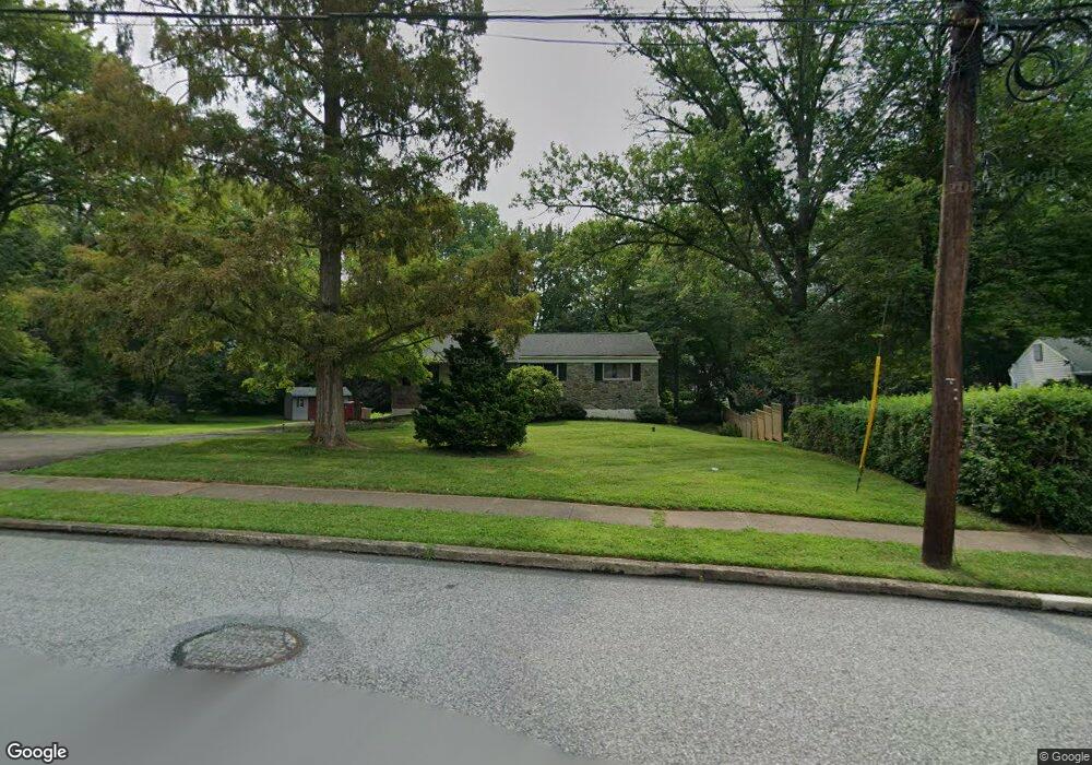
234 Tomstock Rd Norristown, PA 19403
Estimated Value: $442,000 - $476,000
3
Beds
2
Baths
1,224
Sq Ft
$375/Sq Ft
Est. Value
About This Home
This home is located at 234 Tomstock Rd, Norristown, PA 19403 and is currently estimated at $458,896, approximately $374 per square foot. 234 Tomstock Rd is a home located in Montgomery County with nearby schools including Woodland Elementary School, Skyview Upper Elementary School, and Arcola Intermediate School.
Ownership History
Date
Name
Owned For
Owner Type
Purchase Details
Closed on
Sep 22, 2010
Sold by
Davidson William and Joyce Lisa M
Bought by
Keyser Roger B and Keyser Gina L
Current Estimated Value
Home Financials for this Owner
Home Financials are based on the most recent Mortgage that was taken out on this home.
Original Mortgage
$184,000
Outstanding Balance
$121,007
Interest Rate
4.36%
Estimated Equity
$337,889
Purchase Details
Closed on
Oct 3, 2003
Sold by
Davis Herbert -L and Donovan Jacqueline
Bought by
Davidson William
Purchase Details
Closed on
Aug 4, 1994
Sold by
Davis Herbert L
Bought by
Davis Herbert L
Create a Home Valuation Report for This Property
The Home Valuation Report is an in-depth analysis detailing your home's value as well as a comparison with similar homes in the area
Home Values in the Area
Average Home Value in this Area
Purchase History
| Date | Buyer | Sale Price | Title Company |
|---|---|---|---|
| Keyser Roger B | $230,000 | None Available | |
| Davidson William | -- | -- | |
| Davis Herbert L | -- | -- |
Source: Public Records
Mortgage History
| Date | Status | Borrower | Loan Amount |
|---|---|---|---|
| Open | Keyser Roger B | $184,000 |
Source: Public Records
Tax History Compared to Growth
Tax History
| Year | Tax Paid | Tax Assessment Tax Assessment Total Assessment is a certain percentage of the fair market value that is determined by local assessors to be the total taxable value of land and additions on the property. | Land | Improvement |
|---|---|---|---|---|
| 2025 | $5,110 | $125,260 | $53,550 | $71,710 |
| 2024 | $5,110 | $125,260 | $53,550 | $71,710 |
| 2023 | $4,916 | $125,260 | $53,550 | $71,710 |
| 2022 | $4,781 | $125,260 | $53,550 | $71,710 |
| 2021 | $4,658 | $125,260 | $53,550 | $71,710 |
| 2020 | $4,549 | $125,260 | $53,550 | $71,710 |
| 2019 | $4,507 | $125,260 | $53,550 | $71,710 |
| 2018 | $4,506 | $125,260 | $53,550 | $71,710 |
| 2017 | $4,303 | $125,260 | $53,550 | $71,710 |
| 2016 | $4,254 | $125,260 | $53,550 | $71,710 |
| 2015 | $4,149 | $125,260 | $53,550 | $71,710 |
| 2014 | $4,089 | $125,260 | $53,550 | $71,710 |
Source: Public Records
Map
Nearby Homes
- 2044 Mill Rd
- 24 Wayne Ave
- 115 Sunnyside Ave
- 636 Hillside Ave
- 109 N Park Ave
- 44 N Barry Ave
- 0 Roosevelt Blvd
- 32 Miami Rd
- 37 Burnside Ave
- 2008 Hemlock Rd
- 136 Markley Farm Cir
- 300 Norris Hall Ln Unit 300
- 617 Meadowlark Rd
- 253 Stone Ridge Dr Unit 253
- 3026 Highley Rd
- 706 Kennedy Ct Unit 706
- 278 Stone Ridge Dr
- 404 Truman Ct
- 2055 W Marshall St
- 365 Norris Hall Ln
- 230 Tomstock Rd
- 229 Clearfield Ave
- 233 Tomstock Rd
- 242 Tomstock Rd
- 237 Tomstock Rd
- 226 Tomstock Rd
- 231 Clearfield Ave
- 221 Clearfield Ave
- 222 Tomstock Rd
- 241 Tomstock Rd
- 233 Clearfield Ave
- 219 Clearfield Ave
- 124 Tomstock Cir
- 225 Tomstock Rd
- 246 Tomstock Rd
- 218 Tomstock Rd
- 217 Clearfield Ave
- 130 Tomstock Cir
- 239 Clearfield Ave
- 215 Clearfield Ave