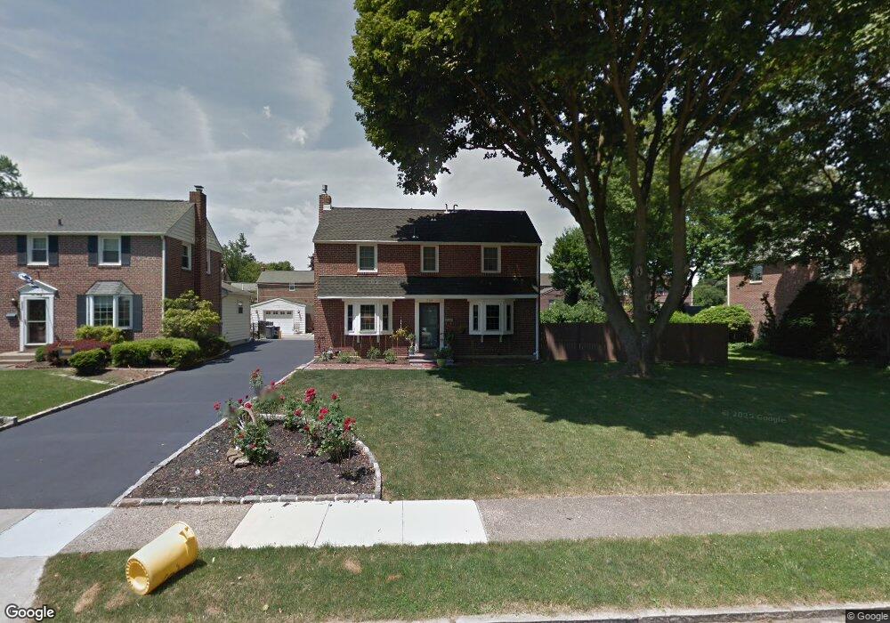
234 Worrell Dr Springfield, PA 19064
Estimated Value: $350,000 - $524,600
3
Beds
1
Bath
1,292
Sq Ft
$358/Sq Ft
Est. Value
About This Home
This home is located at 234 Worrell Dr, Springfield, PA 19064 and is currently estimated at $462,400, approximately $357 per square foot. 234 Worrell Dr is a home located in Delaware County with nearby schools including Springfield High School, Holy Cross School, and Sonshine Christian Academy.
Ownership History
Date
Name
Owned For
Owner Type
Purchase Details
Closed on
Jun 16, 2011
Sold by
Coxe Chad and Coxe Heidi
Bought by
Coxe Chad and Coxe Heidi
Current Estimated Value
Home Financials for this Owner
Home Financials are based on the most recent Mortgage that was taken out on this home.
Original Mortgage
$154,400
Outstanding Balance
$106,440
Interest Rate
4.63%
Mortgage Type
New Conventional
Estimated Equity
$355,960
Purchase Details
Closed on
Nov 18, 2010
Sold by
Schmidt George W
Bought by
Coxe Chad and Coxe Heidi
Create a Home Valuation Report for This Property
The Home Valuation Report is an in-depth analysis detailing your home's value as well as a comparison with similar homes in the area
Home Values in the Area
Average Home Value in this Area
Purchase History
| Date | Buyer | Sale Price | Title Company |
|---|---|---|---|
| Coxe Chad | -- | None Available | |
| Coxe Chad | $160,000 | None Available |
Source: Public Records
Mortgage History
| Date | Status | Borrower | Loan Amount |
|---|---|---|---|
| Open | Coxe Chad | $154,400 |
Source: Public Records
Tax History Compared to Growth
Tax History
| Year | Tax Paid | Tax Assessment Tax Assessment Total Assessment is a certain percentage of the fair market value that is determined by local assessors to be the total taxable value of land and additions on the property. | Land | Improvement |
|---|---|---|---|---|
| 2025 | $8,592 | $305,700 | $101,830 | $203,870 |
| 2024 | $8,592 | $305,700 | $101,830 | $203,870 |
| 2023 | $8,273 | $305,700 | $101,830 | $203,870 |
| 2022 | $8,094 | $305,700 | $101,830 | $203,870 |
| 2021 | $12,536 | $305,700 | $101,830 | $203,870 |
| 2020 | $7,444 | $164,270 | $48,950 | $115,320 |
| 2019 | $7,269 | $164,270 | $48,950 | $115,320 |
| 2018 | $7,165 | $164,270 | $0 | $0 |
| 2017 | $6,999 | $164,270 | $0 | $0 |
| 2016 | $902 | $164,270 | $0 | $0 |
| 2015 | $920 | $164,270 | $0 | $0 |
| 2014 | $902 | $164,270 | $0 | $0 |
Source: Public Records
Map
Nearby Homes
- 730 Dutton Cir
- 632 Dutton Cir
- 637 Hawarden Rd
- 449 Hawarden Rd
- 72 Colonial Park Dr
- 320 Gramercy Dr
- 324 Valley View Rd
- 207 N Bishop Ave
- 301 N Norwinden Dr
- 399 N Sycamore Ave
- 158 Hillview Dr
- 624 E Springfield Rd
- 5134 Westley Dr
- 230 Westpark Ln
- 401 N Sycamore Ave
- 523 Bloomfield Ave
- 511 Rodney Ln
- 342 E Springfield Rd
- 160 Westbrook Dr
- 306 E Springfield Rd
- 230 Worrell Dr
- 242 Worrell Dr
- 224 Worrell Dr
- 229 Indian Rock Dr
- 248 Worrell Dr
- 233 Indian Rock Dr
- 223 Indian Rock Dr
- 239 Indian Rock Dr
- 235 Worrell Dr
- 239 Worrell Dr
- 229 Worrell Dr
- 220 Worrell Dr
- 225 Worrell Dr
- 245 Worrell Dr
- 256 Worrell Dr
- 506 Valley View Rd
- 213 Indian Rock Dr
- 219 Worrell Dr
- 249 Worrell Dr
- 247 Indian Rock Dr