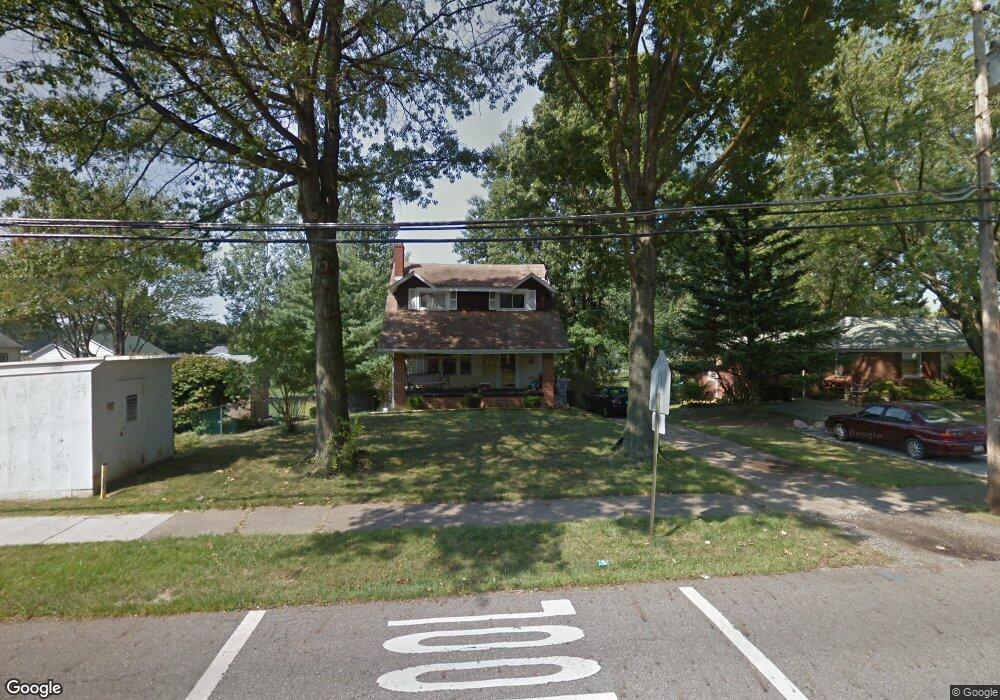
2343 S Rockhill Ave Alliance, OH 44601
Estimated Value: $102,000 - $215,000
3
Beds
2
Baths
1,232
Sq Ft
$133/Sq Ft
Est. Value
About This Home
This home is located at 2343 S Rockhill Ave, Alliance, OH 44601 and is currently estimated at $164,358, approximately $133 per square foot. 2343 S Rockhill Ave is a home located in Stark County with nearby schools including Alliance Elementary School at Rockhill, Alliance Intermediate School at Northside, and Alliance Middle School.
Ownership History
Date
Name
Owned For
Owner Type
Purchase Details
Closed on
Oct 11, 2019
Bought by
Epm7 Llc
Current Estimated Value
Home Financials for this Owner
Home Financials are based on the most recent Mortgage that was taken out on this home.
Interest Rate
3.57%
Purchase Details
Closed on
Sep 3, 2010
Sold by
Ewing Nigel S
Bought by
Stewart Jamie L
Purchase Details
Closed on
Apr 3, 2006
Sold by
Abraham Paul and Abraham Michelle Marie
Bought by
Stewart Jamie L
Home Financials for this Owner
Home Financials are based on the most recent Mortgage that was taken out on this home.
Original Mortgage
$92,449
Interest Rate
6.38%
Mortgage Type
FHA
Purchase Details
Closed on
Apr 17, 1998
Sold by
Mulholland Virginia A
Bought by
Abraham Paul and Abraham Michelle M
Home Financials for this Owner
Home Financials are based on the most recent Mortgage that was taken out on this home.
Original Mortgage
$70,775
Interest Rate
7.27%
Mortgage Type
New Conventional
Purchase Details
Closed on
Dec 18, 1992
Create a Home Valuation Report for This Property
The Home Valuation Report is an in-depth analysis detailing your home's value as well as a comparison with similar homes in the area
Home Values in the Area
Average Home Value in this Area
Purchase History
| Date | Buyer | Sale Price | Title Company |
|---|---|---|---|
| Epm7 Llc | $59,000 | -- | |
| Stewart Jamie L | $46,900 | Attorney | |
| Stewart Jamie L | $93,900 | First American Title | |
| Abraham Paul | $75,000 | -- | |
| -- | -- | -- |
Source: Public Records
Mortgage History
| Date | Status | Borrower | Loan Amount |
|---|---|---|---|
| Closed | Epm7 Llc | -- | |
| Previous Owner | Stewart Jamie L | $92,449 | |
| Previous Owner | Abraham Paul | $70,775 |
Source: Public Records
Tax History Compared to Growth
Tax History
| Year | Tax Paid | Tax Assessment Tax Assessment Total Assessment is a certain percentage of the fair market value that is determined by local assessors to be the total taxable value of land and additions on the property. | Land | Improvement |
|---|---|---|---|---|
| 2025 | -- | $40,850 | $11,550 | $29,300 |
| 2024 | -- | $40,850 | $11,550 | $29,300 |
| 2023 | $1,085 | $26,990 | $8,370 | $18,620 |
| 2022 | $1,092 | $26,990 | $8,370 | $18,620 |
| 2021 | $1,093 | $26,990 | $8,370 | $18,620 |
| 2020 | $1,025 | $23,630 | $7,250 | $16,380 |
| 2019 | $1,257 | $29,410 | $7,250 | $22,160 |
| 2018 | $1,263 | $29,410 | $7,250 | $22,160 |
| 2017 | $1,062 | $24,330 | $5,990 | $18,340 |
| 2016 | $1,070 | $24,330 | $5,990 | $18,340 |
| 2015 | $1,080 | $24,330 | $5,990 | $18,340 |
| 2014 | $1,164 | $24,960 | $6,130 | $18,830 |
| 2013 | $580 | $24,960 | $6,130 | $18,830 |
Source: Public Records
Map
Nearby Homes
- 2705 Shunk Ave
- 2839 S Rockhill Ave
- 1059 Oakwood Dr
- 884 W College Rd
- 549 Linwood Dr
- 2112 Blenheim Ave
- 1515 S Rockhill Ave
- 2195 Blenheim Ave
- 3101 Ridgehill Ave
- 2372 S Union Ave
- 3116 Ridgehill Ave
- 2405 Cherry Ave
- 2220 Western Ave
- 1321 Parkway Blvd
- 236 E Milton St
- 112 E College St
- 2460 S Arch Ave
- 1136 Parkway Blvd
- 317 E State St
- 1201 Overlook Dr
- 2325 S Rockhill Ave
- 819 W 24th St
- 803 W 24th St
- 833 W 24th St
- 2305 S Rockhill Ave
- 849 W 24th St
- 2356 S Rockhill Ave
- 2324 S Rockhill Ave
- 840 W 23rd St
- 2366 S Rockhill Ave
- 2308 S Rockhill Ave
- 2390 S Rockhill Ave
- 2368 Parkway Blvd
- 2245 S Rockhill Ave
- 2356 Parkway Blvd
- 2344 Parkway Blvd
- 2242 Antram Ave
- 2418 S Rockhill Ave
- 906 W 23rd St
- 2341 Ridgewood Ave