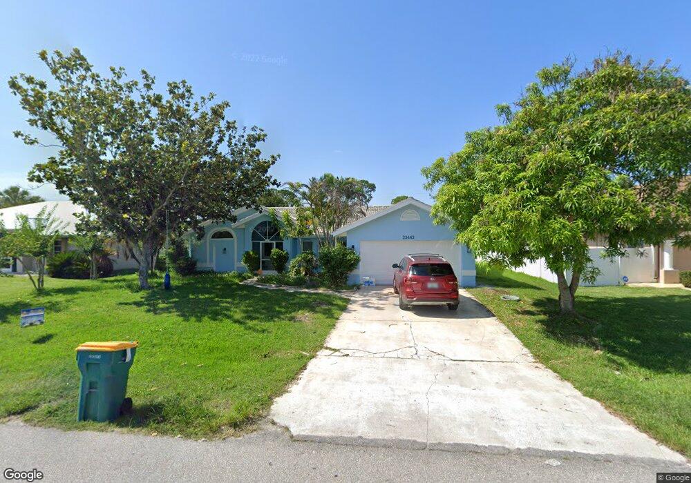
23442 Freeport Ave Port Charlotte, FL 33954
Estimated Value: $297,351 - $494,000
3
Beds
2
Baths
1,759
Sq Ft
$209/Sq Ft
Est. Value
About This Home
This home is located at 23442 Freeport Ave, Port Charlotte, FL 33954 and is currently estimated at $367,588, approximately $208 per square foot. 23442 Freeport Ave is a home located in Charlotte County with nearby schools including Kingsway Elementary School, Port Charlotte Middle School, and Port Charlotte High School.
Ownership History
Date
Name
Owned For
Owner Type
Purchase Details
Closed on
Apr 12, 2019
Sold by
Hollman Guy F
Bought by
Hollman Guy F and Hollman Carolyn
Current Estimated Value
Home Financials for this Owner
Home Financials are based on the most recent Mortgage that was taken out on this home.
Original Mortgage
$113,000
Outstanding Balance
$99,547
Interest Rate
4.4%
Mortgage Type
New Conventional
Estimated Equity
$268,041
Purchase Details
Closed on
Jul 7, 2004
Sold by
Hollman Francis R and Hollman Eleanor F
Bought by
Hollman Guy F
Create a Home Valuation Report for This Property
The Home Valuation Report is an in-depth analysis detailing your home's value as well as a comparison with similar homes in the area
Home Values in the Area
Average Home Value in this Area
Purchase History
| Date | Buyer | Sale Price | Title Company |
|---|---|---|---|
| Hollman Guy F | $42,000 | Attorney | |
| Hollman Guy F | $78,000 | -- |
Source: Public Records
Mortgage History
| Date | Status | Borrower | Loan Amount |
|---|---|---|---|
| Open | Hollman Guy F | $113,000 |
Source: Public Records
Tax History Compared to Growth
Tax History
| Year | Tax Paid | Tax Assessment Tax Assessment Total Assessment is a certain percentage of the fair market value that is determined by local assessors to be the total taxable value of land and additions on the property. | Land | Improvement |
|---|---|---|---|---|
| 2023 | $5,196 | $126,454 | $0 | $0 |
| 2022 | $5,118 | $119,707 | $0 | $0 |
| 2021 | $1,932 | $116,220 | $0 | $0 |
| 2020 | $1,884 | $114,615 | $0 | $0 |
| 2019 | $1,804 | $112,038 | $0 | $0 |
| 2018 | $1,651 | $109,949 | $0 | $0 |
| 2017 | $1,630 | $107,688 | $0 | $0 |
| 2016 | $1,615 | $105,473 | $0 | $0 |
| 2015 | $1,603 | $104,740 | $0 | $0 |
| 2014 | $1,577 | $103,909 | $0 | $0 |
Source: Public Records
Map
Nearby Homes
- 23482 and 23490 Freeport Ave
- 23466 Garrett Ave
- 72 Norman St
- 23531 Dunstan Ave
- 23338 Duchess Ave
- 183 Appian St
- 249 Hallcrest Terrace
- 268 Wabash Terrace
- 164 Morgan
- 23370 Garrison Ave
- 184 Robina St
- 145 Robina St
- 0 Lisa Blvd
- 1306 Richbriar Dr
- 000 Lisa Blvd
- 23348 Mullins Ave
- 230 Viceroy Terrace
- 0 Teakwood St Unit MFRC7501535
- 12779 SW Pembroke Cir S
- 23149 Hammond Ave
- 23434 Freeport Ave
- 23450 Freeport Ave
- 23443 Dunstan Ave
- 23435 Dunstan Ave
- 23451 Dunstan Ave
- 23458 Freeport Ave
- 114 Hannah St
- 23439 Freeport Ave
- 23447 Freeport Ave
- 23427 Dunstan Ave
- 23431 Freeport Ave
- 23423 Freeport Ave
- 23463 Freeport Ave
- 23475 Dunstan Ave
- 23450 Dunstan Ave
- 115 Hannah St
- 23415 Freeport Ave
- 23458 Dunstan Ave
- 23426 Dunstan Ave
- 97 Hannah St