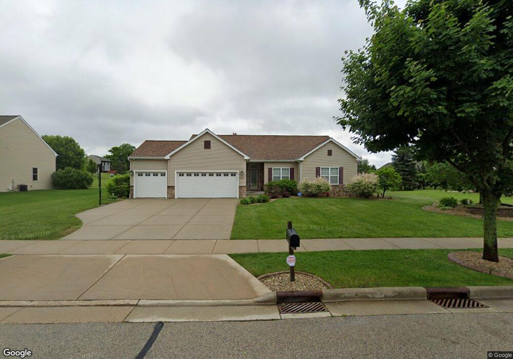
2347 Cedar Crest Dr Slinger, WI 53086
Estimated Value: $544,000 - $647,000
4
Beds
3
Baths
2,128
Sq Ft
$277/Sq Ft
Est. Value
About This Home
This home is located at 2347 Cedar Crest Dr, Slinger, WI 53086 and is currently estimated at $588,493, approximately $276 per square foot. 2347 Cedar Crest Dr is a home located in Washington County with nearby schools including Slinger High School and St Peter Elementary School.
Ownership History
Date
Name
Owned For
Owner Type
Purchase Details
Closed on
Dec 12, 2024
Sold by
Tinsley Donnell
Bought by
Braimah Omuwa
Current Estimated Value
Purchase Details
Closed on
Jul 16, 2018
Sold by
Ihrke Harvey P and Ihrke Kelly K
Bought by
Tinsley Donnell and Braimah Omuwa
Home Financials for this Owner
Home Financials are based on the most recent Mortgage that was taken out on this home.
Original Mortgage
$370,000
Interest Rate
4.5%
Mortgage Type
Purchase Money Mortgage
Purchase Details
Closed on
Apr 18, 2012
Sold by
Dempsey Kelly K and Ihrke Harvey P
Bought by
Ihrk Dempsey 2012 Revocable Trust
Purchase Details
Closed on
Aug 18, 2008
Sold by
Benton Land & Development Llc
Bought by
Larke Harvey P and Dempsey Kelly K
Home Financials for this Owner
Home Financials are based on the most recent Mortgage that was taken out on this home.
Original Mortgage
$190,000
Interest Rate
6.31%
Mortgage Type
New Conventional
Create a Home Valuation Report for This Property
The Home Valuation Report is an in-depth analysis detailing your home's value as well as a comparison with similar homes in the area
Home Values in the Area
Average Home Value in this Area
Purchase History
| Date | Buyer | Sale Price | Title Company |
|---|---|---|---|
| Braimah Omuwa | -- | -- | |
| Tinsley Donnell | $370,000 | Land Title Services Inc | |
| Ihrk Dempsey 2012 Revocable Trust | -- | None Available | |
| Larke Harvey P | $53,966 | None Available |
Source: Public Records
Mortgage History
| Date | Status | Borrower | Loan Amount |
|---|---|---|---|
| Previous Owner | Tinsley Donnell | $370,000 | |
| Previous Owner | Larke Harvey P | $190,000 |
Source: Public Records
Tax History
| Year | Tax Paid | Tax Assessment Tax Assessment Total Assessment is a certain percentage of the fair market value that is determined by local assessors to be the total taxable value of land and additions on the property. | Land | Improvement |
|---|---|---|---|---|
| 2024 | $6,242 | $549,500 | $100,000 | $449,500 |
| 2023 | $5,373 | $400,800 | $77,000 | $323,800 |
| 2022 | $5,502 | $400,800 | $77,000 | $323,800 |
| 2021 | $5,255 | $400,800 | $77,000 | $323,800 |
| 2020 | $4,989 | $334,700 | $75,500 | $259,200 |
| 2019 | $4,927 | $334,700 | $75,500 | $259,200 |
| 2018 | $4,884 | $334,700 | $75,500 | $259,200 |
| 2017 | $4,748 | $310,900 | $72,000 | $238,900 |
| 2016 | $4,745 | $280,800 | $72,000 | $208,800 |
| 2015 | -- | $280,800 | $72,000 | $208,800 |
| 2014 | -- | $280,800 | $72,000 | $208,800 |
| 2013 | $5,486 | $307,000 | $82,000 | $225,000 |
Source: Public Records
Map
Nearby Homes
- Lt127 Sandstone St
- Lt132 Sandstone St
- Lt126 Sandstone St
- Lt131 Sandstone St
- Lt133 Sandstone St
- Lt96 Sandstone St
- 2484 Boulder Dr
- 2491 Boulder Dr
- 447 Sandstone St
- 2497 Boulder Dr
- 465 Sandstone St
- 2470 Boulder Dr
- Lt50 Limestone Ln
- Lt135 Limestone Ln
- Lt55 Limestone Ln
- Lt51 Limestone Ln
- 2456 Boulder Dr
- 438 Sandstone St
- 469 Limestone Ln
- Lt62 Boulder Dr
- 2352 Cedar Crest Dr
- 2327 Cedar Crest Dr
- 2367 Cedar Crest Dr
- 2332 Cedar Crest Dr
- 2312 Cedar Crest Dr
- 2372 Cedar Crest Dr
- 2387 Cedar Crest Dr
- 340 Maple Grove Terrace
- 2307 Cedar Crest Dr
- 2392 Cedar Crest Dr
- 2302 Cedar Crest Dr
- 335 Cedar Crest Dr
- 4043 County Road C
- 2402 Cedar Crest Dr
- 360 Maple Grove Terrace
- 303 Cedar Crest Ln
- 302 Cedar Crest Dr
- 353 Maple Grove Terrace
- 380 Maple Grove Terrace
- 400 Maple Grove Terrace
Your Personal Tour Guide
Ask me questions while you tour the home.