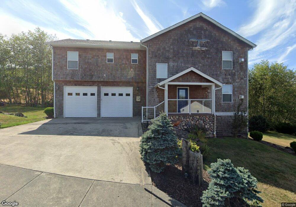
2348 N Fork Rd Seaside, OR 97138
Estimated Value: $548,000 - $805,000
3
Beds
52
Baths
2,000
Sq Ft
$317/Sq Ft
Est. Value
About This Home
This home is located at 2348 N Fork Rd, Seaside, OR 97138 and is currently estimated at $633,332, approximately $316 per square foot. 2348 N Fork Rd is a home located in Clatsop County with nearby schools including Seaside High School.
Ownership History
Date
Name
Owned For
Owner Type
Purchase Details
Closed on
Oct 19, 2016
Sold by
Staton Daniel W and Staton Kimberly A
Bought by
Staton Daniel William and Staton Kimberly Ann
Current Estimated Value
Purchase Details
Closed on
Sep 20, 2013
Sold by
Sum Properties Llc
Bought by
Staton Daniel W and Staton Kimberly A
Home Financials for this Owner
Home Financials are based on the most recent Mortgage that was taken out on this home.
Original Mortgage
$250,000
Outstanding Balance
$185,693
Interest Rate
4.36%
Mortgage Type
New Conventional
Estimated Equity
$447,639
Purchase Details
Closed on
Feb 4, 2011
Sold by
Sum Properties Llc
Bought by
North Coast Land Conservancy Inc
Purchase Details
Closed on
Jun 4, 2009
Sold by
Olstedt Construction Inc
Bought by
Sum Properties Llc
Home Financials for this Owner
Home Financials are based on the most recent Mortgage that was taken out on this home.
Original Mortgage
$67,500
Interest Rate
4.78%
Mortgage Type
Commercial
Create a Home Valuation Report for This Property
The Home Valuation Report is an in-depth analysis detailing your home's value as well as a comparison with similar homes in the area
Purchase History
| Date | Buyer | Sale Price | Title Company |
|---|---|---|---|
| Staton Daniel William | -- | None Available | |
| Staton Daniel W | $312,500 | Ticor Title Ins Co | |
| North Coast Land Conservancy Inc | -- | None Available | |
| Sum Properties Llc | $90,000 | Pacific Title Company |
Source: Public Records
Mortgage History
| Date | Status | Borrower | Loan Amount |
|---|---|---|---|
| Open | Staton Daniel W | $250,000 | |
| Previous Owner | Sum Properties Llc | $67,500 |
Source: Public Records
Tax History
| Year | Tax Paid | Tax Assessment Tax Assessment Total Assessment is a certain percentage of the fair market value that is determined by local assessors to be the total taxable value of land and additions on the property. | Land | Improvement |
|---|---|---|---|---|
| 2025 | $3,836 | $266,978 | -- | -- |
| 2024 | $3,724 | $259,203 | -- | -- |
| 2023 | $3,614 | $251,654 | $0 | $0 |
| 2022 | $3,515 | $244,326 | $0 | $0 |
| 2021 | $3,440 | $237,211 | $0 | $0 |
| 2020 | $3,360 | $230,303 | $0 | $0 |
| 2019 | $3,268 | $223,596 | $0 | $0 |
Source: Public Records
Map
Nearby Homes
- 2188 Stanley Lake Ct
- 2110 Thompson Falls Dr
- 2344 Royal View Dr
- 2657 N Hwy 101 Unit 6
- 802 25th Ave
- 481 Hillside Loop
- 1350 13th Ave
- 790 17th Ave
- 810 16th Ave
- 782 Woodland Ct
- 934 H St
- 0 McCormick Gardens Rd
- 1299 6th Ave
- 1110 6th Ave
- 3389 U S 101
- 3387-3389 U S 101
- 1265 D St
- 1000 N Holladay Dr
- 1000 N Holladay Dr Unit 304
- 815 N King St
- 2348 N Fork Dr
- 2351 N Fork Dr
- 2337 N Fork Rd
- 2367 N Fork Rd
- 2362 N Fork Rd
- 2333 N Fork Rd
- 1915 N Fork Rd
- 0 N Fork Rd Unit 51
- -1 N Fork Rd
- 2245 N Fork Rd
- 2387 N Fork Rd
- 2235 1weuoquzdxbz Fork
- 2235 N Fork
- 2235 N Fork Rd
- 2255 N Fork Rd
- 2225 N Fork Rd
- 2372 N Fork Dr
- 2372 N Fork Rd
- 2215 N Fork Rd
- 2275 N Fork Rd Unit 53