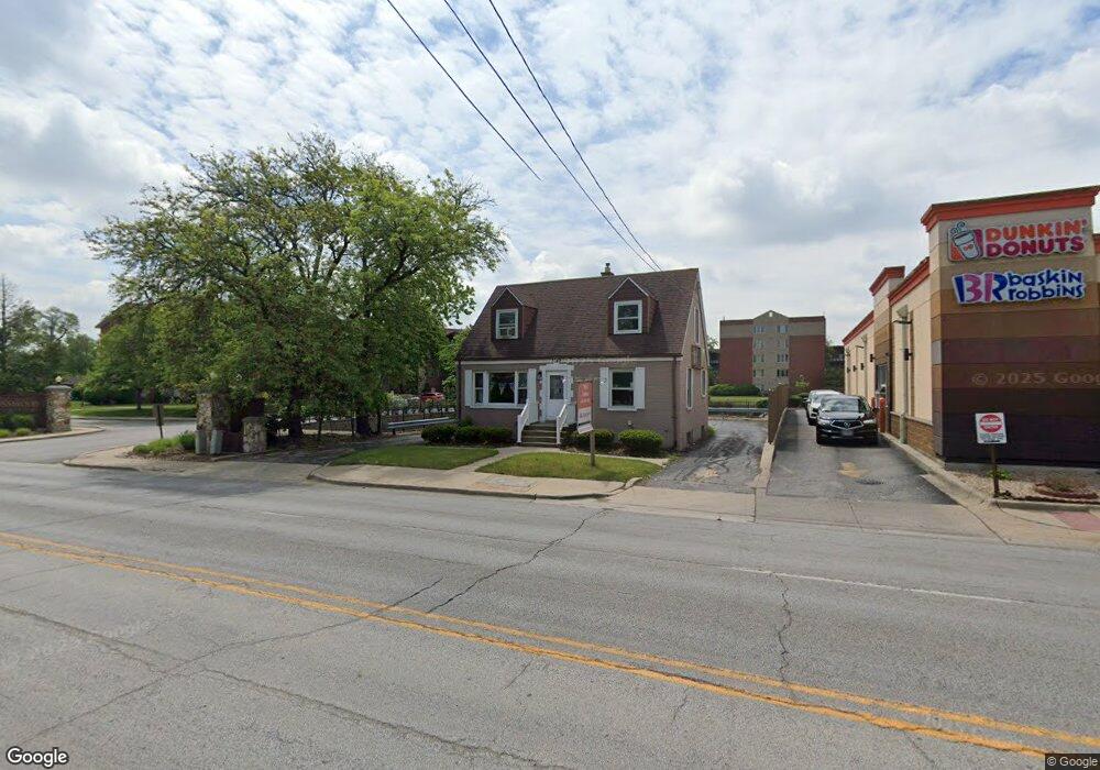
2349 183rd St Homewood, IL 60430
Estimated Value: $187,000 - $259,000
3
Beds
1
Bath
1,320
Sq Ft
$174/Sq Ft
Est. Value
About This Home
This home is located at 2349 183rd St, Homewood, IL 60430 and is currently estimated at $229,456, approximately $173 per square foot. 2349 183rd St is a home located in Cook County with nearby schools including Willow Elementary School, Winston Churchill School, and James Hart School.
Ownership History
Date
Name
Owned For
Owner Type
Purchase Details
Closed on
Feb 11, 2019
Sold by
Williams Ronnie G and Williams Pamela K
Bought by
Bluelake Holdings Llc
Current Estimated Value
Home Financials for this Owner
Home Financials are based on the most recent Mortgage that was taken out on this home.
Original Mortgage
$108,000
Outstanding Balance
$34,953
Interest Rate
4.4%
Mortgage Type
Seller Take Back
Estimated Equity
$194,503
Create a Home Valuation Report for This Property
The Home Valuation Report is an in-depth analysis detailing your home's value as well as a comparison with similar homes in the area
Home Values in the Area
Average Home Value in this Area
Purchase History
| Date | Buyer | Sale Price | Title Company |
|---|---|---|---|
| Bluelake Holdings Llc | $120,000 | Lakeland Title Services |
Source: Public Records
Mortgage History
| Date | Status | Borrower | Loan Amount |
|---|---|---|---|
| Open | Bluelake Holdings Llc | $108,000 |
Source: Public Records
Tax History Compared to Growth
Tax History
| Year | Tax Paid | Tax Assessment Tax Assessment Total Assessment is a certain percentage of the fair market value that is determined by local assessors to be the total taxable value of land and additions on the property. | Land | Improvement |
|---|---|---|---|---|
| 2024 | $7,026 | $17,000 | $3,600 | $13,400 |
| 2023 | $5,979 | $17,000 | $3,600 | $13,400 |
| 2022 | $5,979 | $11,558 | $3,060 | $8,498 |
| 2021 | $5,576 | $11,558 | $3,060 | $8,498 |
| 2020 | $5,417 | $11,558 | $3,060 | $8,498 |
| 2019 | $5,103 | $10,505 | $2,700 | $7,805 |
| 2018 | $4,935 | $10,505 | $2,700 | $7,805 |
| 2017 | $4,949 | $10,505 | $2,700 | $7,805 |
| 2016 | $4,621 | $9,583 | $2,520 | $7,063 |
| 2015 | $4,587 | $9,583 | $2,520 | $7,063 |
| 2014 | $4,501 | $9,583 | $2,520 | $7,063 |
| 2013 | $4,849 | $11,219 | $2,520 | $8,699 |
Source: Public Records
Map
Nearby Homes
- 18330 Perth Ave
- 18210 Perth Ave
- 18404 Perth Ave
- 2055 183rd St
- 18104 Park Ave
- 18461 Morris Ave
- 18157 Rockwell Ave
- 18137 Martin Ave Unit 1NE
- 18065 Harwood Ave Unit A
- 18418 Clyde Rd
- 18462 Dixie Hwy
- 1940 183rd St Unit 1D
- 1940 183rd St Unit 1C
- 18646 Palmer Cir
- 18509 Stedhall Rd
- 18450 Stedhall Rd
- 625 Perth Ave
- 2163 Chestnut Rd
- 18526 Dixie Hwy
- 2619 Alexander St
- 2321 183rd St Unit G11
- 2321 183rd St Unit 101
- 2321 183rd St Unit 5SE
- 2321 183rd St Unit 5SW
- 2321 183rd St Unit 5NE
- 2321 183rd St Unit 5NW
- 2321 183rd St Unit 4SE
- 2321 183rd St Unit 4SW
- 2321 183rd St Unit 4NE
- 2321 183rd St Unit 4NW
- 2321 183rd St Unit 3SW
- 2321 183rd St Unit 3NE
- 2321 183rd St Unit 3NW
- 2321 183rd St Unit 2SW
- 2321 183rd St Unit 2NE
- 2321 183rd St Unit 2NW
- 2321 183rd St Unit 1SE
- 2321 183rd St Unit 1SW
- 2321 183rd St Unit 1NW
- 2321 183rd St Unit 403