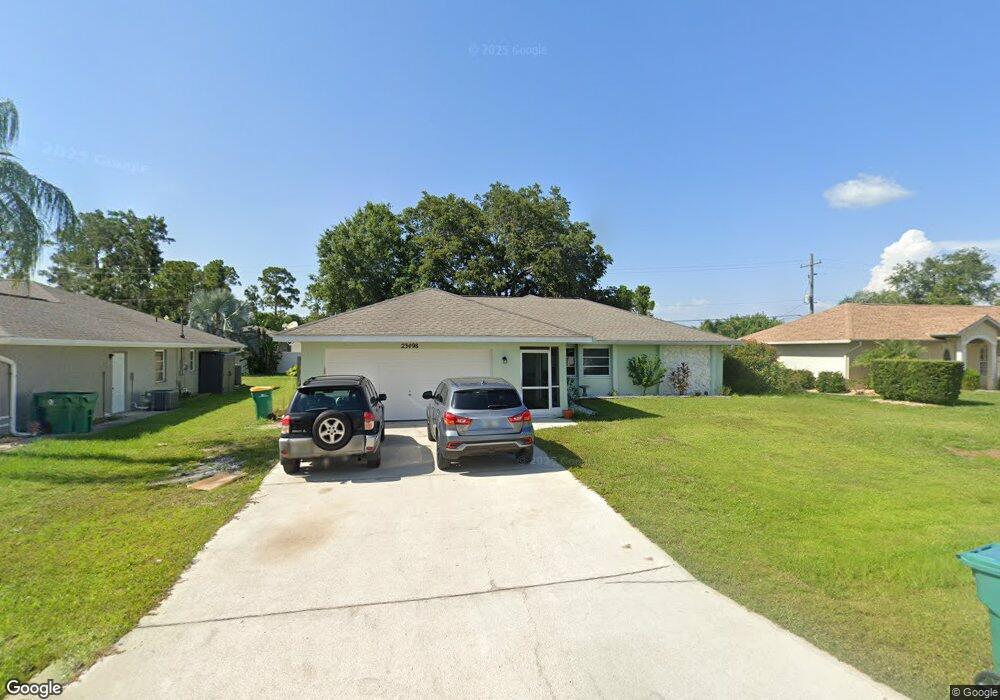
23498 Dunstan Ave Port Charlotte, FL 33954
Estimated Value: $279,000 - $470,000
3
Beds
2
Baths
1,848
Sq Ft
$190/Sq Ft
Est. Value
About This Home
This home is located at 23498 Dunstan Ave, Port Charlotte, FL 33954 and is currently estimated at $351,389, approximately $190 per square foot. 23498 Dunstan Ave is a home located in Charlotte County with nearby schools including Kingsway Elementary School, Port Charlotte Middle School, and Port Charlotte High School.
Ownership History
Date
Name
Owned For
Owner Type
Purchase Details
Closed on
Sep 27, 2018
Sold by
Blair Loretta and The Loretta Blair Revocable Tr
Bought by
Francis Scott and Francis Sharon
Current Estimated Value
Home Financials for this Owner
Home Financials are based on the most recent Mortgage that was taken out on this home.
Original Mortgage
$174,284
Outstanding Balance
$151,986
Interest Rate
4.5%
Mortgage Type
FHA
Estimated Equity
$199,403
Purchase Details
Closed on
Sep 26, 2003
Sold by
Blair Loretta
Bought by
Blair Loretta
Create a Home Valuation Report for This Property
The Home Valuation Report is an in-depth analysis detailing your home's value as well as a comparison with similar homes in the area
Home Values in the Area
Average Home Value in this Area
Purchase History
| Date | Buyer | Sale Price | Title Company |
|---|---|---|---|
| Francis Scott | $177,500 | First Intl Title Inc | |
| Blair Loretta | -- | -- |
Source: Public Records
Mortgage History
| Date | Status | Borrower | Loan Amount |
|---|---|---|---|
| Open | Francis Scott | $174,284 |
Source: Public Records
Tax History Compared to Growth
Tax History
| Year | Tax Paid | Tax Assessment Tax Assessment Total Assessment is a certain percentage of the fair market value that is determined by local assessors to be the total taxable value of land and additions on the property. | Land | Improvement |
|---|---|---|---|---|
| 2024 | $4,499 | $272,714 | $34,000 | $238,714 |
| 2023 | $4,499 | $204,578 | $0 | $0 |
| 2022 | $3,996 | $240,114 | $23,800 | $216,314 |
| 2021 | $3,472 | $169,073 | $15,725 | $153,348 |
| 2020 | $3,392 | $165,027 | $13,600 | $151,427 |
| 2019 | $3,208 | $155,854 | $11,475 | $144,379 |
| 2018 | $1,563 | $104,436 | $0 | $0 |
| 2017 | $1,542 | $102,288 | $0 | $0 |
| 2016 | $1,527 | $100,184 | $0 | $0 |
| 2015 | $1,513 | $99,488 | $0 | $0 |
| 2014 | $1,488 | $98,698 | $0 | $0 |
Source: Public Records
Map
Nearby Homes
- 23531 Dunstan Ave
- 23482 and 23490 Freeport Ave
- 23466 Garrett Ave
- 72 Norman St
- 23338 Duchess Ave
- 164 Morgan
- 249 Hallcrest Terrace
- 183 Appian St
- 268 Wabash Terrace
- 0 Lisa Blvd
- 000 Lisa Blvd
- 1306 Richbriar Dr
- 23370 Garrison Ave
- 184 Robina St
- 12779 SW Pembroke Cir S
- 145 Robina St
- 12711 SW Pembroke Cir S
- 23348 Mullins Ave
- 12932 SW Pembroke Cir S
- 0 Teakwood St Unit MFRC7501535
- 23490 Dunstan Ave
- 23506 Dunstan Ave
- 23499 Garrett Ave
- 23491 Garrett Ave
- 23482 Dunstan Ave
- 23514 Dunstan Ave
- 23499 Dunstan Ave
- 23507 Dunstan Ave
- 23491 Dunstan Ave
- 23483 Garrett Ave
- 23515 Garrett Ave
- 23515 Dunstan Ave
- 23483 Dunstan Ave
- 23522 Dunstan Ave
- 23475 Garrett Ave
- 23523 Garrett Ave
- 23498 Garrett Ave
- 23506 Garrett Ave
- 23490 Garrett Ave
- 23506 Freeport Ave